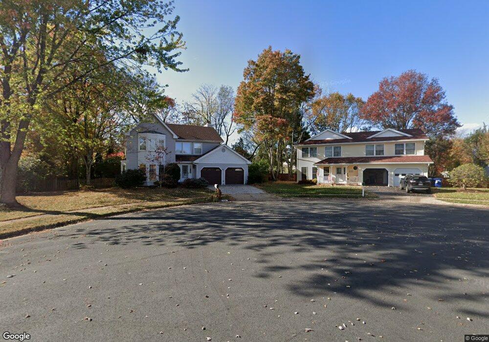
1302 Boulder Crest Ct Herndon, VA 20170
Estimated Value: $781,977 - $840,000
4
Beds
4
Baths
1,958
Sq Ft
$411/Sq Ft
Est. Value
About This Home
This home is located at 1302 Boulder Crest Ct, Herndon, VA 20170 and is currently estimated at $804,994, approximately $411 per square foot. 1302 Boulder Crest Ct is a home located in Fairfax County with nearby schools including Dranesville Elementary, Herndon Middle School, and Herndon High School.
Ownership History
Date
Name
Owned For
Owner Type
Purchase Details
Closed on
Dec 21, 2006
Sold by
Cox Philip J
Bought by
Payne Kenneth B
Current Estimated Value
Home Financials for this Owner
Home Financials are based on the most recent Mortgage that was taken out on this home.
Original Mortgage
$417,000
Outstanding Balance
$249,039
Interest Rate
6.29%
Mortgage Type
New Conventional
Estimated Equity
$555,955
Purchase Details
Closed on
Jun 3, 1997
Sold by
Paulson Daniel H
Bought by
Cox Philip J and Cox Pamela E
Home Financials for this Owner
Home Financials are based on the most recent Mortgage that was taken out on this home.
Original Mortgage
$191,250
Interest Rate
8.09%
Mortgage Type
New Conventional
Create a Home Valuation Report for This Property
The Home Valuation Report is an in-depth analysis detailing your home's value as well as a comparison with similar homes in the area
Home Values in the Area
Average Home Value in this Area
Purchase History
| Date | Buyer | Sale Price | Title Company |
|---|---|---|---|
| Payne Kenneth B | $545,000 | -- | |
| Cox Philip J | $212,500 | -- |
Source: Public Records
Mortgage History
| Date | Status | Borrower | Loan Amount |
|---|---|---|---|
| Open | Payne Kenneth B | $417,000 | |
| Previous Owner | Cox Philip J | $191,250 |
Source: Public Records
Tax History
| Year | Tax Paid | Tax Assessment Tax Assessment Total Assessment is a certain percentage of the fair market value that is determined by local assessors to be the total taxable value of land and additions on the property. | Land | Improvement |
|---|---|---|---|---|
| 2025 | $7,485 | $702,930 | $245,000 | $457,930 |
| 2024 | $7,485 | $646,100 | $245,000 | $401,100 |
| 2023 | $6,946 | $615,500 | $240,000 | $375,500 |
| 2022 | $6,861 | $600,010 | $240,000 | $360,010 |
| 2021 | $6,212 | $529,330 | $205,000 | $324,330 |
| 2020 | $6,071 | $512,970 | $195,000 | $317,970 |
| 2019 | $5,865 | $495,600 | $190,000 | $305,600 |
| 2018 | $5,466 | $475,310 | $185,000 | $290,310 |
| 2017 | $5,463 | $470,540 | $185,000 | $285,540 |
| 2016 | $5,382 | $464,590 | $185,000 | $279,590 |
| 2015 | $5,046 | $452,160 | $185,000 | $267,160 |
| 2014 | $5,060 | $454,390 | $185,000 | $269,390 |
Source: Public Records
Map
Nearby Homes
- 1431 Flynn Ct
- 1439 Millikens Bend Rd
- 1359 Rock Chapel Rd
- 1407 Skyhaven Ct
- 1354 Shallow Ford Rd
- 1374 Rock Chapel Rd
- 204 Elizabeth Ct
- 207 N Laura Anne Dr
- 211 Amy Ct
- 125 N Lincoln Ave
- 112 N Kennedy Rd
- 12524 Philmont Dr
- 1530 Powells Tavern Place
- 138 N Ithaca Ct
- 1314 E Holly Ave
- 21039 Barcroft Way
- 1515 Judd Ct
- 46966 Courtyard Square Unit 301
- 102 Evergreen St
- 46934 Courtyard Square Unit 300
- 1300 Boulder Crest Ct
- 1304 Boulder Crest Ct
- 1323 Mason Mill Ct
- 1319 Mason Mill Ct
- 1321 Mason Mill Ct
- 1301 Boulder Crest Ct
- 1306 Boulder Crest Ct
- 1429 Powells Tavern Place
- 1305 Boulder Crest Ct
- 1427 Powells Tavern Place
- 1303 Boulder Crest Ct
- 1317 Mason Mill Ct
- 1325 Mason Mill Ct
- 1307 Boulder Crest Ct
- 1425 Powells Tavern Place
- 1327 Mason Mill Ct
- 1308 Boulder Crest Ct
- 12528 Browns Ferry Rd
- 1320 Mason Mill Ct
- 12398 Rock Ridge Rd
Your Personal Tour Guide
Ask me questions while you tour the home.