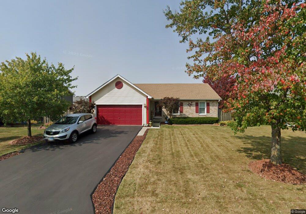
1302 Butterfield Ln Zion, IL 60099
West Zion NeighborhoodEstimated Value: $270,000 - $304,000
3
Beds
2
Baths
1,287
Sq Ft
$222/Sq Ft
Est. Value
About This Home
This home is located at 1302 Butterfield Ln, Zion, IL 60099 and is currently estimated at $285,324, approximately $221 per square foot. 1302 Butterfield Ln is a home located in Lake County with nearby schools including Newport Elementary School, Beach Park Middle School, and Zion-Benton Township High School.
Ownership History
Date
Name
Owned For
Owner Type
Purchase Details
Closed on
May 1, 1996
Sold by
Beverly Trust Company
Bought by
Taylor Scott Jr William H and Taylor Scott Ann
Current Estimated Value
Home Financials for this Owner
Home Financials are based on the most recent Mortgage that was taken out on this home.
Original Mortgage
$136,708
Outstanding Balance
$7,782
Interest Rate
7.99%
Mortgage Type
FHA
Estimated Equity
$277,542
Create a Home Valuation Report for This Property
The Home Valuation Report is an in-depth analysis detailing your home's value as well as a comparison with similar homes in the area
Home Values in the Area
Average Home Value in this Area
Purchase History
| Date | Buyer | Sale Price | Title Company |
|---|---|---|---|
| Taylor Scott Jr William H | $139,000 | Chicago Title Insurance Co |
Source: Public Records
Mortgage History
| Date | Status | Borrower | Loan Amount |
|---|---|---|---|
| Open | Taylor Scott Jr William H | $136,708 |
Source: Public Records
Tax History Compared to Growth
Tax History
| Year | Tax Paid | Tax Assessment Tax Assessment Total Assessment is a certain percentage of the fair market value that is determined by local assessors to be the total taxable value of land and additions on the property. | Land | Improvement |
|---|---|---|---|---|
| 2024 | $5,997 | $71,755 | $9,976 | $61,779 |
| 2023 | $6,192 | $62,941 | $8,894 | $54,047 |
| 2022 | $6,192 | $58,460 | $7,299 | $51,161 |
| 2021 | $6,733 | $54,840 | $6,847 | $47,993 |
| 2020 | $6,481 | $51,580 | $6,440 | $45,140 |
| 2019 | $6,291 | $48,048 | $5,999 | $42,049 |
| 2018 | $5,582 | $42,656 | $5,420 | $37,236 |
| 2017 | $5,463 | $39,570 | $5,028 | $34,542 |
| 2016 | $5,035 | $35,920 | $4,564 | $31,356 |
| 2015 | $4,800 | $32,592 | $4,141 | $28,451 |
| 2014 | $4,603 | $32,071 | $3,908 | $28,163 |
| 2012 | $5,069 | $34,155 | $4,162 | $29,993 |
Source: Public Records
Map
Nearby Homes
- 1302 Lorelei Dr
- 1304 Lorelei Dr
- 1417 Westside Trail
- 4014 Ridge Rd
- 3717 Willow Crest Dr
- 908 Countrywood Dr
- 3707 Willow Crest Dr
- 0 9th St
- 4539 Illinois 173
- 4533 Illinois 173
- 1304 Pelican Ct
- 41320 N Green Bay Rd
- 1916 Sunshine Ct
- 2010 Sunset Ct
- 1531 Southport Ct
- 1521 Southport Ct
- 1405 Lewis Ave
- 42334 N Heritage Lot 7 Trail
- 12434 W Van Ct
- 1817 Joppa Ave
- 1304 Butterfield Ln
- 1300 Butterfield Ln
- 1301 Reed Rd
- 1303 Reed Rd
- 1216 Butterfield Ln
- 1306 Butterfield Ln
- 4211 Highland Rd
- 3800 Tickseed Dr
- 1305 Reed Rd
- 4210 Heather Ct
- 1235 Pheasant Run
- 4210 Highland Rd
- 1214 Butterfield Ln
- 1308 Butterfield Ln
- 4209 Highland Rd
- 1237 Pheasant Run
- 3802 Tickseed Dr
- 1307 Reed Rd
- 4208 Heather Ct
- 4208 Highland Rd