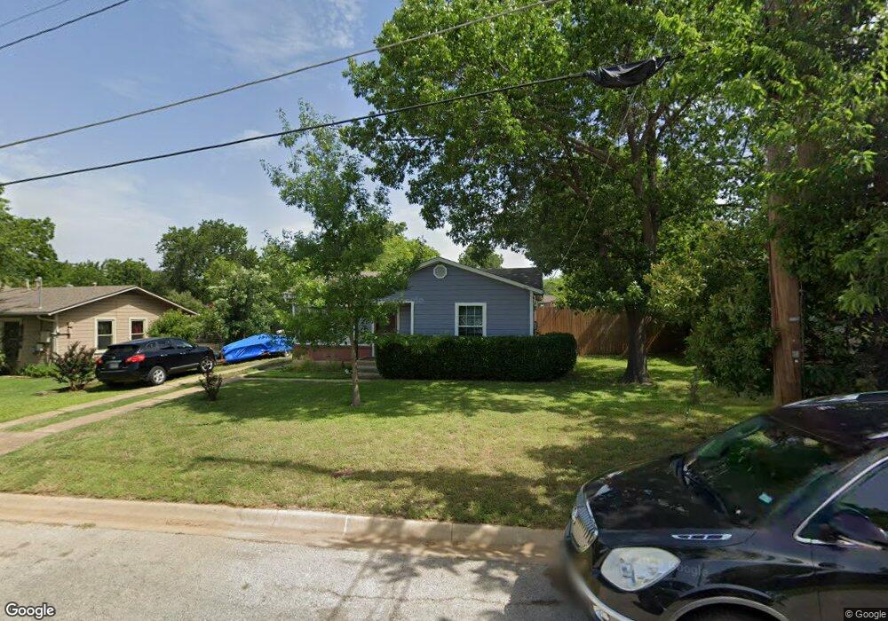
1302 Oakwood Dr Denton, TX 76205
Denia NeighborhoodEstimated Value: $188,605 - $282,000
--
Bed
1
Bath
702
Sq Ft
$342/Sq Ft
Est. Value
About This Home
This home is located at 1302 Oakwood Dr, Denton, TX 76205 and is currently estimated at $240,401, approximately $342 per square foot. 1302 Oakwood Dr is a home located in Denton County with nearby schools including Borman Elementary School, McMath Middle School, and Denton High School.
Ownership History
Date
Name
Owned For
Owner Type
Purchase Details
Closed on
Aug 2, 2005
Sold by
Hud
Bought by
Grace Tim
Current Estimated Value
Home Financials for this Owner
Home Financials are based on the most recent Mortgage that was taken out on this home.
Original Mortgage
$43,200
Interest Rate
5.55%
Mortgage Type
Fannie Mae Freddie Mac
Purchase Details
Closed on
Dec 8, 2004
Sold by
Gmac Mortgage Corp
Bought by
Hud
Purchase Details
Closed on
Dec 7, 2004
Sold by
Smith Richard Marion and Smith Kathleen
Bought by
Gmac Mortgage Corp
Create a Home Valuation Report for This Property
The Home Valuation Report is an in-depth analysis detailing your home's value as well as a comparison with similar homes in the area
Home Values in the Area
Average Home Value in this Area
Purchase History
| Date | Buyer | Sale Price | Title Company |
|---|---|---|---|
| Grace Tim | -- | -- | |
| Hud | -- | -- | |
| Gmac Mortgage Corp | $36,902 | -- |
Source: Public Records
Mortgage History
| Date | Status | Borrower | Loan Amount |
|---|---|---|---|
| Closed | Grace Tim | $43,200 |
Source: Public Records
Tax History Compared to Growth
Tax History
| Year | Tax Paid | Tax Assessment Tax Assessment Total Assessment is a certain percentage of the fair market value that is determined by local assessors to be the total taxable value of land and additions on the property. | Land | Improvement |
|---|---|---|---|---|
| 2025 | $108 | $108,359 | $56,595 | $89,197 |
| 2024 | $1,901 | $98,508 | $0 | $0 |
| 2023 | $108 | $89,553 | $56,595 | $83,254 |
| 2022 | $1,728 | $81,412 | $56,595 | $52,907 |
| 2021 | $1,645 | $74,011 | $33,014 | $40,997 |
| 2020 | $1,659 | $72,569 | $33,014 | $39,555 |
| 2019 | $1,725 | $72,293 | $33,014 | $39,279 |
| 2018 | $1,599 | $66,184 | $33,014 | $33,170 |
| 2017 | $1,557 | $63,000 | $33,014 | $29,986 |
| 2016 | $1,529 | $61,846 | $33,014 | $28,832 |
| 2015 | $1,155 | $59,937 | $33,014 | $26,923 |
| 2013 | -- | $55,200 | $33,014 | $22,186 |
Source: Public Records
Map
Nearby Homes
- 1523 Oakwood Dr
- 1619 Mccormick St
- 1211 Lindsey St
- 1024 Greenlee St
- 1618 Kendolph Dr
- 631 Acme St
- 2302 Mercedes Rd
- 1115 Mccormick St
- 2314 Leslie St
- 1311 Margie St Unit 1&2
- 1211 Kendolph Dr
- 2216 Redwing Dr
- 2421 Mercedes Rd
- 2216 Ruff Rd
- 1301 Fannin St
- 2305 Bernard St
- 2321 Ruff Rd
- 808 W Collins St
- 1303 Fannin St
- 2304 Blackcap St
- 1218 Oakwood Dr
- 1306 Oakwood Dr
- 1214 Oakwood Dr
- 1310 Oakwood Dr
- 1703 Westwood Dr
- 1702 Westwood Dr
- 1210 Oakwood Dr
- 1307 Lindsey St
- 1707 Westwood Dr
- 1706 Westwood Dr
- 1301 Lindsey St
- 1206 Oakwood Dr
- 1607 Mccormick St
- 1613 Mccormick St
- 1702 Mercedes Rd
- 1305 Lindsey St
- 1605 Mccormick St
- 1711 Westwood Dr
- 1703 Mccormick St
- 1710 Westwood Dr