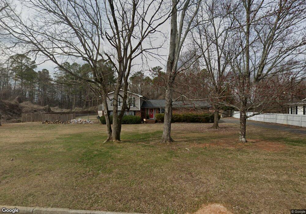
1302 Phillips Dr Dalton, GA 30720
Estimated Value: $318,000 - $444,000
4
Beds
3
Baths
2,400
Sq Ft
$159/Sq Ft
Est. Value
About This Home
This home is located at 1302 Phillips Dr, Dalton, GA 30720 and is currently estimated at $382,180, approximately $159 per square foot. 1302 Phillips Dr is a home located in Whitfield County with nearby schools including City Park Elementary School, Dalton Middle School, and Dalton High School.
Ownership History
Date
Name
Owned For
Owner Type
Purchase Details
Closed on
Feb 13, 2009
Sold by
Otts Yvonne
Bought by
Giles Meredith
Current Estimated Value
Home Financials for this Owner
Home Financials are based on the most recent Mortgage that was taken out on this home.
Original Mortgage
$160,001
Outstanding Balance
$100,761
Interest Rate
5.03%
Mortgage Type
FHA
Estimated Equity
$281,419
Purchase Details
Closed on
Dec 5, 2008
Sold by
Otts Yvonne
Bought by
Giles Meredith
Purchase Details
Closed on
Mar 24, 2006
Sold by
Harrison Steven M
Bought by
Otts Yvonne
Purchase Details
Closed on
Apr 25, 2003
Sold by
Harrison Lorita Den
Bought by
Harrison Steven M
Purchase Details
Closed on
May 26, 2000
Sold by
Coots Ronald G and Martha Sue
Bought by
Harrison Steven M and Lorita Denise
Purchase Details
Closed on
Jul 1, 1995
Bought by
Coots Ronald G and Martha Sue
Create a Home Valuation Report for This Property
The Home Valuation Report is an in-depth analysis detailing your home's value as well as a comparison with similar homes in the area
Home Values in the Area
Average Home Value in this Area
Purchase History
| Date | Buyer | Sale Price | Title Company |
|---|---|---|---|
| Giles Meredith | -- | -- | |
| Giles Meredith | -- | -- | |
| Otts Yvonne | $175,000 | -- | |
| Harrison Steven M | -- | -- | |
| Harrison Steven M | $162,500 | -- | |
| Coots Ronald G | -- | -- |
Source: Public Records
Mortgage History
| Date | Status | Borrower | Loan Amount |
|---|---|---|---|
| Open | Giles Meredith | $160,001 |
Source: Public Records
Tax History Compared to Growth
Tax History
| Year | Tax Paid | Tax Assessment Tax Assessment Total Assessment is a certain percentage of the fair market value that is determined by local assessors to be the total taxable value of land and additions on the property. | Land | Improvement |
|---|---|---|---|---|
| 2024 | $2,534 | $139,330 | $14,000 | $125,330 |
| 2023 | $2,534 | $74,576 | $14,000 | $60,576 |
| 2022 | $1,982 | $64,946 | $9,660 | $55,286 |
| 2021 | $1,693 | $56,467 | $9,660 | $46,807 |
| 2020 | $1,747 | $56,467 | $9,660 | $46,807 |
| 2019 | $1,797 | $56,467 | $9,660 | $46,807 |
| 2018 | $1,818 | $56,467 | $9,660 | $46,807 |
| 2017 | $1,969 | $56,467 | $9,660 | $46,807 |
| 2016 | $1,785 | $57,344 | $8,820 | $48,524 |
| 2014 | $1,574 | $54,612 | $8,400 | $46,212 |
| 2013 | -- | $54,612 | $8,400 | $46,212 |
Source: Public Records
Map
Nearby Homes
- 1510 Thornebrooke Cir Unit 3
- 1505 Anthony Ave
- Tract 2 Willowdale Rd Unit TRACT 2
- 1006 Willowdale Rd NW
- 1411 Belton Ave
- 115 Cliffs Dr NE
- Lot 5 Haig Mill Lake Rd
- Lot 12 Haig Mill Lake Rd
- Lot 13 Haig Mill Lake Rd
- 2205 Seminole Way
- 1202 Covie Dr
- 1420 Cleo Way
- 1416 Cleo Way
- 204 Roslyn Ct
- 1521 Ashton Woods Way
- 1402 Elite Dr
- 2203 Mathis Ln
- 1369 Lida St
- 1403 Mack St
- 1705 Wellington NW
- 1300 Phillips Dr
- 1301 Phillips Dr
- 1303 Phillips Dr
- 1305 Phillips Dr
- 1214 Phillips Dr
- 1307 Phillips Dr
- 1308 Phillips Dr
- 1701 Anthony Ave
- 1215 Phillips Dr
- 1700 Anthony Ave
- 1309 Phillips Dr
- 1531 Thornebrooke Cir
- 1210 Phillips Dr
- 1303 Tacoma Dr
- 1211 Phillips Dr
- 1208 Tacoma Dr
- 1529 Thornebrooke Cir
- 0 Phillips Dr Unit 121770
- 1527 Thornebrooke Cir
- 1522 Thornebrooke Cir