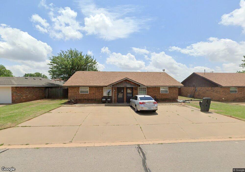
1302 Quail Ave Unit 2 Weatherford, OK 73096
Estimated Value: $185,000 - $306,000
2
Beds
1
Bath
900
Sq Ft
$276/Sq Ft
Est. Value
About This Home
This home is located at 1302 Quail Ave Unit 2, Weatherford, OK 73096 and is currently estimated at $248,650, approximately $276 per square foot. 1302 Quail Ave Unit 2 is a home located in Custer County with nearby schools including Burcham Elementary School, Lt. General Thomas P. Stafford Elementary School, and Weatherford West Elementary School.
Ownership History
Date
Name
Owned For
Owner Type
Purchase Details
Closed on
Sep 30, 2014
Sold by
Merlo Associates, Llc
Bought by
Kelley Kevin Don
Current Estimated Value
Purchase Details
Closed on
Apr 3, 2002
Sold by
Michael Deimling
Bought by
Merlo Associates Llc
Purchase Details
Closed on
Feb 28, 1997
Sold by
Darrell Wootton
Bought by
Michael Deimling
Purchase Details
Closed on
Jan 3, 1995
Sold by
Park Lang R
Bought by
Darrell Wootton
Create a Home Valuation Report for This Property
The Home Valuation Report is an in-depth analysis detailing your home's value as well as a comparison with similar homes in the area
Home Values in the Area
Average Home Value in this Area
Purchase History
| Date | Buyer | Sale Price | Title Company |
|---|---|---|---|
| Kelley Kevin Don | -- | -- | |
| Merlo Associates Llc | $75,000 | -- | |
| Michael Deimling | $70,500 | -- | |
| Darrell Wootton | $67,500 | -- |
Source: Public Records
Tax History Compared to Growth
Tax History
| Year | Tax Paid | Tax Assessment Tax Assessment Total Assessment is a certain percentage of the fair market value that is determined by local assessors to be the total taxable value of land and additions on the property. | Land | Improvement |
|---|---|---|---|---|
| 2025 | $1,071 | $11,400 | $1,856 | $9,544 |
| 2024 | $1,071 | $10,857 | $1,459 | $9,398 |
| 2023 | $1,071 | $10,340 | $1,459 | $8,881 |
| 2022 | $995 | $10,340 | $1,459 | $8,881 |
| 2021 | $1,002 | $10,340 | $1,459 | $8,881 |
| 2020 | $1,061 | $10,533 | $1,459 | $9,074 |
| 2019 | $1,092 | $10,726 | $1,459 | $9,267 |
| 2018 | $1,010 | $10,919 | $1,459 | $9,460 |
| 2017 | $1,066 | $11,310 | $1,463 | $9,847 |
| 2016 | $1,065 | $11,194 | $1,463 | $9,731 |
| 2015 | $1,029 | $10,661 | $1,463 | $9,198 |
| 2014 | $1,014 | $10,528 | $1,422 | $9,106 |
Source: Public Records
Map
Nearby Homes
- 1400 Rolling Hills St
- 0 Debra Dr
- 0 N Washington Ave
- 1414 Chisholm Trail
- 1804 Kristie Ln
- 24130 E 1016 Rd
- 24126 E 1016 Rd
- 1509 Steiner Rd
- 24122 E 1016 Rd
- 708 Cornerstone Ave
- 1300 Crimson Dr
- 1312 Linwood St
- 24117 E 106 Rd
- 10009 Lark St
- 24131 E 1016 Rd
- 1230 N Indiana St
- 24119 E 1016 Rd
- 241127 E 1016 Rd
- 1229 N Indiana St
- 24109 E 1016 Rd
- 1301 Quail Ave
- 1312 E Quail Ave
- 1308 Steiner Rd
- 1313 E Quail Ave
- 1313 Plains Ave
- 1300 Steiner Rd
- 1312 Steiner Rd
- 1304 Plains Ave Unit 1
- 1304 Plains Ave Unit 2
- 1304 Plains Ave
- 1316 E Quail Ave
- 1316 Quail Ave
- 1316 Steiner Rd
- 1317 Plains Ave
- 1312 Plains Ave
- 1320 Steiner Rd
- 1801 N Washington St
- 1801 Debra Dr
- 1320 E Quail Ave
- 1321 E Quail Ave