Estimated Value: $322,000 - $413,000
3
Beds
3
Baths
1,660
Sq Ft
$211/Sq Ft
Est. Value
About This Home
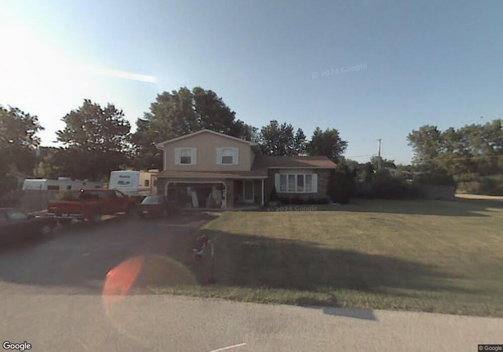
This home is located at 13020 W 28th Place, Zion, IL 60099 and is currently estimated at $350,392, approximately $211 per square foot. 13020 W 28th Place is a home located in Lake County with nearby schools including Kenneth Murphy School, Beach Park Middle School, and Zion-Benton Township High School.
Ownership History
Date
Name
Owned For
Owner Type
Purchase Details
Closed on
Aug 25, 2005
Sold by
Fletcher Linda Mae
Bought by
Fletcher Michael H
Current Estimated Value
Purchase Details
Closed on
Aug 4, 1998
Sold by
Carnahan Mark L and Carnahan Leslie Kay
Bought by
Fletcher Michael H and Fletcher Linda Mae
Home Financials for this Owner
Home Financials are based on the most recent Mortgage that was taken out on this home.
Original Mortgage
$132,800
Interest Rate
7.06%
Create a Home Valuation Report for This Property
The Home Valuation Report is an in-depth analysis detailing your home's value as well as a comparison with similar homes in the area
Home Values in the Area
Average Home Value in this Area
Purchase History
| Date | Buyer | Sale Price | Title Company |
|---|---|---|---|
| Fletcher Michael H | -- | -- | |
| Fletcher Michael H | $166,000 | Ticor Title |
Source: Public Records
Mortgage History
| Date | Status | Borrower | Loan Amount |
|---|---|---|---|
| Previous Owner | Fletcher Michael H | $132,800 |
Source: Public Records
Tax History Compared to Growth
Tax History
| Year | Tax Paid | Tax Assessment Tax Assessment Total Assessment is a certain percentage of the fair market value that is determined by local assessors to be the total taxable value of land and additions on the property. | Land | Improvement |
|---|---|---|---|---|
| 2024 | $6,993 | $90,890 | $13,553 | $77,337 |
| 2023 | $6,548 | $75,436 | $11,307 | $64,129 |
| 2022 | $6,548 | $68,252 | $10,083 | $58,169 |
| 2021 | $6,123 | $61,127 | $9,221 | $51,906 |
| 2020 | $6,109 | $59,706 | $9,007 | $50,699 |
| 2019 | $6,161 | $57,338 | $8,650 | $48,688 |
| 2018 | $6,795 | $60,157 | $7,759 | $52,398 |
| 2017 | $6,873 | $59,041 | $7,615 | $51,426 |
| 2016 | $6,833 | $57,066 | $7,360 | $49,706 |
| 2015 | $6,800 | $53,892 | $6,951 | $46,941 |
| 2014 | $5,966 | $52,414 | $6,760 | $45,654 |
| 2012 | $6,020 | $53,288 | $6,873 | $46,415 |
Source: Public Records
Map
Nearby Homes
- 13051 Bucksburn Ct
- 39787 Torry Ln
- 13129 W Shannon Dr
- 39631 N Warren Ln Unit 4625
- 13154 W Sheffield Ln
- 13661 W Adams Rd
- 13551 W Adams Rd
- 39616 N Warren Ln Unit 4824
- 39520 N Green Bay Rd
- 13428 Victoria Ln
- 39401 N Green Bay Rd
- 2414 Phillip Dr
- 42334 N Heritage Lot 7 Trail
- 2407 Phillip Dr
- 2407 Miriam Ave
- 2413 Michael Ave
- 2031 Dawn Ln
- 39176 Welsh Ln Unit 5563
- 39092 Welsh Ln Unit 5501
- 39111 N Aberdeen Ln Unit 39111
- 13005 W 28th St
- 13005 W 28th St
- 13035 W 28th St
- 13035 W 28th St
- 13052 W 28th Place
- 13003 W 28th Place
- 12975 W 28th St
- 13035 W 28th Place
- 13055 W 28th St
- 12973 W 28th Place
- 13063 W 28th St
- 13071 W 28th Place
- 12969 W 28th Place
- 13020 W 29th St
- 13020 W 29th St
- 13060 W 28th St
- 13034 W 29th St
- 13032 W 28th St
- 12953 W 28th St
- 13090 W 28th Place