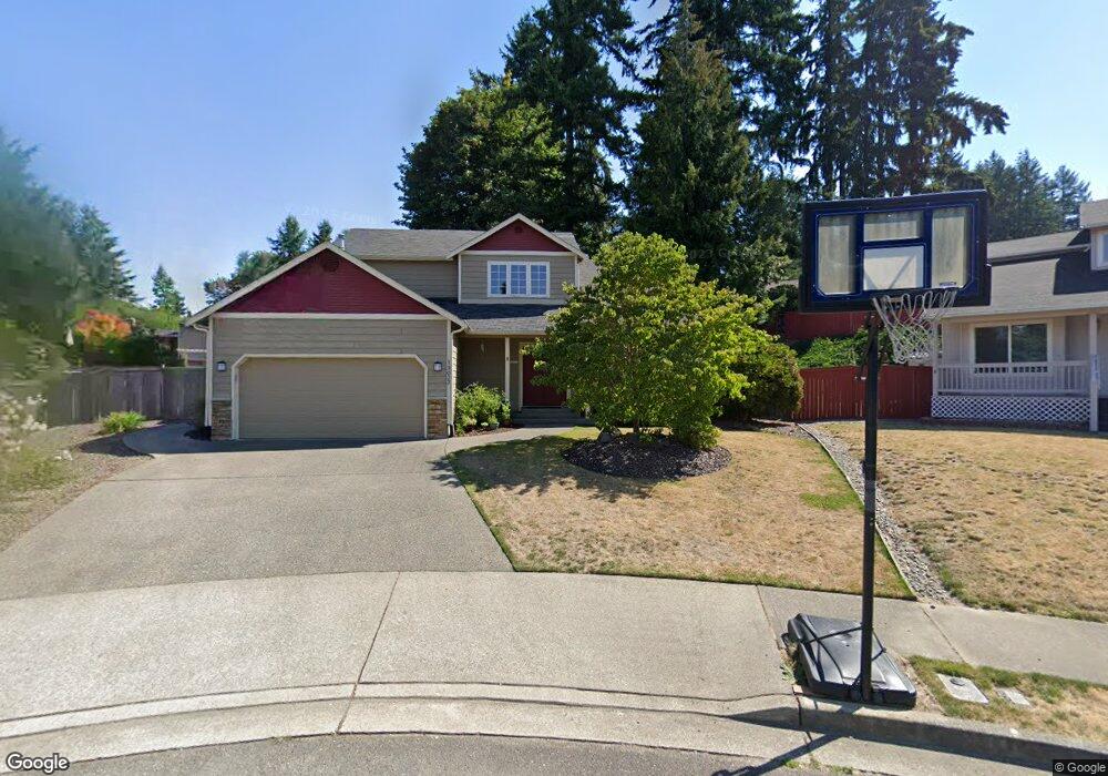
13022 107th St E Puyallup, WA 98374
Estimated Value: $578,000 - $606,000
3
Beds
3
Baths
1,784
Sq Ft
$331/Sq Ft
Est. Value
About This Home
This home is located at 13022 107th St E, Puyallup, WA 98374 and is currently estimated at $589,623, approximately $330 per square foot. 13022 107th St E is a home located in Pierce County with nearby schools including Sunrise Elementary School, Ferrucci Junior High School, and Emerald Ridge High School.
Ownership History
Date
Name
Owned For
Owner Type
Purchase Details
Closed on
May 18, 2023
Sold by
Burchett Kristin M and Burchett Michael F
Bought by
Burchett Living Trust
Current Estimated Value
Purchase Details
Closed on
Aug 21, 1997
Sold by
Delong Todd R
Bought by
Burchett Michael F and Burchett Kristin M
Home Financials for this Owner
Home Financials are based on the most recent Mortgage that was taken out on this home.
Original Mortgage
$135,000
Interest Rate
7.5%
Purchase Details
Closed on
Apr 11, 1997
Sold by
The Quadrant Corp
Bought by
Delong Todd R and Delong Michelle L
Home Financials for this Owner
Home Financials are based on the most recent Mortgage that was taken out on this home.
Original Mortgage
$119,200
Interest Rate
7.86%
Mortgage Type
Construction
Create a Home Valuation Report for This Property
The Home Valuation Report is an in-depth analysis detailing your home's value as well as a comparison with similar homes in the area
Home Values in the Area
Average Home Value in this Area
Purchase History
| Date | Buyer | Sale Price | Title Company |
|---|---|---|---|
| Burchett Living Trust | -- | None Listed On Document | |
| Burchett Michael F | $148,950 | Commonwealth Title Company | |
| Delong Todd R | $39,950 | -- |
Source: Public Records
Mortgage History
| Date | Status | Borrower | Loan Amount |
|---|---|---|---|
| Previous Owner | Burchett Michael F | $135,000 | |
| Previous Owner | Delong Todd R | $119,200 |
Source: Public Records
Tax History Compared to Growth
Tax History
| Year | Tax Paid | Tax Assessment Tax Assessment Total Assessment is a certain percentage of the fair market value that is determined by local assessors to be the total taxable value of land and additions on the property. | Land | Improvement |
|---|---|---|---|---|
| 2025 | $5,123 | $543,600 | $256,400 | $287,200 |
| 2024 | $5,123 | $518,000 | $250,600 | $267,400 |
| 2023 | $5,123 | $486,100 | $237,700 | $248,400 |
| 2022 | $5,070 | $506,200 | $233,300 | $272,900 |
| 2021 | $4,797 | $371,800 | $158,900 | $212,900 |
| 2019 | $4,164 | $341,500 | $136,700 | $204,800 |
| 2018 | $4,181 | $320,600 | $125,600 | $195,000 |
| 2017 | $3,840 | $287,500 | $107,200 | $180,300 |
| 2016 | $3,381 | $226,700 | $85,700 | $141,000 |
| 2014 | $3,013 | $209,600 | $70,200 | $139,400 |
| 2013 | $3,013 | $186,700 | $61,400 | $125,300 |
Source: Public Records
Map
Nearby Homes
- 3501 27th St SE
- 2617 35th Ave SE
- 2927 Forest Rim Ct S
- 2921 Forest Rim Ct S
- 11312 134th Avenue Ct E
- 2622 31st Street Ct SE
- 11421 133rd Ave E
- 2303 Cherokee Blvd
- 2810 Cherokee Blvd
- 2331 40th Ave SE
- 11505 134th Avenue Ct E
- 13208 116th Street Ct E
- 4305 25th St SE
- 4013 23rd St SE
- 3610 21st St SE
- 11704 132nd Avenue Ct E
- 2202 28th Ave SE
- 2804 25th Avenue Ct SE
- 4014 23rd St SE
- 13712 116th Street Ct E
- 13020 107th St E
- 18417 107th St E Unit 500
- 10606 Sierra Dr E
- 10612 Sierra Dr E
- 13021 107th St E
- 10710 Rampart Dr E
- 13016 107th St E
- 10602 Sierra Dr E
- 10714 Rampart Dr E
- 10702 Rampart Dr E
- 13019 107th St E
- 10718 Rampart Dr E
- 13013 107th St E
- 13012 107th St E
- 10603 Sierra Dr E
- 10722 Rampart Dr E
- 10609 Sierra Dr E
- 2911 33rd Ave SE
- 10609 130th Ave E