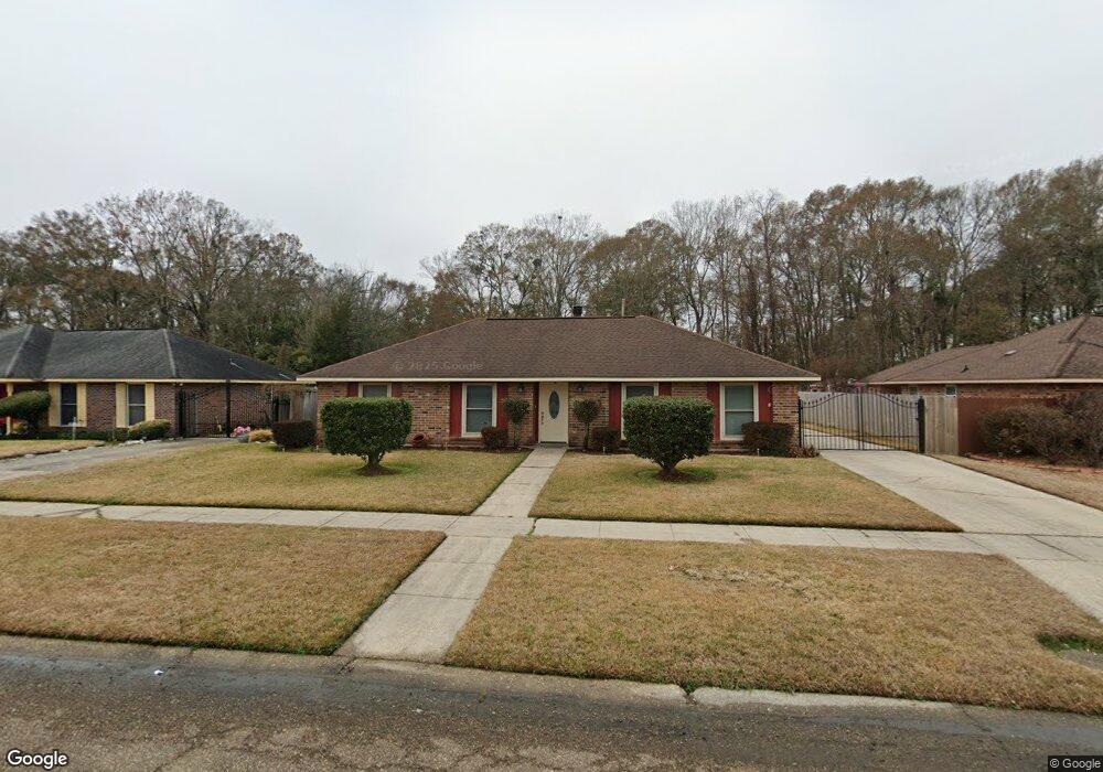
13023 Wynell Dr Baker, LA 70714
Brownfields NeighborhoodEstimated Value: $174,000 - $221,000
3
Beds
2
Baths
1,534
Sq Ft
$123/Sq Ft
Est. Value
About This Home
This home is located at 13023 Wynell Dr, Baker, LA 70714 and is currently estimated at $188,526, approximately $122 per square foot. 13023 Wynell Dr is a home located in East Baton Rouge Parish with nearby schools including White Hills Elementary School, Northeast High School, and Impact Charter School.
Ownership History
Date
Name
Owned For
Owner Type
Purchase Details
Closed on
Jun 17, 2023
Sold by
Sterling Feltus
Bought by
Shaffer Saleria Sterling
Current Estimated Value
Purchase Details
Closed on
Aug 7, 2000
Sold by
Hud
Bought by
Blue Furman and Blue Saleria S
Home Financials for this Owner
Home Financials are based on the most recent Mortgage that was taken out on this home.
Original Mortgage
$72,086
Interest Rate
8.15%
Mortgage Type
FHA
Purchase Details
Closed on
Feb 8, 2000
Sold by
Norwest Mtg Inc
Bought by
Hud
Purchase Details
Closed on
Jan 12, 2000
Sold by
Pryor Ronnie W
Bought by
Norwest Mtg Inc
Create a Home Valuation Report for This Property
The Home Valuation Report is an in-depth analysis detailing your home's value as well as a comparison with similar homes in the area
Home Values in the Area
Average Home Value in this Area
Purchase History
| Date | Buyer | Sale Price | Title Company |
|---|---|---|---|
| Shaffer Saleria Sterling | $9,390 | None Listed On Document | |
| Blue Furman | $77,500 | -- | |
| Hud | $68,244 | -- | |
| Norwest Mtg Inc | $65,000 | -- |
Source: Public Records
Mortgage History
| Date | Status | Borrower | Loan Amount |
|---|---|---|---|
| Previous Owner | Blue Furman | $72,086 |
Source: Public Records
Tax History Compared to Growth
Tax History
| Year | Tax Paid | Tax Assessment Tax Assessment Total Assessment is a certain percentage of the fair market value that is determined by local assessors to be the total taxable value of land and additions on the property. | Land | Improvement |
|---|---|---|---|---|
| 2024 | $1,106 | $15,900 | $1,100 | $14,800 |
| 2023 | $1,110 | $13,520 | $1,100 | $12,420 |
| 2022 | $1,831 | $13,520 | $1,100 | $12,420 |
| 2021 | $1,801 | $13,520 | $1,100 | $12,420 |
| 2020 | $1,821 | $13,520 | $1,100 | $12,420 |
| 2019 | $1,450 | $10,350 | $1,100 | $9,250 |
| 2018 | $1,435 | $10,350 | $1,100 | $9,250 |
| 2017 | $1,435 | $10,350 | $1,100 | $9,250 |
| 2016 | $975 | $7,113 | $1,100 | $6,013 |
| 2015 | $1,108 | $8,650 | $1,100 | $7,550 |
| 2014 | $1,104 | $8,650 | $1,100 | $7,550 |
| 2013 | -- | $8,650 | $1,100 | $7,550 |
Source: Public Records
Map
Nearby Homes
- 6505 Stoneview Ave
- 13261 Plank Rd
- 13311 Plank Rd
- 13443 Plank Rd
- 16920 Plank Rd
- 6525 Brownfields Dr
- 6836 Yorkdale Ave
- 13841 Blairstown Dr
- 12265 Plank Rd
- 12105 Foster Rd
- 14137 Blairstown Dr
- 7425 Comite Dr
- 6466 Celia Ave
- 13420 Docile Ct
- 13418 Dawes Ct
- 8724 Pettit Rd
- 13401 Dawes Ct
- 5885 Lavey Ln Unit 128
- 5885 Lavey Ln Unit 46
- 5885 Lavey Ln Unit 131
- 13043 Wynell Dr
- 13013 Wynell Dr
- 12951 Wynell Dr
- 6411 Garland Ave
- 13053 Wynell Dr
- 6412 Lebrent Ave
- 12941 Wynell Dr
- 6421 Garland Ave
- 6422 Lebrent Ave
- 6410 Garland Ave
- 6431 Garland Ave
- 12931 Wynell Dr
- 6432 Lebrent Ave
- 6420 Garland Ave
- 6411 Lebrent Ave
- 6421 Lebrent Ave
- 6413 Stoneview Ave
- 6430 Garland Ave
- 6513 Garland Ave
- 6514 Lebrent Ave