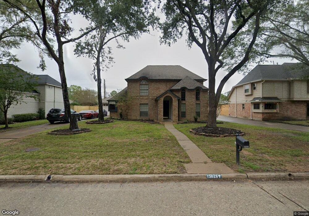
13026 Chriswood Dr Cypress, TX 77429
Estimated Value: $380,983 - $402,000
4
Beds
3
Baths
2,625
Sq Ft
$149/Sq Ft
Est. Value
About This Home
This home is located at 13026 Chriswood Dr, Cypress, TX 77429 and is currently estimated at $390,996, approximately $148 per square foot. 13026 Chriswood Dr is a home located in Harris County with nearby schools including Hamilton Elementary School, Hamilton Middle School, and Cypress Creek High School.
Ownership History
Date
Name
Owned For
Owner Type
Purchase Details
Closed on
May 20, 1996
Sold by
Uem Properties Inc
Bought by
Crooks G Jeffrey and Crooks Pamela
Current Estimated Value
Home Financials for this Owner
Home Financials are based on the most recent Mortgage that was taken out on this home.
Original Mortgage
$103,550
Interest Rate
7.93%
Purchase Details
Closed on
Apr 8, 1996
Sold by
Canady Timothy R and Canady Mary K
Bought by
Uem Properties Inc
Home Financials for this Owner
Home Financials are based on the most recent Mortgage that was taken out on this home.
Original Mortgage
$103,550
Interest Rate
7.93%
Create a Home Valuation Report for This Property
The Home Valuation Report is an in-depth analysis detailing your home's value as well as a comparison with similar homes in the area
Home Values in the Area
Average Home Value in this Area
Purchase History
| Date | Buyer | Sale Price | Title Company |
|---|---|---|---|
| Crooks G Jeffrey | -- | -- | |
| Uem Properties Inc | $80,000 | -- |
Source: Public Records
Mortgage History
| Date | Status | Borrower | Loan Amount |
|---|---|---|---|
| Closed | Crooks G Jeffrey | $103,550 |
Source: Public Records
Tax History Compared to Growth
Tax History
| Year | Tax Paid | Tax Assessment Tax Assessment Total Assessment is a certain percentage of the fair market value that is determined by local assessors to be the total taxable value of land and additions on the property. | Land | Improvement |
|---|---|---|---|---|
| 2025 | $4,848 | $359,316 | $90,290 | $269,026 |
| 2024 | $4,848 | $350,988 | $90,290 | $260,698 |
| 2023 | $4,848 | $362,814 | $90,290 | $272,524 |
| 2022 | $6,330 | $311,993 | $75,448 | $236,545 |
| 2021 | $6,064 | $240,461 | $75,448 | $165,013 |
| 2020 | $6,240 | $239,878 | $58,132 | $181,746 |
| 2019 | $6,565 | $243,236 | $47,619 | $195,617 |
| 2018 | $2,442 | $243,236 | $47,619 | $195,617 |
| 2017 | $6,115 | $243,236 | $47,619 | $195,617 |
| 2016 | $5,559 | $243,236 | $47,619 | $195,617 |
| 2015 | $3,685 | $233,959 | $47,619 | $186,340 |
| 2014 | $3,685 | $192,775 | $31,539 | $161,236 |
Source: Public Records
Map
Nearby Homes
- 13206 Chriswood Dr
- 13210 Chriswood Dr
- 12906 Ivyforest Dr
- 13012 Kathy Ln
- 12903 Cluster Pine Dr
- 12502 Wealdstone Dr
- 13307 Cypress Pond Dr
- 12422 Hammersmith Dr
- 12515 Pavilion Ct
- 13018 Wincrest Ct
- 12943 Spring Cypress Rd
- 12407 Wealdstone Dr
- 12502 Pavilion Ct
- 13114 Kathy Ln
- 13119 Rosewood Glen Dr
- 16610 Avenfield Rd
- 13503 Copeland Oaks Blvd
- 12411 Exbury Ct
- 16723 Chewton Glen St
- 12610 Ivyforest Dr
- 13030 Chriswood Dr
- 13018 Chriswood Dr
- 13102 Chriswood Dr
- 12902 Glenyork Ct
- 12903 Kathy Ln
- 13014 Chriswood Dr
- 12639 Hammersmith Dr
- 13106 Chriswood Dr
- 12906 Glenyork Ct
- 12635 Hammersmith Dr
- 12902 Kathy Ln
- 12643 Hammersmith Dr
- 13010 Chriswood Dr
- 12907 Kathy Ln
- 12631 Hammersmith Dr
- 13015 Chriswood Dr
- 12906 Kathy Ln
- 12627 Hammersmith Dr
- 12703 Hammersmith Dr
- 13110 Chriswood Dr