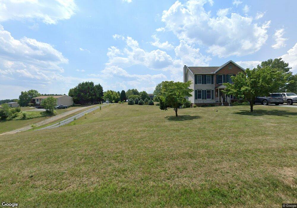
13026 Independence Rd Clear Spring, MD 21722
Estimated Value: $303,000 - $382,000
Studio
2
Baths
1,512
Sq Ft
$225/Sq Ft
Est. Value
About This Home
This home is located at 13026 Independence Rd, Clear Spring, MD 21722 and is currently estimated at $339,640, approximately $224 per square foot. 13026 Independence Rd is a home located in Washington County with nearby schools including Clear Spring Elementary School, Clear Spring Middle School, and Clear Spring High School.
Ownership History
Date
Name
Owned For
Owner Type
Purchase Details
Closed on
Jun 28, 2012
Sold by
Jessop Marie E and Rolls Marie E
Bought by
Rolls Marie E
Current Estimated Value
Purchase Details
Closed on
Mar 20, 2009
Sold by
Jessop Larry L and Jessop Marie E
Bought by
Jessop Marie E
Purchase Details
Closed on
Apr 14, 1989
Sold by
Mcmullan Henry W
Bought by
Jessop Larry L and Jessop Marie E
Home Financials for this Owner
Home Financials are based on the most recent Mortgage that was taken out on this home.
Original Mortgage
$12,500
Interest Rate
11.11%
Create a Home Valuation Report for This Property
The Home Valuation Report is an in-depth analysis detailing your home's value as well as a comparison with similar homes in the area
Purchase History
| Date | Buyer | Sale Price | Title Company |
|---|---|---|---|
| Rolls Marie E | -- | None Available | |
| Jessop Marie E | -- | -- | |
| Jessop Larry L | $15,500 | -- |
Source: Public Records
Mortgage History
| Date | Status | Borrower | Loan Amount |
|---|---|---|---|
| Previous Owner | Jessop Larry L | $12,500 | |
| Closed | Jessop Marie E | -- |
Source: Public Records
Tax History
| Year | Tax Paid | Tax Assessment Tax Assessment Total Assessment is a certain percentage of the fair market value that is determined by local assessors to be the total taxable value of land and additions on the property. | Land | Improvement |
|---|---|---|---|---|
| 2025 | $1,958 | $233,467 | $0 | $0 |
| 2024 | $1,806 | $207,333 | $0 | $0 |
| 2023 | $1,858 | $181,200 | $57,000 | $124,200 |
| 2022 | $1,770 | $170,533 | $0 | $0 |
| 2021 | $1,634 | $159,867 | $0 | $0 |
| 2020 | $1,634 | $149,200 | $57,000 | $92,200 |
| 2019 | $1,642 | $149,200 | $57,000 | $92,200 |
| 2018 | $1,642 | $149,200 | $57,000 | $92,200 |
| 2017 | $1,766 | $160,900 | $0 | $0 |
| 2016 | -- | $160,900 | $0 | $0 |
| 2015 | $1,726 | $160,900 | $0 | $0 |
| 2014 | $1,726 | $165,800 | $0 | $0 |
Source: Public Records
Map
Nearby Homes
- 15642 Deer Lodge Dr
- 0 Walnut Point W
- 0 Pinehill Dr
- 13643 Creek View Dr
- 13638 Creek View Dr
- 13224 Greencastle Pike
- 16512 National Pike
- 13726 Hopps Landing Rd
- 15954 Hosta Dr
- 0 Rockdale Rd
- 71 Charlotte St
- 11701 Walnut Point Rd
- 14312 Gossard Mill Rd
- 11625 Walnut Point Rd
- 13824 Broadfording Church Rd
- 13656 Greencastle Pike
- 17038 Broadfording Rd
- 14521 Fairview Hill Ln
- 14906 Clear Spring Rd
- 14910 Clear Spring Rd
- 13040 Independence Rd
- 13024 Independence Rd
- 13020 Independence Rd
- 13030 Independence Rd
- 13066 Independence Rd
- 13036 Independence Rd
- 12924 Independence Rd
- 12932 Independence Rd
- 13072 Independence Rd
- 12940 Independence Rd
- 13082 Independence Rd
- 13046 Independence Rd
- 13039 Independence Rd
- 13104 Independence Rd
- 13049 Independence Rd
- 13057 Independence Rd
- 12862 Independence Rd
- 13073 Independence Rd
- 13067 Independence Rd
- 13112 Independence Rd
Your Personal Tour Guide
Ask me questions while you tour the home.