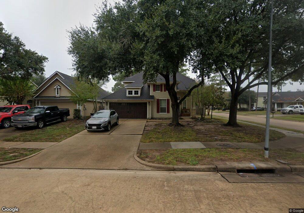
13027 Red Laurel Ct Cypress, TX 77429
Estimated Value: $371,000 - $442,000
4
Beds
3
Baths
2,596
Sq Ft
$154/Sq Ft
Est. Value
About This Home
This home is located at 13027 Red Laurel Ct, Cypress, TX 77429 and is currently estimated at $400,930, approximately $154 per square foot. 13027 Red Laurel Ct is a home located in Harris County with nearby schools including Sampson Elementary School, Spillane Middle School, and Cypress Woods High School.
Ownership History
Date
Name
Owned For
Owner Type
Purchase Details
Closed on
Mar 14, 2019
Sold by
Mccardle Michael and Mccardle Brittany Noel
Bought by
Woodson Wendy
Current Estimated Value
Home Financials for this Owner
Home Financials are based on the most recent Mortgage that was taken out on this home.
Original Mortgage
$263,547
Interest Rate
4.4%
Mortgage Type
VA
Purchase Details
Closed on
Jun 28, 2017
Sold by
Poff Clint R and Poff Laura
Bought by
Mccardle Michael and Mccardle Brittany Noel
Home Financials for this Owner
Home Financials are based on the most recent Mortgage that was taken out on this home.
Original Mortgage
$191,200
Interest Rate
4.02%
Mortgage Type
New Conventional
Purchase Details
Closed on
Jul 17, 2002
Sold by
Mhi Partnership Ltd
Bought by
Poff Clint R and Poff Laura
Home Financials for this Owner
Home Financials are based on the most recent Mortgage that was taken out on this home.
Original Mortgage
$175,040
Interest Rate
6.73%
Create a Home Valuation Report for This Property
The Home Valuation Report is an in-depth analysis detailing your home's value as well as a comparison with similar homes in the area
Home Values in the Area
Average Home Value in this Area
Purchase History
| Date | Buyer | Sale Price | Title Company |
|---|---|---|---|
| Woodson Wendy | -- | Frontier Title Co Wh Llc | |
| Mccardle Michael | -- | None Available | |
| Poff Clint R | -- | Millennium Title |
Source: Public Records
Mortgage History
| Date | Status | Borrower | Loan Amount |
|---|---|---|---|
| Open | Woodson Wendy | $263,547 | |
| Previous Owner | Mccardle Michael | $191,200 | |
| Previous Owner | Poff Clint R | $175,040 |
Source: Public Records
Tax History Compared to Growth
Tax History
| Year | Tax Paid | Tax Assessment Tax Assessment Total Assessment is a certain percentage of the fair market value that is determined by local assessors to be the total taxable value of land and additions on the property. | Land | Improvement |
|---|---|---|---|---|
| 2025 | -- | $374,453 | $65,696 | $308,757 |
| 2024 | -- | $388,536 | $65,696 | $322,840 |
| 2023 | $7,298 | $388,758 | $65,696 | $323,062 |
| 2022 | $7,360 | $310,624 | $48,664 | $261,960 |
| 2021 | $7,106 | $280,772 | $48,664 | $232,108 |
| 2020 | $6,802 | $260,682 | $38,931 | $221,751 |
| 2019 | $6,465 | $240,287 | $38,931 | $201,356 |
| 2018 | $2,408 | $240,287 | $38,931 | $201,356 |
| 2017 | $6,467 | $240,287 | $38,931 | $201,356 |
| 2016 | $6,423 | $240,287 | $38,931 | $201,356 |
| 2015 | $3,013 | $227,781 | $38,931 | $188,850 |
| 2014 | $3,013 | $207,894 | $38,931 | $168,963 |
Source: Public Records
Map
Nearby Homes
- 13003 Oakwood Manor Dr
- 14306 Prosper Ridge Dr
- 14210 Prospect Point Dr
- 14103 Sherburn Manor Dr
- 13718 Sherburn Manor Dr
- 14546 Bergenia Dr
- 15923 Hurstfield Pointe Dr
- 13014 Vivienne Westmoreland Dr
- 12803 Shady Knoll Ln
- 12726 Shady Knoll Ln
- 14634 Bergenia Dr
- 14710 Early Hollow Ln
- 13718 Cardinal Flowers Dr
- 13002 Huffmeister Rd
- 16047 Lockdale Ln
- 12603 Telge Rd Unit 26 E-F
- 12603 Telge Rd Unit 30C-D
- 12603 Telge Rd Unit 8 I-L
- 0 Huffmeister Rd
- 13931 Huffmeister Rd
- 13023 Red Laurel Ct
- 13019 Red Laurel Ct
- 13022 Tall Spruce Dr
- 13018 Tall Spruce Dr
- 15226 Ledgewood Park Dr
- 15230 Ledgewood Park Dr
- 13015 Red Laurel Ct
- 13014 Tall Spruce Dr
- 15222 Ledgewood Park Dr
- 15234 Ledgewood Park Dr
- 13026 Red Laurel Ct
- 15218 Ledgewood Park Dr
- 13022 Red Laurel Ct
- 13010 Tall Spruce Dr
- 13011 Red Laurel Ct
- 13018 Red Laurel Ct
- 15214 Ledgewood Park Dr
- 15242 Ledgewood Park Dr
- 13014 Red Laurel Ct
- 13007 Red Laurel Ct