Estimated Value: $232,000 - $324,000
4
Beds
1
Bath
1,800
Sq Ft
$152/Sq Ft
Est. Value
About This Home
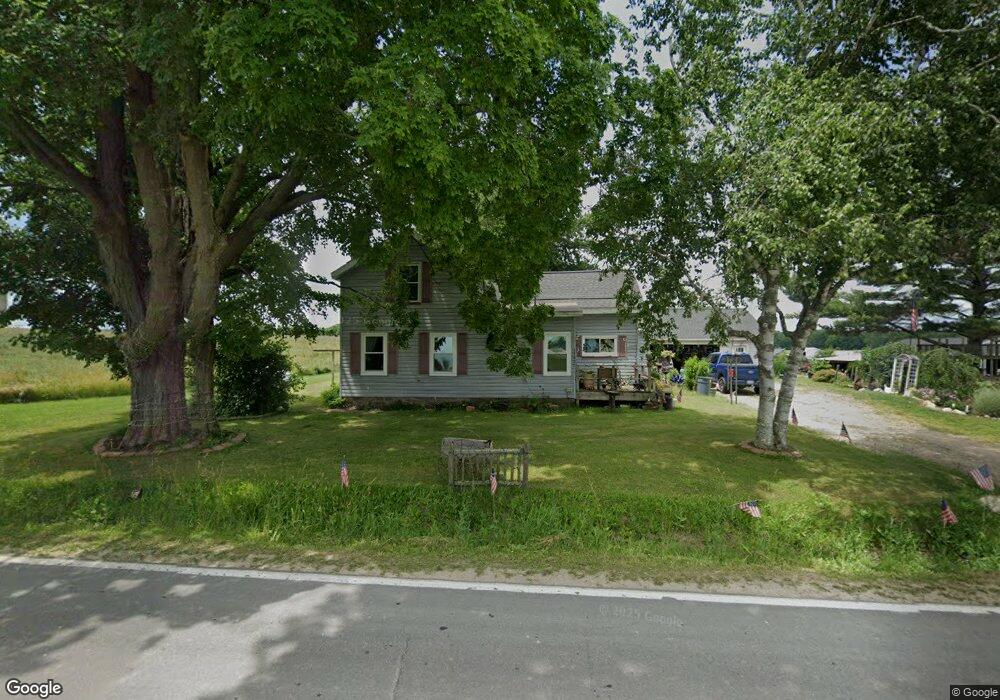
This home is located at 13027 S Wisner Ave, Grant, MI 49327 and is currently estimated at $272,919, approximately $151 per square foot. 13027 S Wisner Ave is a home located in Newaygo County with nearby schools including Grant Elementary School, Grant Primary Center, and Grant Middle School.
Ownership History
Date
Name
Owned For
Owner Type
Purchase Details
Closed on
Nov 13, 2019
Sold by
Charles Hargreaves
Bought by
Crumback Patrick and Crumback June
Current Estimated Value
Purchase Details
Closed on
Feb 19, 2009
Sold by
Federal National Mortgage Association
Bought by
Scott Samantha A and Scott Randolph L
Home Financials for this Owner
Home Financials are based on the most recent Mortgage that was taken out on this home.
Original Mortgage
$79,152
Interest Rate
5.14%
Mortgage Type
Stand Alone First
Purchase Details
Closed on
May 21, 2008
Sold by
Mortgage Electronic Registration
Bought by
Federal Natl Mortgage Assoc
Purchase Details
Closed on
May 20, 2008
Sold by
Brock Larry J
Bought by
Mers
Purchase Details
Closed on
Oct 18, 2001
Sold by
Dupras Denal
Bought by
Brock Larry J
Create a Home Valuation Report for This Property
The Home Valuation Report is an in-depth analysis detailing your home's value as well as a comparison with similar homes in the area
Home Values in the Area
Average Home Value in this Area
Purchase History
| Date | Buyer | Sale Price | Title Company |
|---|---|---|---|
| Crumback Patrick | $150,000 | -- | |
| Scott Samantha A | $71,600 | Warranty Title Agency Llc | |
| Federal Natl Mortgage Assoc | -- | -- | |
| Mers | $93,200 | -- | |
| Brock Larry J | $95,000 | -- |
Source: Public Records
Mortgage History
| Date | Status | Borrower | Loan Amount |
|---|---|---|---|
| Previous Owner | Scott Samantha A | $79,152 |
Source: Public Records
Tax History Compared to Growth
Tax History
| Year | Tax Paid | Tax Assessment Tax Assessment Total Assessment is a certain percentage of the fair market value that is determined by local assessors to be the total taxable value of land and additions on the property. | Land | Improvement |
|---|---|---|---|---|
| 2025 | $1,681 | $90,200 | $0 | $0 |
| 2024 | $7 | $76,400 | $0 | $0 |
| 2023 | $664 | $62,000 | $0 | $0 |
| 2022 | $1,550 | $56,400 | $0 | $0 |
| 2021 | $1,541 | $55,900 | $0 | $0 |
| 2020 | $1,521 | $53,300 | $0 | $0 |
| 2019 | $1,064 | $49,900 | $0 | $0 |
| 2018 | $1,088 | $41,700 | $0 | $0 |
| 2017 | $1,103 | $39,800 | $0 | $0 |
| 2016 | $1,080 | $38,200 | $0 | $0 |
| 2015 | -- | $37,800 | $0 | $0 |
| 2014 | -- | $35,700 | $0 | $0 |
Source: Public Records
Map
Nearby Homes
- 12745 Austrian Dr
- 12515 Rosemary Ave
- 2119 W 116th St
- 1885 Shaw Rd
- 3193 W 112th St
- 2308 W 112th St
- 15255 Bailey Rd
- 10201 Mason Dr
- 2346 W 112th St
- 86 W State Rd
- 4115 W 108th St
- 11298 S Gordon Ave
- 151 & 153 Clark St
- 4615 W 112th St
- 17474 Connor Cir
- Lot 19 S Elder Ave
- 11365 Warner Ave
- 11291 Warner Ave
- 14074 S Elder Ave
- 187 Behler Rd
- 13027 S Wisner Ave
- 13066 S Wisner Ave
- 12814 Wisner Ave
- 13190 S Wisner Ave
- 12721 S Wisner Ave
- 13294 Wisner Ave
- 13340 Wisner Ave
- 13374 S Wisner Ave
- 13405 Wisner Ave
- 13418 S Wisner Ave
- 12560 S Wisner Ave
- 13525 S Wisner Ave
- 13549 Wisner Ave
- 13504 S Wisner Ave
- 3017 W 136th St
- 2899 W 136th St
- 2755 W 136th St
- 2867 W 136th St
- 2573 W 136th St
- 12441 S Wisner Ave