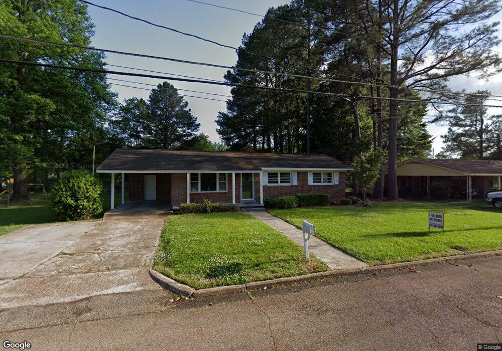
1303 E Bristow Dr Tupelo, MI 38801
Estimated Value: $138,907 - $150,000
3
Beds
1
Bath
1,125
Sq Ft
$130/Sq Ft
Est. Value
About This Home
This home is located at 1303 E Bristow Dr, Tupelo, MI 38801 and is currently estimated at $146,227, approximately $129 per square foot. 1303 E Bristow Dr is a home located in Lee County with nearby schools including Rankin Elementary School, Joyner Elementary School, and Milam Elementary School.
Ownership History
Date
Name
Owned For
Owner Type
Purchase Details
Closed on
Dec 12, 2018
Sold by
Hoover Tracy G and Hoover Mark
Bought by
Oleput Properties Llc
Current Estimated Value
Purchase Details
Closed on
Dec 7, 2018
Bought by
Oleput Properties Llc
Purchase Details
Closed on
Sep 20, 2007
Sold by
Wood William L and Wood Betty C
Bought by
Lewis Tracy G
Home Financials for this Owner
Home Financials are based on the most recent Mortgage that was taken out on this home.
Original Mortgage
$87,526
Interest Rate
6.55%
Mortgage Type
Purchase Money Mortgage
Create a Home Valuation Report for This Property
The Home Valuation Report is an in-depth analysis detailing your home's value as well as a comparison with similar homes in the area
Purchase History
| Date | Buyer | Sale Price | Title Company |
|---|---|---|---|
| Oleput Properties Llc | -- | None Available | |
| Oleput Properties Llc | $82,800 | -- | |
| Lewis Tracy G | -- | -- |
Source: Public Records
Mortgage History
| Date | Status | Borrower | Loan Amount |
|---|---|---|---|
| Previous Owner | Oleput Properties Llc | $79,259 | |
| Previous Owner | Lewis Tracy G | $87,526 |
Source: Public Records
Tax History
| Year | Tax Paid | Tax Assessment Tax Assessment Total Assessment is a certain percentage of the fair market value that is determined by local assessors to be the total taxable value of land and additions on the property. | Land | Improvement |
|---|---|---|---|---|
| 2025 | $1,524 | $11,208 | $0 | $0 |
| 2024 | $1,524 | $11,208 | $0 | $0 |
| 2023 | $1,489 | $10,298 | $0 | $0 |
| 2022 | $1,453 | $10,298 | $0 | $0 |
| 2021 | $1,409 | $10,298 | $0 | $0 |
| 2020 | $1,378 | $10,298 | $0 | $0 |
| 2019 | $1,432 | $10,188 | $0 | $0 |
| 2018 | $679 | $6,792 | $0 | $0 |
| 2017 | $676 | $6,792 | $0 | $0 |
| 2016 | $676 | $6,792 | $0 | $0 |
| 2015 | $613 | $6,284 | $0 | $0 |
| 2014 | $613 | $6,284 | $0 | $0 |
Source: Public Records
Map
Nearby Homes
- 0 Leonard Dr
- 909 Desoto Dr
- 1338 W Jackson St
- 1108 Marquette St
- 1606 Lambard Dr
- 104 Marquette Cir
- 1302 Lumpkin Ave
- 141 1802 West Jackson St
- 0 W Jackson St
- 355 Rankin Blvd
- 414 N Thomas St
- Lot 6 Kincannon St
- Lot 4 Kincannon St
- Lot 10 Kincannon St
- Lot 11 Kincannon St
- Lot 5 Kincannon St
- Lot 7 Kincannon St
- Lot 8 Kincannon St
- Lot 9 Kincannon St
- 1131 Woodlawn St
- 1303 E Bristow Dr
- 1304A E Bristow
- 1301 E Bristow Dr
- 1305 E Bristow Dr
- 1305 E Bristow Dr
- 1306 E Bristow Dr
- 1301 E Bristow Dr
- 811 George Ave
- 1307 E Bristow Dr
- 1302 E Bristow Dr
- 1302 E Bristow Dr
- 903 George Ave
- 1308 Lambard Dr
- 1310 Lambard Dr
- 1306 Lambard Dr
- 1312 Lambard Dr
- 811 George Ave
- 807 George Ave
- 1304 Lambard Dr
- 905 George Ave
Your Personal Tour Guide
Ask me questions while you tour the home.