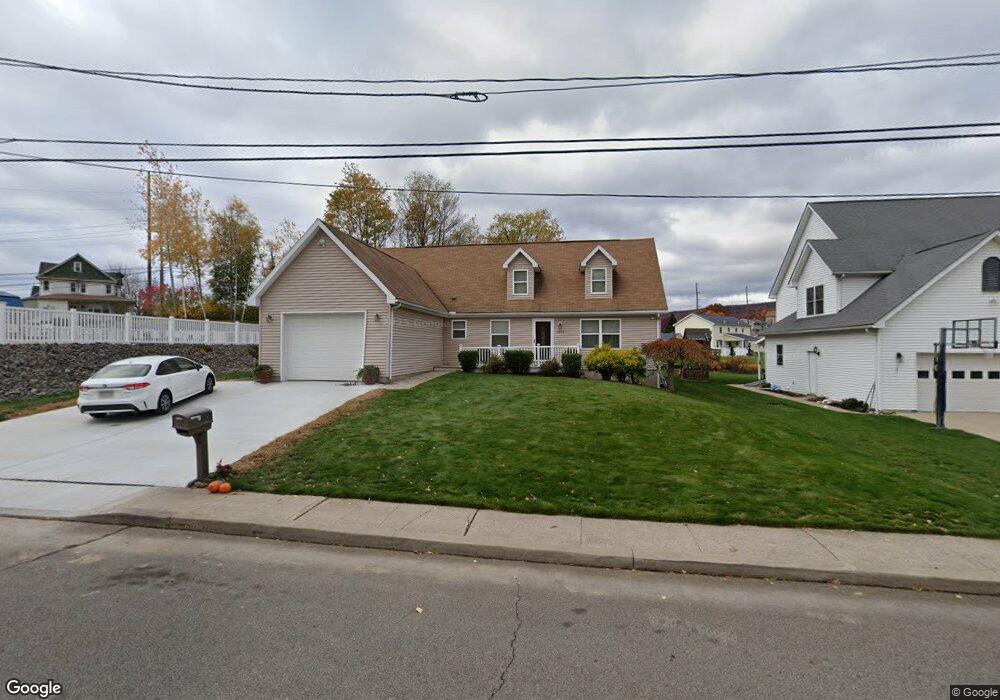
1303 Euclid Ave Scranton, PA 18504
Tripp's Park NeighborhoodEstimated Value: $211,097 - $435,000
4
Beds
3
Baths
2,151
Sq Ft
$164/Sq Ft
Est. Value
About This Home
This home is located at 1303 Euclid Ave, Scranton, PA 18504 and is currently estimated at $353,774, approximately $164 per square foot. 1303 Euclid Ave is a home located in Lackawanna County with nearby schools including Isaac Tripp Elementary School, West Scranton Intrmd School, and West Scranton High School.
Ownership History
Date
Name
Owned For
Owner Type
Purchase Details
Closed on
May 10, 2018
Sold by
Scaramuzzo Arthur and Scaramuzzo Gail B
Bought by
Cholish William J
Current Estimated Value
Home Financials for this Owner
Home Financials are based on the most recent Mortgage that was taken out on this home.
Original Mortgage
$980,000
Outstanding Balance
$843,812
Interest Rate
4.4%
Mortgage Type
New Conventional
Estimated Equity
-$490,038
Create a Home Valuation Report for This Property
The Home Valuation Report is an in-depth analysis detailing your home's value as well as a comparison with similar homes in the area
Home Values in the Area
Average Home Value in this Area
Purchase History
| Date | Buyer | Sale Price | Title Company |
|---|---|---|---|
| Cholish William J | $200,000 | None Available |
Source: Public Records
Mortgage History
| Date | Status | Borrower | Loan Amount |
|---|---|---|---|
| Open | Cholish William J | $980,000 |
Source: Public Records
Tax History Compared to Growth
Tax History
| Year | Tax Paid | Tax Assessment Tax Assessment Total Assessment is a certain percentage of the fair market value that is determined by local assessors to be the total taxable value of land and additions on the property. | Land | Improvement |
|---|---|---|---|---|
| 2025 | $8,288 | $24,000 | $6,700 | $17,300 |
| 2024 | $7,612 | $24,000 | $6,700 | $17,300 |
| 2023 | $7,612 | $24,000 | $6,700 | $17,300 |
| 2022 | $7,445 | $24,000 | $6,700 | $17,300 |
| 2021 | $7,445 | $24,000 | $6,700 | $17,300 |
| 2020 | $7,317 | $24,000 | $6,700 | $17,300 |
| 2019 | $6,894 | $24,000 | $6,700 | $17,300 |
| 2018 | $6,894 | $24,000 | $6,700 | $17,300 |
| 2017 | $6,781 | $24,000 | $6,700 | $17,300 |
| 2016 | $0 | $24,000 | $6,700 | $17,300 |
| 2015 | $5,031 | $24,000 | $6,700 | $17,300 |
| 2014 | -- | $25,000 | $6,700 | $18,300 |
Source: Public Records
Map
Nearby Homes
- 1210-1212 N Rebecca Ave
- 1057 Euclid Ave
- 116 Little Spike Way Unit L 40
- 1235 N Sumner Ave
- 1425 Bulwer St
- 0 Philo St Unit GSBSC4763
- 1431 Dorothy St
- 1402 N Rebecca Ave
- 1727 Dorothy St
- 1008 Mount Vernon Ave
- 1501 Farr St
- 1819 Clearview St Unit L 109
- 656 Philo St
- 1316 W Gibson St
- 1311 Short Ave
- 1436 Church Ave
- 1430 N Main Ave
- 955-961 Providence Rd
- 2133 Dorothy St
- 833 Powderly Ct
- 1301 Euclid Ave
- 1305 Euclid Ave
- 1504 Dickens St
- 1307 Euclid Ave
- 1503 Court St
- 1308 Euclid Ave
- 1501 Dickens St
- 1310 Euclid Ave
- 1505 Court St
- 1213 N Rebecca Ave
- 1215 Euclid Ave
- 1508 Dickens St
- 1210 N Rebecca Ave Unit 1212
- 1500 Court L 89 St
- 1500 Court St
- 1531 Dickens St
- 1211 N Rebecca Ave
- 1500 Dickens St
- 1533 Dickens St Unit L25
- 1213 Euclid Ave