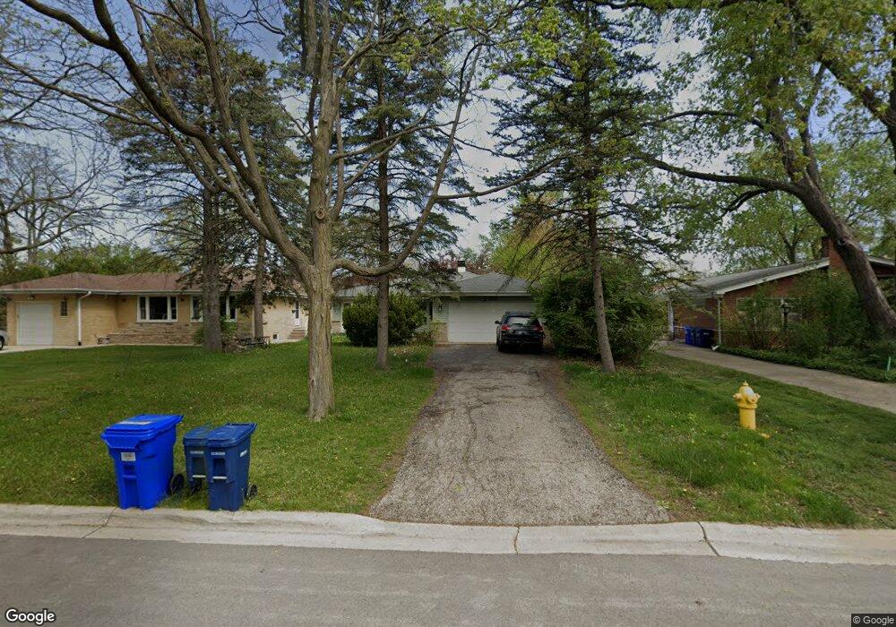
1303 Pershing Ave Wheaton, IL 60189
Southeast Wheaton NeighborhoodEstimated Value: $335,000 - $449,000
3
Beds
2
Baths
1,287
Sq Ft
$316/Sq Ft
Est. Value
About This Home
This home is located at 1303 Pershing Ave, Wheaton, IL 60189 and is currently estimated at $406,759, approximately $316 per square foot. 1303 Pershing Ave is a home located in DuPage County with nearby schools including Lincoln Elementary School, Edison Middle School, and Wheaton Warrenville South High School.
Ownership History
Date
Name
Owned For
Owner Type
Purchase Details
Closed on
Nov 20, 2009
Sold by
Johnsen Richard G and Johnsen Carolyn A
Bought by
Todd Brandon I and Reyes Todd Claudia
Current Estimated Value
Home Financials for this Owner
Home Financials are based on the most recent Mortgage that was taken out on this home.
Original Mortgage
$216,015
Outstanding Balance
$141,409
Interest Rate
5.05%
Mortgage Type
FHA
Estimated Equity
$265,350
Create a Home Valuation Report for This Property
The Home Valuation Report is an in-depth analysis detailing your home's value as well as a comparison with similar homes in the area
Home Values in the Area
Average Home Value in this Area
Purchase History
| Date | Buyer | Sale Price | Title Company |
|---|---|---|---|
| Todd Brandon I | $220,000 | Multiple |
Source: Public Records
Mortgage History
| Date | Status | Borrower | Loan Amount |
|---|---|---|---|
| Open | Todd Brandon I | $216,015 |
Source: Public Records
Tax History
| Year | Tax Paid | Tax Assessment Tax Assessment Total Assessment is a certain percentage of the fair market value that is determined by local assessors to be the total taxable value of land and additions on the property. | Land | Improvement |
|---|---|---|---|---|
| 2024 | $6,980 | $116,299 | $36,970 | $79,329 |
| 2023 | $6,694 | $107,050 | $34,030 | $73,020 |
| 2022 | $6,591 | $101,170 | $32,160 | $69,010 |
| 2021 | $6,566 | $98,770 | $31,400 | $67,370 |
| 2020 | $6,544 | $97,850 | $31,110 | $66,740 |
| 2019 | $6,391 | $95,270 | $30,290 | $64,980 |
| 2018 | $6,210 | $91,740 | $28,540 | $63,200 |
| 2017 | $6,113 | $88,360 | $27,490 | $60,870 |
| 2016 | $6,025 | $84,830 | $26,390 | $58,440 |
| 2015 | $5,972 | $80,930 | $25,180 | $55,750 |
| 2014 | $5,781 | $77,300 | $17,870 | $59,430 |
| 2013 | $5,633 | $77,530 | $17,920 | $59,610 |
Source: Public Records
Map
Nearby Homes
- 1500 Pershing Ave
- 1728 Pershing Ave Unit 3
- 1607 E Indiana St
- 510 S President St
- 1818 E Indiana St
- 213 S Summit St
- 220 S President St
- 123 S Blanchard St
- 119 S Williston St
- 1690 Darwin Ct Unit D
- 302 Roscommon Ct
- 97 N Kenilworth Ave
- 1581 Groton Ln
- 1026 Briarcliffe Blvd
- 421 E Willow Ave
- 270 S Ott Ave
- 715 S Naperville Rd
- 502 N Blanchard St
- 1551 Briarcliffe Blvd
- 1614 Sawyer Ave
- 1307 Pershing Ave
- 1219 Pershing Ave
- 1311 Pershing Ave
- 1302 Taft Ave
- 1215 Pershing Ave
- 1306 Taft Ave
- 1315 Pershing Ave
- 1218 Taft Ave
- 1310 Taft Ave
- 1211 Pershing Ave
- 1214 Taft Ave
- 1314 Taft Ave
- 1319 Pershing Ave
- 1302 Pershing Ave
- 1218 Pershing Ave
- 1304 Pershing Ave
- 1222 Pershing Ave
- 1210 Taft Ave
- 1308 Pershing Ave
- 1207 Pershing Ave
Your Personal Tour Guide
Ask me questions while you tour the home.