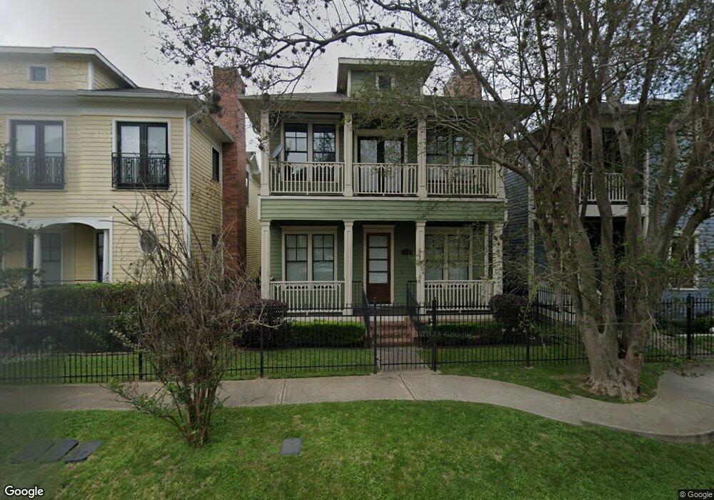
1303 W 25th St Unit A Houston, TX 77008
Greater Heights NeighborhoodEstimated Value: $422,751 - $517,000
3
Beds
3
Baths
1,936
Sq Ft
$244/Sq Ft
Est. Value
About This Home
This home is located at 1303 W 25th St Unit A, Houston, TX 77008 and is currently estimated at $473,188, approximately $244 per square foot. 1303 W 25th St Unit A is a home located in Harris County with nearby schools including Sinclair Elementary School, Hamilton Middle, and Waltrip High School.
Ownership History
Date
Name
Owned For
Owner Type
Purchase Details
Closed on
Sep 28, 2007
Sold by
Hsa Townhomes Lp
Bought by
Bragg Melanie D
Current Estimated Value
Home Financials for this Owner
Home Financials are based on the most recent Mortgage that was taken out on this home.
Original Mortgage
$264,900
Outstanding Balance
$169,252
Interest Rate
6.66%
Mortgage Type
Purchase Money Mortgage
Estimated Equity
$303,936
Create a Home Valuation Report for This Property
The Home Valuation Report is an in-depth analysis detailing your home's value as well as a comparison with similar homes in the area
Home Values in the Area
Average Home Value in this Area
Purchase History
| Date | Buyer | Sale Price | Title Company |
|---|---|---|---|
| Bragg Melanie D | -- | Startex Title Company |
Source: Public Records
Mortgage History
| Date | Status | Borrower | Loan Amount |
|---|---|---|---|
| Open | Bragg Melanie D | $264,900 |
Source: Public Records
Tax History Compared to Growth
Tax History
| Year | Tax Paid | Tax Assessment Tax Assessment Total Assessment is a certain percentage of the fair market value that is determined by local assessors to be the total taxable value of land and additions on the property. | Land | Improvement |
|---|---|---|---|---|
| 2025 | $2,484 | $428,895 | $143,760 | $285,135 |
| 2024 | $2,484 | $433,086 | $131,780 | $301,306 |
| 2023 | $2,484 | $425,716 | $131,780 | $293,936 |
| 2022 | $8,420 | $382,417 | $107,820 | $274,597 |
| 2021 | $8,151 | $349,733 | $107,820 | $241,913 |
| 2020 | $8,277 | $341,810 | $111,055 | $230,755 |
| 2019 | $8,449 | $333,912 | $111,055 | $222,857 |
| 2018 | $8,453 | $334,045 | $111,055 | $222,990 |
| 2017 | $8,447 | $334,045 | $111,055 | $222,990 |
| 2016 | $8,266 | $334,045 | $111,055 | $222,990 |
| 2015 | $5,406 | $334,045 | $111,055 | $222,990 |
| 2014 | $5,406 | $285,081 | $98,715 | $186,366 |
Source: Public Records
Map
Nearby Homes
- 2543 Bevis St
- 2426 Bevis St
- 1240 W 26th St
- 1348 W 25th St
- 1235 W 25th St
- 1431 W 25th St
- 1427 W 25th St
- 1230 W 26th St
- 1360 W 25th St
- 2609 Bevis St
- 1408 W 25th St
- 2308 Bevis St
- 2623 Shady Woods Ln
- 1232 W 24th St Unit C
- 1243 W 23rd St Unit C
- 1207 W 24th St Unit A
- 1214 W 24th St Unit D
- 1214 W 24th St Unit E
- 1214 W 24th St Unit B
- 1214 W 24th St Unit A
- 1303 W 25th St Unit B
- 1303 W 25th St
- 1301 W 25th & Bevis
- 1305 W 25th St Unit A
- 1305 W 25th St Unit B
- 1305 W 25th St
- 1301 W 25th St Unit A
- 1301 W 25th St Unit B
- 1301 W 25th St
- 1311 W 25th St Unit A
- 1311 W 25th St Unit B
- 1311 W 25th St
- 1313 W 25th St Unit A
- 1313 W 25th St
- 1309 W 25th St Unit B
- 1309 W 25th St Unit A
- 1309 W 25th St
- 2516 Bevis St
- 2518 Bevis St
- 2502 Bevis St