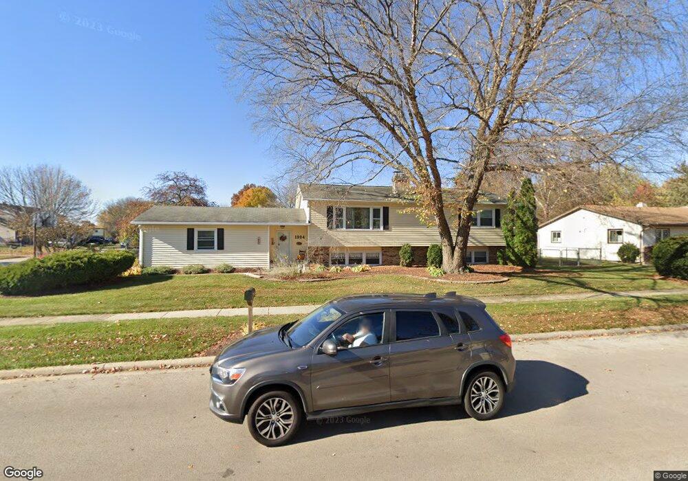
1304 Pappas Dr Elgin, IL 60123
Century Oaks West NeighborhoodEstimated Value: $408,000 - $478,000
5
Beds
2
Baths
2,524
Sq Ft
$171/Sq Ft
Est. Value
About This Home
This home is located at 1304 Pappas Dr, Elgin, IL 60123 and is currently estimated at $430,745, approximately $170 per square foot. 1304 Pappas Dr is a home located in Kane County with nearby schools including Century Oaks Elementary School, Kimball Middle School, and Larkin High School.
Ownership History
Date
Name
Owned For
Owner Type
Purchase Details
Closed on
Jan 14, 2002
Sold by
Higgins Dennis M and Higgins Judy A
Bought by
Higgins Dennis M
Current Estimated Value
Home Financials for this Owner
Home Financials are based on the most recent Mortgage that was taken out on this home.
Original Mortgage
$133,600
Interest Rate
7.16%
Mortgage Type
Balloon
Create a Home Valuation Report for This Property
The Home Valuation Report is an in-depth analysis detailing your home's value as well as a comparison with similar homes in the area
Home Values in the Area
Average Home Value in this Area
Purchase History
| Date | Buyer | Sale Price | Title Company |
|---|---|---|---|
| Higgins Dennis M | -- | Chicago Title Insurance Co |
Source: Public Records
Mortgage History
| Date | Status | Borrower | Loan Amount |
|---|---|---|---|
| Closed | Higgins Dennis M | $133,600 | |
| Closed | Higgins Dennis M | $14,400 |
Source: Public Records
Tax History Compared to Growth
Tax History
| Year | Tax Paid | Tax Assessment Tax Assessment Total Assessment is a certain percentage of the fair market value that is determined by local assessors to be the total taxable value of land and additions on the property. | Land | Improvement |
|---|---|---|---|---|
| 2024 | $7,990 | $107,837 | $26,129 | $81,708 |
| 2023 | $7,623 | $97,423 | $23,606 | $73,817 |
| 2022 | $7,183 | $88,833 | $21,525 | $67,308 |
| 2021 | $6,874 | $83,052 | $20,124 | $62,928 |
| 2020 | $6,684 | $79,285 | $19,211 | $60,074 |
| 2019 | $6,493 | $75,524 | $18,300 | $57,224 |
| 2018 | $5,914 | $65,819 | $17,240 | $48,579 |
| 2017 | $5,783 | $62,223 | $16,298 | $45,925 |
| 2016 | $5,517 | $57,726 | $15,120 | $42,606 |
| 2015 | -- | $52,911 | $13,859 | $39,052 |
| 2014 | -- | $52,258 | $13,688 | $38,570 |
| 2013 | -- | $53,636 | $14,049 | $39,587 |
Source: Public Records
Map
Nearby Homes
- 89 Brookwood Ct
- 41 Lockman Cir Unit 5
- 5 Creekside Cir Unit B
- 1405 Creekside Ct Unit B
- 1121 Forest Dr
- 1235 Meadow Ln
- 1223 Ridgeway Dr
- 900 Ruth Dr
- 997 Meadow Ln
- 2032 Swan Ln
- 938 Hillcrest Rd
- 730 N Lyle Ave
- 801 N Mclean Blvd Unit 220
- 801 N Mclean Blvd Unit 226
- 801 N Mclean Blvd Unit 316
- 801 N Mclean Blvd Unit 362
- 949 Millcreek Cir
- 2141 Colorado Ave Unit 3
- 36W225 Hickory Hollow Dr
- 36W251 Oak Hill Dr
- 1680 Sheffield Dr
- 1320 Pappas Dr
- 1686 Sheffield Dr
- 1640 Sheffield Dr Unit 3
- 1330 Pappas Dr
- 1673 Sheffield Dr
- 1675 Sheffield Dr
- 1319 Pappas Dr
- 1550 Sheffield Dr
- Lot 129 Sheffield Dr
- 1683 Sheffield Dr
- 1692 Sheffield Dr
- 1338 Pappas Dr
- 1327 Pappas Dr
- 1630 Sheffield Dr
- 1685 Sheffield Dr
- 1288 Pappas Ct
- 1635 Sheffield Dr Unit 37
- 1635 Sheffield Dr
- 1637 Sheffield Dr