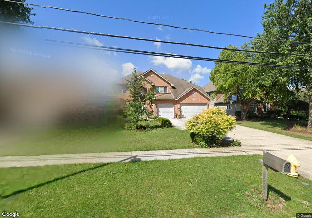
1304 S Ridge Rd Willowbrook, IL 60527
South Westmont NeighborhoodEstimated Value: $789,000 - $1,089,000
--
Bed
--
Bath
3,178
Sq Ft
$275/Sq Ft
Est. Value
About This Home
This home is located at 1304 S Ridge Rd, Willowbrook, IL 60527 and is currently estimated at $875,049, approximately $275 per square foot. 1304 S Ridge Rd is a home located in DuPage County with nearby schools including Holmes Elementary School, Maercker Elementary School, and Westview Hills Middle School.
Ownership History
Date
Name
Owned For
Owner Type
Purchase Details
Closed on
Nov 25, 2003
Sold by
Scumaci Ralph A and Scumaci Kathy A
Bought by
Collanto Rustico and Collanto Raquel
Current Estimated Value
Home Financials for this Owner
Home Financials are based on the most recent Mortgage that was taken out on this home.
Original Mortgage
$492,000
Outstanding Balance
$185,721
Interest Rate
3.25%
Mortgage Type
Purchase Money Mortgage
Estimated Equity
$689,328
Purchase Details
Closed on
Jul 31, 2000
Sold by
Prairie Bank & Trust Company
Bought by
Scumaci Ralph A and Scumaci Kathy A
Home Financials for this Owner
Home Financials are based on the most recent Mortgage that was taken out on this home.
Original Mortgage
$395,200
Interest Rate
8.12%
Create a Home Valuation Report for This Property
The Home Valuation Report is an in-depth analysis detailing your home's value as well as a comparison with similar homes in the area
Home Values in the Area
Average Home Value in this Area
Purchase History
| Date | Buyer | Sale Price | Title Company |
|---|---|---|---|
| Collanto Rustico | $615,000 | Multiple | |
| Scumaci Ralph A | $494,000 | Chicago Title Insurance Co |
Source: Public Records
Mortgage History
| Date | Status | Borrower | Loan Amount |
|---|---|---|---|
| Open | Collanto Rustico | $492,000 | |
| Previous Owner | Scumaci Ralph A | $395,200 | |
| Closed | Collanto Rustico | $60,000 |
Source: Public Records
Tax History Compared to Growth
Tax History
| Year | Tax Paid | Tax Assessment Tax Assessment Total Assessment is a certain percentage of the fair market value that is determined by local assessors to be the total taxable value of land and additions on the property. | Land | Improvement |
|---|---|---|---|---|
| 2024 | $14,280 | $236,630 | $63,876 | $172,754 |
| 2023 | $13,633 | $217,530 | $58,720 | $158,810 |
| 2022 | $13,892 | $213,070 | $57,520 | $155,550 |
| 2021 | $13,421 | $210,650 | $56,870 | $153,780 |
| 2020 | $13,167 | $206,470 | $55,740 | $150,730 |
| 2019 | $12,740 | $198,110 | $53,480 | $144,630 |
| 2018 | $13,414 | $208,360 | $53,210 | $155,150 |
| 2017 | $12,739 | $200,500 | $51,200 | $149,300 |
| 2016 | $12,520 | $191,350 | $48,860 | $142,490 |
| 2015 | $12,385 | $180,030 | $45,970 | $134,060 |
| 2014 | $12,068 | $175,040 | $44,700 | $130,340 |
| 2013 | $12,704 | $188,630 | $44,490 | $144,140 |
Source: Public Records
Map
Nearby Homes
- 1205 Charleston Ct Unit 1205
- 1017 Fordham Way
- 824 High Ridge Ct
- 1040 Longford Ct
- 47 W Pier Dr Unit 102
- 6655 S Cass Ave Unit 5D
- 55 W 64th St Unit 202
- 107 65th Lake Dr Unit 202
- 67 W 64th St Unit 101
- 55 W 64th St Unit 102
- 1313 Cass Ln E Unit 301
- 61 Pier Dr Unit 202
- 1121 Lodgepole Ct
- 1116 Bristlecone Ct
- 263 Deming Place
- 6538 Bentley Ave
- 6540 Bentley Ave
- 6542 Bentley Ave
- 1145 Lacebark Ct
- 6039 Bentley Ave