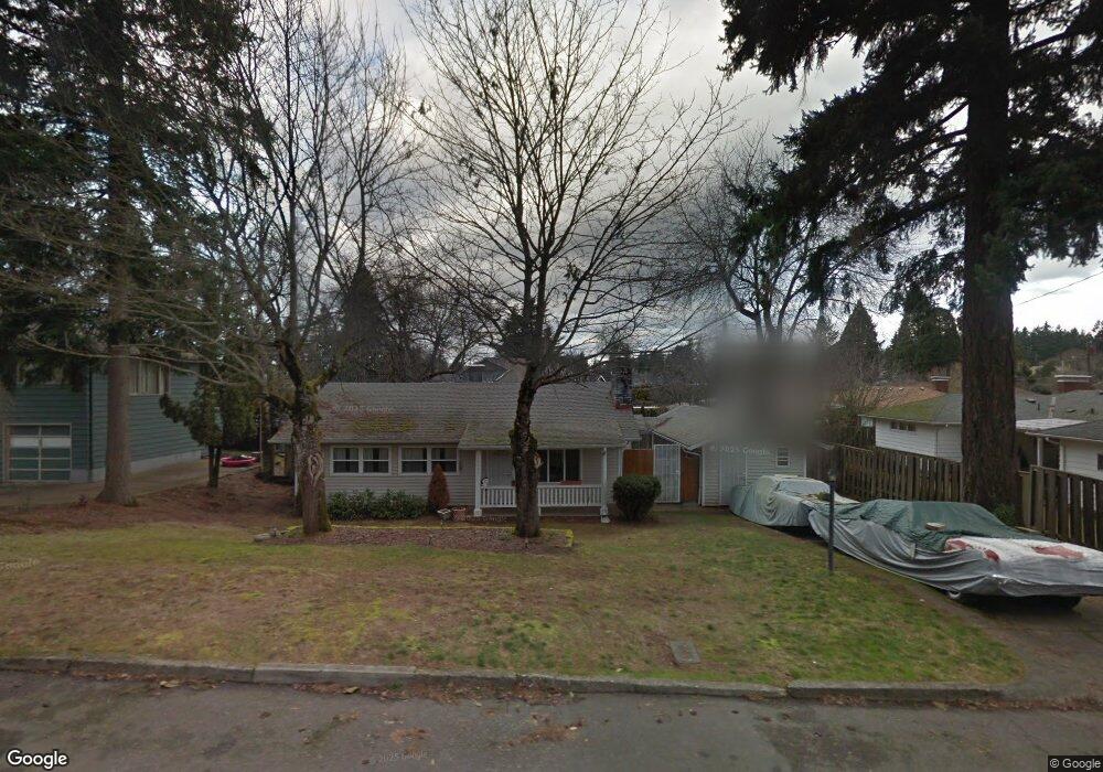
13043 NE Couch St Portland, OR 97230
Hazelwood NeighborhoodEstimated Value: $361,000 - $403,255
3
Beds
1
Bath
1,048
Sq Ft
$373/Sq Ft
Est. Value
About This Home
This home is located at 13043 NE Couch St, Portland, OR 97230 and is currently estimated at $391,314, approximately $373 per square foot. 13043 NE Couch St is a home located in Multnomah County with nearby schools including Menlo Park Elementary School, Floyd Light Middle School, and David Douglas High School.
Ownership History
Date
Name
Owned For
Owner Type
Purchase Details
Closed on
Sep 5, 2025
Sold by
Lincoln Loan Co
Bought by
Principal Holding Co Llc
Current Estimated Value
Purchase Details
Closed on
Aug 11, 2016
Sold by
Stewart Deana
Bought by
Lincoln Loan Co
Purchase Details
Closed on
Apr 1, 2011
Sold by
Lincoln Loan Co
Bought by
Wasilk Deanna and Stewart Donald
Purchase Details
Closed on
Oct 7, 1998
Sold by
Meldrum John R
Bought by
Lincoln Loan Co
Purchase Details
Closed on
Jan 31, 1996
Sold by
Cauthorn Frank A
Bought by
Meldrum John R
Create a Home Valuation Report for This Property
The Home Valuation Report is an in-depth analysis detailing your home's value as well as a comparison with similar homes in the area
Home Values in the Area
Average Home Value in this Area
Purchase History
| Date | Buyer | Sale Price | Title Company |
|---|---|---|---|
| Principal Holding Co Llc | -- | None Listed On Document | |
| Lincoln Loan Co | $247,500 | First American | |
| Wasilk Deanna | $125,364 | None Available | |
| Lincoln Loan Co | $100,736 | -- | |
| Meldrum John R | -- | -- |
Source: Public Records
Tax History Compared to Growth
Tax History
| Year | Tax Paid | Tax Assessment Tax Assessment Total Assessment is a certain percentage of the fair market value that is determined by local assessors to be the total taxable value of land and additions on the property. | Land | Improvement |
|---|---|---|---|---|
| 2024 | $4,464 | $187,100 | -- | -- |
| 2023 | $4,270 | $181,660 | $0 | $0 |
| 2022 | $4,047 | $176,370 | $0 | $0 |
| 2021 | $3,981 | $171,240 | $0 | $0 |
| 2020 | $3,606 | $166,260 | $0 | $0 |
| 2019 | $3,492 | $161,420 | $0 | $0 |
| 2018 | $3,384 | $156,720 | $0 | $0 |
| 2017 | $3,259 | $152,160 | $0 | $0 |
| 2016 | $3,173 | $147,730 | $0 | $0 |
| 2015 | $2,900 | $143,430 | $0 | $0 |
| 2014 | $2,654 | $139,260 | $0 | $0 |
Source: Public Records
Map
Nearby Homes
- 142 NE 128th Ave
- 13035 SE Stark St
- 301 SE 129th Ave
- 59 NE 134th Place
- 13045 SE Stark St Unit 124
- 13045 SE Stark St
- 13045 SE Stark St Unit 6
- 15 NE 127th Ave
- 335 SE 129th Ave
- 12827 SE Stark St Unit B4
- 12841 SE Stark St Unit A19
- 12950 NE Glisan St
- 12871 SE Stark St Unit A16
- 307 SE 127th Ave
- 13241 SE Washington St
- 601 SE 135th Ave
- 706 SE 135th Ave
- 13730 SE Stark St Unit 13752
- 13050 SE Morrison St
- 900 NE 131st Place
- 13019 NE Couch St
- 121 NE 131st Place
- 142 NE 130th Place
- 136 NE 130th Place
- 131 NE 131st Place
- 31 NE 131st Place
- 110 NE 130th Place
- 13046 NE Couch St
- 13030 NE Couch St
- 130 NE 130th Place
- 145 NE 131st Place
- 148 NE 130th Place
- 17 NE 131st Place
- 13016 NE Couch St
- 110 NE 131st Place
- 130 NE 131st Place
- 211 NE 131st Place
- 154 NE 130th Place
- 32 NE 131st Place
- 13039 E Burnside St