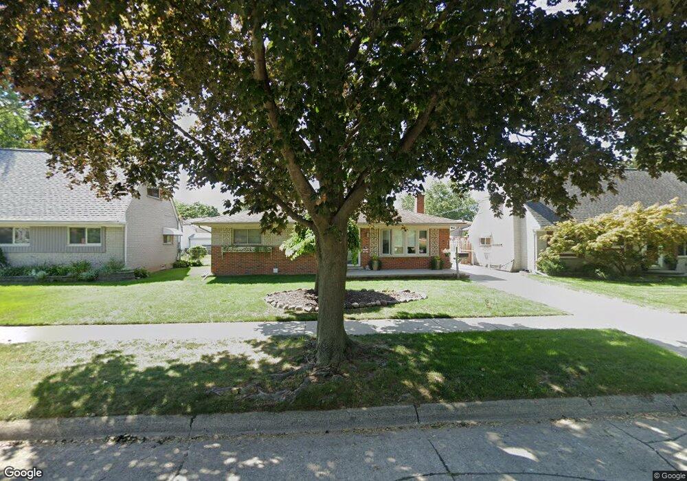
13044 Walter Ave Warren, MI 48088
Northeast Warren NeighborhoodEstimated Value: $241,928 - $260,000
3
Beds
2
Baths
1,337
Sq Ft
$186/Sq Ft
Est. Value
About This Home
This home is located at 13044 Walter Ave, Warren, MI 48088 and is currently estimated at $248,482, approximately $185 per square foot. 13044 Walter Ave is a home located in Macomb County with nearby schools including Warren Woods Tower High School, Frontier International Academy Elementary, and Warren Woods Christian School.
Ownership History
Date
Name
Owned For
Owner Type
Purchase Details
Closed on
Mar 16, 2020
Sold by
Ciampa Nathaniel A and Ciampa Jennifer L
Bought by
Ciampa Family Trust
Current Estimated Value
Purchase Details
Closed on
Apr 28, 2000
Sold by
Constance George G
Bought by
Ciampa Nathaniel A
Home Financials for this Owner
Home Financials are based on the most recent Mortgage that was taken out on this home.
Original Mortgage
$130,900
Outstanding Balance
$45,613
Interest Rate
8.26%
Mortgage Type
Purchase Money Mortgage
Estimated Equity
$202,869
Create a Home Valuation Report for This Property
The Home Valuation Report is an in-depth analysis detailing your home's value as well as a comparison with similar homes in the area
Home Values in the Area
Average Home Value in this Area
Purchase History
| Date | Buyer | Sale Price | Title Company |
|---|---|---|---|
| Ciampa Family Trust | -- | None Available | |
| Ciampa Nathaniel A | $154,000 | -- |
Source: Public Records
Mortgage History
| Date | Status | Borrower | Loan Amount |
|---|---|---|---|
| Open | Ciampa Nathaniel A | $130,900 |
Source: Public Records
Tax History
| Year | Tax Paid | Tax Assessment Tax Assessment Total Assessment is a certain percentage of the fair market value that is determined by local assessors to be the total taxable value of land and additions on the property. | Land | Improvement |
|---|---|---|---|---|
| 2025 | $3,252 | $120,090 | $0 | $0 |
| 2024 | $32 | $108,980 | $0 | $0 |
| 2023 | $2,998 | $101,320 | $0 | $0 |
| 2022 | $2,940 | $88,440 | $0 | $0 |
| 2021 | $2,885 | $81,160 | $0 | $0 |
| 2020 | $2,765 | $77,730 | $0 | $0 |
| 2019 | $2,641 | $73,340 | $0 | $0 |
| 2018 | $2,667 | $65,680 | $0 | $0 |
| 2017 | $2,523 | $58,910 | $10,620 | $48,290 |
| 2016 | $2,503 | $58,910 | $0 | $0 |
| 2015 | -- | $51,090 | $0 | $0 |
| 2013 | $4,837 | $47,330 | $0 | $0 |
Source: Public Records
Map
Nearby Homes
- 13015 Walter Ave
- 29579 Fairfield Dr
- 29531 Eiffel Ave
- 12531 Common Rd
- 13325 Iowa Dr
- 54765 Palomino Ave
- 29143 Dover Ave
- 30507 Moulin Ave
- 29134 Palomino Dr
- 30806 Ridgefield Ave
- 29337 Roan Dr
- 29105 Palomino Dr
- 29417 Scarborough Dr Unit 28
- 29088 Yorkshire Ln Unit 28
- 30139 Flanders Ave
- 29454 Scarborough Dr Unit 7
- 30955 Iroquois Dr
- 29010 Wagner Dr
- 29091 Wagner Dr
- 29226 Scarborough Dr
- 13032 Walter Ave
- 13056 Walter Ave
- 29673 Dover Ave
- 13020 Walter Ave
- 29676 Fairfield Dr
- 29661 Dover Ave
- 29807 Dover Ave
- 29664 Fairfield Dr
- 13110 Walter Ave
- 13039 Walter Ave
- 13027 Walter Ave
- 29652 Fairfield Dr
- 29819 Dover Ave
- 29672 Dover Ave Unit Bldg-Unit
- 29672 Dover Ave
- 12954 Walter Ave
- 13122 Walter Ave
- 29637 Dover Ave
- 29806 Dover Ave
- 29660 Dover Ave
Your Personal Tour Guide
Ask me questions while you tour the home.