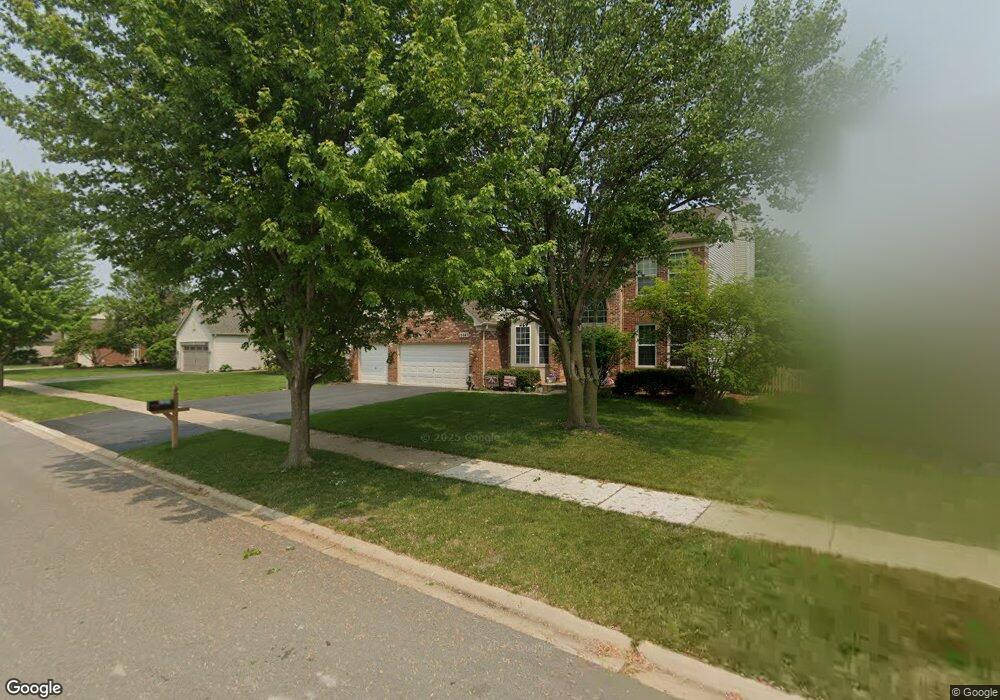
13047 Bradford Ln Unit 1 Plainfield, IL 60585
North Plainfield NeighborhoodEstimated Value: $516,191 - $573,000
4
Beds
3
Baths
2,757
Sq Ft
$200/Sq Ft
Est. Value
About This Home
This home is located at 13047 Bradford Ln Unit 1, Plainfield, IL 60585 and is currently estimated at $550,298, approximately $199 per square foot. 13047 Bradford Ln Unit 1 is a home located in Will County with nearby schools including Eagle Pointe Elementary School, Heritage Grove Middle School, and Plainfield North High School.
Ownership History
Date
Name
Owned For
Owner Type
Purchase Details
Closed on
Apr 8, 2004
Sold by
Blasini Francois R
Bought by
Zumstein Carl R and Zumstein Lynn A
Current Estimated Value
Home Financials for this Owner
Home Financials are based on the most recent Mortgage that was taken out on this home.
Original Mortgage
$195,000
Outstanding Balance
$90,483
Interest Rate
5.46%
Mortgage Type
Purchase Money Mortgage
Estimated Equity
$459,815
Purchase Details
Closed on
Mar 14, 2002
Sold by
Pulte Homes
Bought by
Blasini Francois R
Home Financials for this Owner
Home Financials are based on the most recent Mortgage that was taken out on this home.
Original Mortgage
$92,905
Interest Rate
6.95%
Create a Home Valuation Report for This Property
The Home Valuation Report is an in-depth analysis detailing your home's value as well as a comparison with similar homes in the area
Home Values in the Area
Average Home Value in this Area
Purchase History
| Date | Buyer | Sale Price | Title Company |
|---|---|---|---|
| Zumstein Carl R | $320,000 | -- | |
| Blasini Francois R | $293,000 | Chicago Title Insurance Co |
Source: Public Records
Mortgage History
| Date | Status | Borrower | Loan Amount |
|---|---|---|---|
| Open | Zumstein Carl R | $195,000 | |
| Previous Owner | Blasini Francois R | $92,905 |
Source: Public Records
Tax History Compared to Growth
Tax History
| Year | Tax Paid | Tax Assessment Tax Assessment Total Assessment is a certain percentage of the fair market value that is determined by local assessors to be the total taxable value of land and additions on the property. | Land | Improvement |
|---|---|---|---|---|
| 2024 | $10,895 | $157,701 | $30,792 | $126,909 |
| 2023 | $10,895 | $139,311 | $27,201 | $112,110 |
| 2022 | $9,543 | $125,070 | $25,732 | $99,338 |
| 2021 | $9,190 | $119,115 | $24,507 | $94,608 |
| 2020 | $9,183 | $117,228 | $24,119 | $93,109 |
| 2019 | $9,044 | $113,924 | $23,439 | $90,485 |
| 2018 | $9,088 | $112,270 | $22,923 | $89,347 |
| 2017 | $8,939 | $109,371 | $22,331 | $87,040 |
| 2016 | $8,957 | $107,016 | $21,850 | $85,166 |
| 2015 | $9,008 | $102,900 | $21,010 | $81,890 |
| 2014 | $9,008 | $102,475 | $21,010 | $81,465 |
| 2013 | $9,008 | $101,307 | $21,010 | $80,297 |
Source: Public Records
Map
Nearby Homes
- 13028 Bradford Ln Unit 1
- 24331 Norwood Dr
- 24439 W Beckham Cir
- 12901 S Twin Pines Ln
- 24535 W Beckham Cir
- 12950 S Twin Pines Ln
- 12966 S Twin Pines Ln
- 12916 S Mason Ln
- 24418 W Alexis Ln Unit 67416
- 24420 W Alexis Ln Unit 55407
- 24422 W Alexis Ln Unit 55406
- 24424 W Alexis Ln Unit 55405
- 24434 W Alexis Ln Unit 56400
- 24436 W Alexis Ln
- 24505 W Kroll Dr Unit 67416
- 12938 S Beckham Dr
- 12854 S Sydney Cir
- 24650 W Adalyn Ct
- 12942 S Sydney Cir
- 12946 S Sydney Cir
- 13041 Bradford Ln Unit 1
- 13053 Bradford Ln Unit 1
- 13040 Stockton Ave
- 13048 Stockton Ave
- 13035 Bradford Ln
- 13046 Bradford Ln Unit 1
- 13034 Stockton Ave Unit 1
- 13040 Bradford Ln Unit 1
- 13052 Bradford Ln Unit 1
- 13028 Stockton Ave
- 13029 Bradford Ln Unit 1
- 13034 Bradford Ln
- 24257 Sheffield Ln Unit 1
- 24249 Sheffield Ln Unit 1
- 24265 Sheffield Ln
- 13022 Stockton Ave Unit 1
- 24241 Sheffield Ln
- 13041 Stockton Ave Unit 1
- 13047 Stockton Ave Unit 1
- 13023 Bradford Ln Unit 1