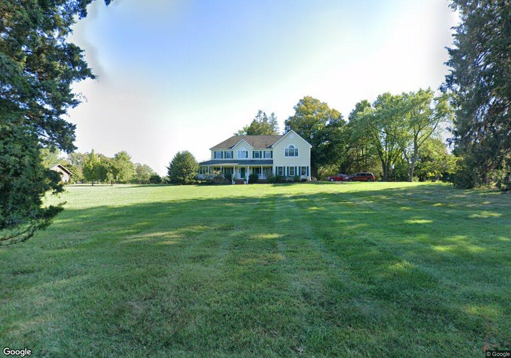
1305 Broadway Rd Lutherville Timonium, MD 21093
Falls Road Corridor NeighborhoodEstimated Value: $768,000 - $850,000
--
Bed
3
Baths
3,624
Sq Ft
$228/Sq Ft
Est. Value
About This Home
This home is located at 1305 Broadway Rd, Lutherville Timonium, MD 21093 and is currently estimated at $827,138, approximately $228 per square foot. 1305 Broadway Rd is a home located in Baltimore County with nearby schools including Fort Garrison Elementary School, Pikesville Middle School, and Pikesville High School.
Ownership History
Date
Name
Owned For
Owner Type
Purchase Details
Closed on
Mar 16, 1998
Sold by
Culotta Vincent A
Bought by
Bacon John and Bacon Antoinette
Current Estimated Value
Purchase Details
Closed on
Mar 7, 1994
Sold by
Foster C V
Bought by
Culotta Vincent A
Home Financials for this Owner
Home Financials are based on the most recent Mortgage that was taken out on this home.
Original Mortgage
$300,000
Interest Rate
7.01%
Create a Home Valuation Report for This Property
The Home Valuation Report is an in-depth analysis detailing your home's value as well as a comparison with similar homes in the area
Home Values in the Area
Average Home Value in this Area
Purchase History
| Date | Buyer | Sale Price | Title Company |
|---|---|---|---|
| Bacon John | $142,640 | -- | |
| Culotta Vincent A | $375,000 | -- |
Source: Public Records
Mortgage History
| Date | Status | Borrower | Loan Amount |
|---|---|---|---|
| Previous Owner | Culotta Vincent A | $300,000 |
Source: Public Records
Tax History Compared to Growth
Tax History
| Year | Tax Paid | Tax Assessment Tax Assessment Total Assessment is a certain percentage of the fair market value that is determined by local assessors to be the total taxable value of land and additions on the property. | Land | Improvement |
|---|---|---|---|---|
| 2025 | $3,576 | $585,200 | $185,100 | $400,100 |
| 2024 | $3,576 | $585,200 | $185,100 | $400,100 |
| 2023 | $3,576 | $585,200 | $185,100 | $400,100 |
| 2022 | $7,217 | $595,900 | $185,100 | $410,800 |
| 2021 | $7,065 | $586,933 | $0 | $0 |
| 2020 | $7,065 | $577,967 | $0 | $0 |
| 2019 | $6,956 | $569,000 | $185,100 | $383,900 |
| 2018 | $6,736 | $550,800 | $0 | $0 |
| 2017 | $6,457 | $532,600 | $0 | $0 |
| 2016 | $6,033 | $514,400 | $0 | $0 |
| 2015 | $6,033 | $514,400 | $0 | $0 |
| 2014 | $6,033 | $514,400 | $0 | $0 |
Source: Public Records
Map
Nearby Homes
- 11812 Meylston Dr
- 11817 Meylston Dr
- 11704 Woodland Dr
- 1511 Peachwood Ln
- 1511 - B Peachwood Ln
- 1208 Scotts Knoll Ct
- 1501 - C Peachwood Ln
- 1501 - B Peachwood Ln
- 1011 Coachford Ct
- 814 W Padonia Rd
- 0 Kelley Ave
- 1507 Heather Hill Ln
- 12325 Falls Rd
- 13 Sugarvale Way
- 2 Hillsyde Ct
- 11512 Greenspring Ave
- 661 Straffan Dr Unit 401
- 641 Straffan Dr Unit 102
- 11713 Greenspring Ave
- 783 Leister Dr
- 1301 Broadway Rd
- 11800 Meylston Dr
- 1218 Broadway Rd
- 1309 Broadway Rd
- 1312 Broadway Rd
- 1315 Broadway Rd
- 1213 Broadway Rd
- 1313 Broadway Rd
- 0 Meylston Dr Unit 1000114373
- 0 Meylston Dr Unit BC9785084
- 0 Meylston Dr Unit MDBC520498
- 0 Meylston Dr Unit MDBC456260
- 0 Meylston Dr Unit 1001634632
- 1212 Broadway Rd
- 1314 Broadway Rd
- 1321 Broadway Rd
- 1300 Musgrove Rd
- 11810 Meylston Dr
- 1302 Musgrove Rd
- 1304 Musgrove Rd