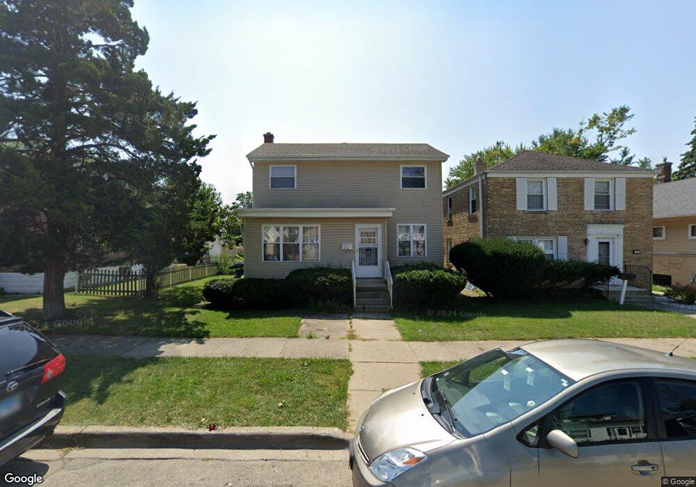
1305 Brookside Ave Waukegan, IL 60085
West Waukegan NeighborhoodEstimated Value: $212,000 - $354,000
3
Beds
2
Baths
1,926
Sq Ft
$141/Sq Ft
Est. Value
About This Home
This home is located at 1305 Brookside Ave, Waukegan, IL 60085 and is currently estimated at $271,249, approximately $140 per square foot. 1305 Brookside Ave is a home located in Lake County with nearby schools including Hyde Park Elementary School, Miguel Juarez Middle School, and Waukegan High School.
Ownership History
Date
Name
Owned For
Owner Type
Purchase Details
Closed on
Apr 17, 2000
Sold by
Monsalud Cesar M
Bought by
Monsalud Cesar M and Monsalud Carmelita L
Current Estimated Value
Purchase Details
Closed on
Mar 8, 2000
Sold by
Monsalud Esmeralda
Bought by
Monsalud Cesar M
Create a Home Valuation Report for This Property
The Home Valuation Report is an in-depth analysis detailing your home's value as well as a comparison with similar homes in the area
Home Values in the Area
Average Home Value in this Area
Purchase History
| Date | Buyer | Sale Price | Title Company |
|---|---|---|---|
| Monsalud Cesar M | -- | -- | |
| Monsalud Cesar M | -- | -- |
Source: Public Records
Tax History Compared to Growth
Tax History
| Year | Tax Paid | Tax Assessment Tax Assessment Total Assessment is a certain percentage of the fair market value that is determined by local assessors to be the total taxable value of land and additions on the property. | Land | Improvement |
|---|---|---|---|---|
| 2024 | $5,001 | $68,176 | $8,157 | $60,019 |
| 2023 | $4,576 | $61,039 | $7,303 | $53,736 |
| 2022 | $4,576 | $52,804 | $6,657 | $46,147 |
| 2021 | $4,321 | $47,446 | $6,271 | $41,175 |
| 2020 | $4,330 | $44,201 | $5,842 | $38,359 |
| 2019 | $4,305 | $40,503 | $5,353 | $35,150 |
| 2018 | $3,696 | $34,966 | $6,315 | $28,651 |
| 2017 | $3,547 | $30,935 | $5,587 | $25,348 |
| 2016 | $3,227 | $26,881 | $4,855 | $22,026 |
| 2015 | $3,051 | $24,059 | $4,345 | $19,714 |
| 2014 | $3,591 | $26,765 | $4,499 | $22,266 |
| 2012 | $4,671 | $28,997 | $4,874 | $24,123 |
Source: Public Records
Map
Nearby Homes
- 1416 Hamilton Ct
- 23 N Jackson St
- 511 Chestnut St
- 428 N Poplar St
- 28 N Saint James St
- 522 N Poplar St
- 702 Franklin St
- 620 N Poplar St
- 1521 Catalpa Ave
- 824 N Butrick St
- 613 Washington St
- 1109 Massena Ave
- 452 North Ave
- 49 S Lewis Ave
- 917 N Linden Ave
- 557 W Water St
- 1213 Grand Ave
- 610 Bluff St
- 2115 Lydia St
- 1000 Pine St
- 1309 Brookside Ave
- 1303 Brookside Ave
- 1313 Brookside Ave
- 1225 Brookside Ave
- 1315 Brookside Ave
- 1306 Clarkson St
- 1209 Brookside Ave
- 1308 Clarkson St
- 1302 Clarkson St
- 1310 Clarkson St
- 1314 Clarkson St
- 1216 Clarkson St
- 1306 Brookside Ave
- 1205 Brookside Ave
- 1310 Brookside Ave
- 1304 Brookside Ave
- 1317 Brookside Ave
- 1312 Brookside Ave
- 1318 Clarkson St
- 1214 Brookside Ave