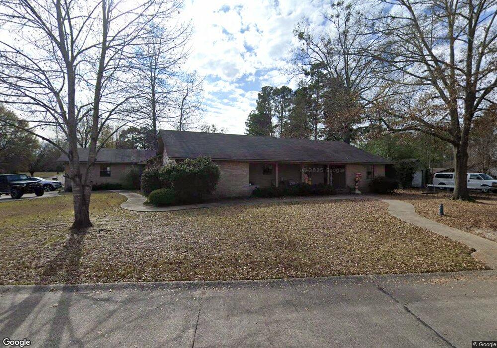
1305 Cypress Dr El Dorado, AR 71730
Estimated Value: $260,000 - $311,179
--
Bed
3
Baths
3,187
Sq Ft
$90/Sq Ft
Est. Value
About This Home
This home is located at 1305 Cypress Dr, El Dorado, AR 71730 and is currently estimated at $288,045, approximately $90 per square foot. 1305 Cypress Dr is a home located in Union County with nearby schools including El Dorado High School, Holy Redeemer School, and West Side Christian School.
Ownership History
Date
Name
Owned For
Owner Type
Purchase Details
Closed on
Feb 27, 2020
Sold by
Margis Michael and Margis Gail
Bought by
Willeford Joshua Nathaniel and Willeford Hillary
Current Estimated Value
Home Financials for this Owner
Home Financials are based on the most recent Mortgage that was taken out on this home.
Original Mortgage
$191,250
Outstanding Balance
$169,379
Interest Rate
3.5%
Mortgage Type
New Conventional
Estimated Equity
$118,666
Purchase Details
Closed on
May 28, 2004
Bought by
Margis Michael
Purchase Details
Closed on
Jan 1, 1983
Bought by
Bolding Parnell W
Create a Home Valuation Report for This Property
The Home Valuation Report is an in-depth analysis detailing your home's value as well as a comparison with similar homes in the area
Home Values in the Area
Average Home Value in this Area
Purchase History
| Date | Buyer | Sale Price | Title Company |
|---|---|---|---|
| Willeford Joshua Nathaniel | $225,000 | None Available | |
| Margis Michael | $187,000 | -- | |
| Bolding Parnell W | -- | -- |
Source: Public Records
Mortgage History
| Date | Status | Borrower | Loan Amount |
|---|---|---|---|
| Open | Willeford Joshua Nathaniel | $191,250 |
Source: Public Records
Tax History Compared to Growth
Tax History
| Year | Tax Paid | Tax Assessment Tax Assessment Total Assessment is a certain percentage of the fair market value that is determined by local assessors to be the total taxable value of land and additions on the property. | Land | Improvement |
|---|---|---|---|---|
| 2024 | $2,313 | $55,540 | $3,200 | $52,340 |
| 2023 | $2,261 | $55,540 | $3,200 | $52,340 |
| 2022 | $1,934 | $49,760 | $3,200 | $46,560 |
| 2021 | $1,934 | $49,760 | $3,200 | $46,560 |
| 2020 | $1,934 | $49,760 | $3,200 | $46,560 |
| 2019 | $2,309 | $49,760 | $3,200 | $46,560 |
| 2018 | $2,309 | $49,760 | $3,200 | $46,560 |
| 2017 | $2,073 | $45,560 | $3,200 | $42,360 |
| 2016 | $2,073 | $45,560 | $3,200 | $42,360 |
| 2014 | $1,723 | $45,560 | $3,200 | $42,360 |
Source: Public Records
Map
Nearby Homes
- 100 Holly St
- 1225 Briarwood Dr
- 1208 Briarwood Dr
- 1314 Coy Dumas St
- 1206 Linwood Dr
- 1211 Linwood Dr
- 1158 N Magnolia Dr
- 1305 W 8th St
- 1104 Glenwood Dr
- 910 W 8th St
- 1005 W 6th St
- 1005 Haney Ave
- 2303 Edgewood St
- 207 Oakhurst Blvd
- 716 N Yocum Ave
- 143 N Broadway Blvd
- 11.73 acres Mount Holly Rd
- 410 Maple Hill St
- 00 Watson St
- 416 S Parkway Dr