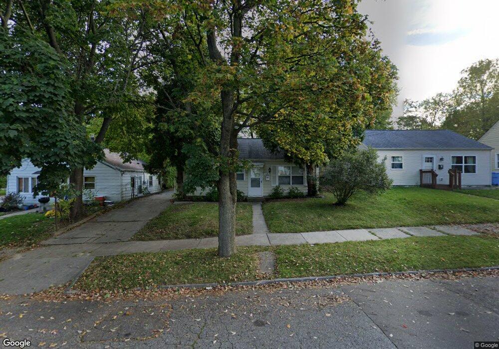
1305 Hammond St Lansing, MI 48910
Quentin Park NeighborhoodEstimated Value: $95,559 - $137,000
3
Beds
1
Bath
796
Sq Ft
$150/Sq Ft
Est. Value
About This Home
This home is located at 1305 Hammond St, Lansing, MI 48910 and is currently estimated at $119,640, approximately $150 per square foot. 1305 Hammond St is a home located in Ingham County with nearby schools including Averill Elementary School, Pattengill Academy, and J.W. Sexton High School.
Ownership History
Date
Name
Owned For
Owner Type
Purchase Details
Closed on
Nov 25, 2009
Sold by
Wilson Kipling C and Wren Deborah J
Bought by
Minc Llc
Current Estimated Value
Purchase Details
Closed on
Apr 5, 2007
Sold by
King Ann W
Bought by
Deutsche Bank National Trust Co and Ameriquest Mortgage Securities Inc Asset
Purchase Details
Closed on
Jan 1, 1992
Create a Home Valuation Report for This Property
The Home Valuation Report is an in-depth analysis detailing your home's value as well as a comparison with similar homes in the area
Home Values in the Area
Average Home Value in this Area
Purchase History
| Date | Buyer | Sale Price | Title Company |
|---|---|---|---|
| Minc Llc | -- | None Available | |
| Deutsche Bank National Trust Co | $108,573 | None Available | |
| -- | $35,000 | -- |
Source: Public Records
Tax History Compared to Growth
Tax History
| Year | Tax Paid | Tax Assessment Tax Assessment Total Assessment is a certain percentage of the fair market value that is determined by local assessors to be the total taxable value of land and additions on the property. | Land | Improvement |
|---|---|---|---|---|
| 2025 | $2,621 | $45,400 | $8,300 | $37,100 |
| 2024 | $22 | $41,900 | $8,300 | $33,600 |
| 2023 | $2,467 | $37,800 | $8,300 | $29,500 |
| 2022 | $2,254 | $35,500 | $9,300 | $26,200 |
| 2021 | $2,201 | $33,700 | $8,500 | $25,200 |
| 2020 | $2,186 | $31,800 | $8,500 | $23,300 |
| 2019 | $2,111 | $29,700 | $8,500 | $21,200 |
| 2018 | $2,003 | $26,300 | $8,500 | $17,800 |
| 2017 | $1,927 | $26,300 | $8,500 | $17,800 |
| 2016 | $1,871 | $25,400 | $8,500 | $16,900 |
| 2015 | $1,871 | $24,800 | $16,981 | $7,819 |
| 2014 | $1,871 | $24,700 | $19,650 | $5,050 |
Source: Public Records
Map
Nearby Homes
- 1309 Hammond St
- 1120 Alsdorf St
- 1221 Moores River Dr
- 1116 George St
- 1010 W Barnes Ave
- 1114 Goodrich St
- 1315 Goodrich St
- 1721 Fletcher St
- 1312 W Mount Hope Ave
- 917 W Barnes Ave
- 1516 Moores River Dr
- 1740 Wellington Rd Unit 103
- 1913 Stirling Ave
- 1708 Beal Ave
- 1420 Poxson Ave
- 2118 Marion Ave
- 907 Lenore Ave
- 2112 Stirling Ave
- 1912 Moores River Dr
- 712 Lenore Ave
- 1301 Hammond St
- 1315 Hammond St
- 1308 Edward St
- 1304 Edward St
- 1319 Hammond St
- 1316 Edward St Unit 55
- 1304 Hammond St
- 1516 Birch St
- 1318 Edward St
- 1310 Hammond St
- 1222 Edward St
- 1605 Park Ave
- 1611 Park Ave
- 1603 Park Ave
- 1314 Hammond St
- 1615 Park Ave
- 1601 Park Ave
- 1519 Birch St
- 1213 Hammond St
- 1212 Edward St