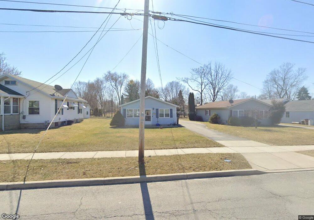
1305 Logan Ave Findlay, OH 45840
Estimated Value: $130,000 - $163,000
3
Beds
1
Bath
960
Sq Ft
$151/Sq Ft
Est. Value
About This Home
This home is located at 1305 Logan Ave, Findlay, OH 45840 and is currently estimated at $144,875, approximately $150 per square foot. 1305 Logan Ave is a home located in Hancock County with nearby schools including Chamberlin Hill Elementary School, Jefferson Elementary School, and Donnell Middle School.
Ownership History
Date
Name
Owned For
Owner Type
Purchase Details
Closed on
Oct 28, 2022
Sold by
Munson Michael W
Bought by
Munson Michael W and Munson Amber K
Current Estimated Value
Purchase Details
Closed on
Sep 28, 2016
Sold by
Burns David A and Burns Lisa M
Bought by
Munson Michael W
Home Financials for this Owner
Home Financials are based on the most recent Mortgage that was taken out on this home.
Original Mortgage
$77,988
Interest Rate
3.43%
Mortgage Type
New Conventional
Purchase Details
Closed on
May 26, 1992
Bought by
Burns David A and Burns Lisa M
Purchase Details
Closed on
Apr 29, 1987
Bought by
Haynes Gary W and Haynes Cheryl A
Purchase Details
Closed on
Oct 23, 1986
Bought by
Ciarrochi Rudolph and Ciarrochi Rema
Purchase Details
Closed on
Jul 17, 1986
Bought by
Sec'Y Housing & Urban Dev
Create a Home Valuation Report for This Property
The Home Valuation Report is an in-depth analysis detailing your home's value as well as a comparison with similar homes in the area
Home Values in the Area
Average Home Value in this Area
Purchase History
| Date | Buyer | Sale Price | Title Company |
|---|---|---|---|
| Munson Michael W | -- | Flag City Title | |
| Munson Michael W | $80,400 | Flag City Title | |
| Burns David A | $34,000 | -- | |
| Haynes Gary W | $29,300 | -- | |
| Ciarrochi Rudolph | -- | -- | |
| Sec'Y Housing & Urban Dev | -- | -- |
Source: Public Records
Mortgage History
| Date | Status | Borrower | Loan Amount |
|---|---|---|---|
| Previous Owner | Munson Michael W | $77,988 |
Source: Public Records
Tax History
| Year | Tax Paid | Tax Assessment Tax Assessment Total Assessment is a certain percentage of the fair market value that is determined by local assessors to be the total taxable value of land and additions on the property. | Land | Improvement |
|---|---|---|---|---|
| 2024 | $1,265 | $35,620 | $3,870 | $31,750 |
| 2023 | $1,267 | $35,620 | $3,870 | $31,750 |
| 2022 | $1,263 | $35,620 | $3,870 | $31,750 |
| 2021 | $1,310 | $32,190 | $3,990 | $28,200 |
| 2020 | $1,310 | $32,190 | $3,990 | $28,200 |
| 2019 | $1,284 | $32,190 | $3,990 | $28,200 |
| 2018 | $1,123 | $25,840 | $3,990 | $21,850 |
| 2017 | $1,124 | $25,840 | $3,990 | $21,850 |
| 2016 | $1,116 | $25,840 | $3,990 | $21,850 |
| 2015 | $990 | $22,020 | $3,990 | $18,030 |
| 2014 | $990 | $22,020 | $3,990 | $18,030 |
| 2012 | $971 | $22,020 | $3,990 | $18,030 |
Source: Public Records
Map
Nearby Homes
- 1401 Logan Ave
- 1604 Gray St
- 0 Bushwillow Dr Unit Lot 154
- 0 Bushwillow Dr Lot 156 Unit 6079046
- 0 Rock Candy Rd Lot 162 Unit 6079070
- 0 Bushwillow Dr Unit Lot 156
- 0 Bearcat Way Or 0 Rock Candy Rd Lot 167 Unit 6079083
- 0 Bushwillow Dr Lot 154 Unit 6079043
- 0 Rock Candy Rd Lot 171 Unit 6079088
- 0 County Road 99 Lot 2 Unit 6081480
- 0 Rock Candy Rd Lot 159 Unit 6079053
- 0 Bushwillow Dr Or Rock Candy Rd Lot 157 Unit 6079052
- 0 Bushwillow Dr Unit Lot 155
- 0 Rock Candy Rd Or Bushwillow Dr Lot 173 Unit 6079093
- 0 Rock Candy Rd Lot 168 Unit 6079085
- 0 Rock Candy Rd Lot 170 Unit 6079087
- 0 Bushwillow Dr Lot 155 Unit 6079044
- 0 Waterford Way Lot 78 Unit 6089639
- 1898 Baker Way Unit 18
- 324 W Mcpherson Ave
Your Personal Tour Guide
Ask me questions while you tour the home.