Estimated Value: $147,382 - $217,000
3
Beds
2
Baths
1,175
Sq Ft
$153/Sq Ft
Est. Value
About This Home
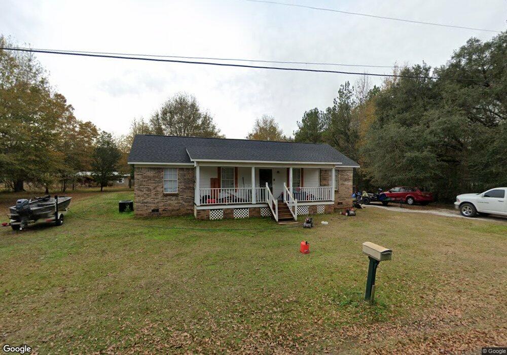
This home is located at 1305 Lyon Dr, Axis, AL 36505 and is currently estimated at $180,346, approximately $153 per square foot. 1305 Lyon Dr is a home located in Mobile County with nearby schools including North Mobile County Middle School and Citronelle High School.
Ownership History
Date
Name
Owned For
Owner Type
Purchase Details
Closed on
Jun 28, 2004
Sold by
Dunn Patrick Tracy
Bought by
Dunn Kristina M
Current Estimated Value
Purchase Details
Closed on
Jun 27, 2003
Sold by
Stringer Richard Dennis and Stringer Vicky H
Bought by
Dunn Patrick and Dunn Kristina
Home Financials for this Owner
Home Financials are based on the most recent Mortgage that was taken out on this home.
Original Mortgage
$78,999
Interest Rate
5.2%
Mortgage Type
FHA
Purchase Details
Closed on
Feb 25, 1998
Sold by
Williams Daniel L and Williams Dolores D
Bought by
Stringer Michael Dennis and Stringer Vicky H
Create a Home Valuation Report for This Property
The Home Valuation Report is an in-depth analysis detailing your home's value as well as a comparison with similar homes in the area
Home Values in the Area
Average Home Value in this Area
Purchase History
| Date | Buyer | Sale Price | Title Company |
|---|---|---|---|
| Dunn Kristina M | $40,000 | -- | |
| Dunn Patrick | $80,240 | -- | |
| Stringer Michael Dennis | -- | -- |
Source: Public Records
Mortgage History
| Date | Status | Borrower | Loan Amount |
|---|---|---|---|
| Previous Owner | Dunn Patrick | $78,999 |
Source: Public Records
Tax History Compared to Growth
Tax History
| Year | Tax Paid | Tax Assessment Tax Assessment Total Assessment is a certain percentage of the fair market value that is determined by local assessors to be the total taxable value of land and additions on the property. | Land | Improvement |
|---|---|---|---|---|
| 2024 | $404 | $9,020 | $1,000 | $8,020 |
| 2023 | $416 | $8,670 | $1,000 | $7,670 |
| 2022 | $408 | $8,880 | $1,000 | $7,880 |
| 2021 | $379 | $8,340 | $1,000 | $7,340 |
| 2020 | $390 | $8,530 | $1,000 | $7,530 |
| 2019 | $356 | $7,900 | $0 | $0 |
| 2018 | $333 | $7,480 | $0 | $0 |
| 2017 | $347 | $7,740 | $0 | $0 |
| 2016 | $351 | $7,820 | $0 | $0 |
| 2013 | $328 | $7,300 | $0 | $0 |
Source: Public Records
Map
Nearby Homes
- 10901 Hall Dr Unit 20
- 11045 Hurst Dr
- 0 Bell Dr Unit 3 0658885
- 0 Bell Dr Unit 5 0658878
- 0 Dead Lake Marina Rd Unit 7360688
- 0 Mcbride Cir S Unit 7098358
- 630 Mcbride Cir N Unit A
- 565 Wilson Blvd
- 11286 Highway 43
- 11286 U S 43
- 1931 Dead Lake Marina Rd
- 11525 Highway 43 N
- 10820 Old Highway 43
- 180 Creax Rd
- 10179 Hardy Dr
- 0 Sailor Rd
- 0 Lucas Rd Unit 7685894
- 0 Dead Lake Rd Unit 25467477
- 0 I-65 Service Rd S
- 0 Highway 43 N Unit 7537989
- 1330 Lyon Dr
- 0 Lyons Dr Unit 29 0213202
- 0 Lyons Dr Unit 192175
- 11040 Hurst Dr
- 1275 Lyon Dr
- 10995 Hurst Dr
- 11995 Hurst Dr
- 1350 Lyon Dr
- 10942 Hall Dr
- 10976 Hall Dr
- 11046 Hurst Dr
- 10900 Hall Dr
- 10876 Hall Dr
- 10799 Ski Chaste Ln
- 1373 Ducey Dr
- 10779 Ski Chaste Ln
- 1271 Ducey Dr
- 10801 Ski Chaste Ln
- 11125 Hurst Dr
- 10800 Ski Chaste Ln