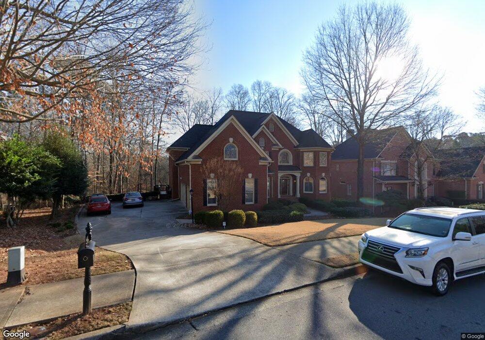
1305 Seale Dr Alpharetta, GA 30022
Estimated Value: $1,088,000 - $1,231,000
5
Beds
4
Baths
3,904
Sq Ft
$297/Sq Ft
Est. Value
About This Home
This home is located at 1305 Seale Dr, Alpharetta, GA 30022 and is currently estimated at $1,159,449, approximately $296 per square foot. 1305 Seale Dr is a home located in Fulton County with nearby schools including New Prospect Elementary School, Webb Bridge Middle School, and Alpharetta High School.
Ownership History
Date
Name
Owned For
Owner Type
Purchase Details
Closed on
Apr 8, 2024
Sold by
Plunkett Gretchen M
Bought by
Hmp & Gmp Trust and Plunkett Gretchen Miller Tr
Current Estimated Value
Purchase Details
Closed on
Jan 19, 1996
Sold by
T D Dev Inc
Bought by
Plunkett H Mark Gretchen M
Purchase Details
Closed on
Aug 24, 1995
Sold by
Wernick Assoc Inc
Bought by
T D Dev Inc
Create a Home Valuation Report for This Property
The Home Valuation Report is an in-depth analysis detailing your home's value as well as a comparison with similar homes in the area
Home Values in the Area
Average Home Value in this Area
Purchase History
| Date | Buyer | Sale Price | Title Company |
|---|---|---|---|
| Hmp & Gmp Trust | -- | -- | |
| Plunkett H Mark Gretchen M | $310,500 | -- | |
| T D Dev Inc | $69,500 | -- |
Source: Public Records
Mortgage History
| Date | Status | Borrower | Loan Amount |
|---|---|---|---|
| Closed | T D Dev Inc | $0 |
Source: Public Records
Tax History Compared to Growth
Tax History
| Year | Tax Paid | Tax Assessment Tax Assessment Total Assessment is a certain percentage of the fair market value that is determined by local assessors to be the total taxable value of land and additions on the property. | Land | Improvement |
|---|---|---|---|---|
| 2025 | $1,464 | $456,520 | $121,480 | $335,040 |
| 2023 | $10,245 | $362,960 | $79,680 | $283,280 |
| 2022 | $6,050 | $298,480 | $67,760 | $230,720 |
| 2021 | $7,097 | $255,200 | $56,680 | $198,520 |
| 2020 | $7,473 | $254,720 | $61,840 | $192,880 |
| 2019 | $1,190 | $240,560 | $58,280 | $182,280 |
| 2018 | $5,833 | $262,680 | $60,600 | $202,080 |
| 2017 | $6,168 | $232,680 | $55,280 | $177,400 |
| 2016 | $6,138 | $232,680 | $55,280 | $177,400 |
| 2015 | $6,219 | $232,680 | $55,280 | $177,400 |
| 2014 | $5,530 | $193,160 | $47,720 | $145,440 |
Source: Public Records
Map
Nearby Homes
- 420 Seale Trail
- 1050 Ambrose Ave Unit 1
- 122 Pinecone Pkwy
- 10900 Wittenridge Dr Unit I3
- 10900 Wittenridge Dr Unit H8
- 10900 Wittenridge Dr Unit L6
- 725 High Hampton Run
- 202 Pinecone Place
- 204 Pinecone Place
- 2718 Wander Ln
- 0 N Point Pkwy Unit 10605589
- 0 N Point Pkwy Unit 7649723
- 11255 Wittenridge Dr
- 3335 Waters Mill Dr
- 355 Fairleaf Ct
- 3430 Waters Mill Dr
- 10625 Haynes Forest Dr
- 825 Highland Bend Cove
- 10845 Carrissa Trail