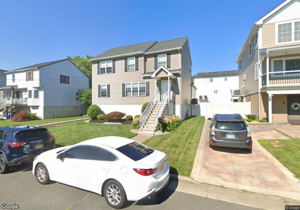
1305 Shore Rd Keyport, NJ 07735
Estimated Value: $577,463 - $615,000
3
Beds
3
Baths
1,899
Sq Ft
$313/Sq Ft
Est. Value
About This Home
This home is located at 1305 Shore Rd, Keyport, NJ 07735 and is currently estimated at $595,116, approximately $313 per square foot. 1305 Shore Rd is a home located in Monmouth County with nearby schools including Memorial School and Baytul-Iman Academy.
Ownership History
Date
Name
Owned For
Owner Type
Purchase Details
Closed on
May 14, 2001
Sold by
Chopyk John
Bought by
Poyner Christopher and Poyner Dawn
Current Estimated Value
Home Financials for this Owner
Home Financials are based on the most recent Mortgage that was taken out on this home.
Original Mortgage
$145,800
Outstanding Balance
$54,522
Interest Rate
7.05%
Mortgage Type
FHA
Estimated Equity
$540,594
Create a Home Valuation Report for This Property
The Home Valuation Report is an in-depth analysis detailing your home's value as well as a comparison with similar homes in the area
Home Values in the Area
Average Home Value in this Area
Purchase History
| Date | Buyer | Sale Price | Title Company |
|---|---|---|---|
| Poyner Christopher | $147,000 | -- |
Source: Public Records
Mortgage History
| Date | Status | Borrower | Loan Amount |
|---|---|---|---|
| Open | Poyner Christopher | $145,800 |
Source: Public Records
Tax History Compared to Growth
Tax History
| Year | Tax Paid | Tax Assessment Tax Assessment Total Assessment is a certain percentage of the fair market value that is determined by local assessors to be the total taxable value of land and additions on the property. | Land | Improvement |
|---|---|---|---|---|
| 2025 | $9,718 | $507,600 | $184,100 | $323,500 |
| 2024 | $9,512 | $471,300 | $160,100 | $311,200 |
| 2023 | $9,512 | $444,500 | $139,200 | $305,300 |
| 2022 | $8,701 | $391,600 | $111,400 | $280,200 |
| 2021 | $8,701 | $354,400 | $101,300 | $253,100 |
| 2020 | $8,484 | $337,200 | $98,000 | $239,200 |
| 2019 | $8,204 | $318,100 | $93,000 | $225,100 |
| 2018 | $8,065 | $300,600 | $80,000 | $220,600 |
| 2017 | $8,292 | $297,100 | $77,000 | $220,100 |
| 2016 | $8,169 | $292,900 | $77,000 | $215,900 |
| 2015 | $7,760 | $283,300 | $75,000 | $208,300 |
| 2014 | $6,777 | $140,900 | $78,900 | $62,000 |
Source: Public Records
Map
Nearby Homes
- 1319 Union Ave
- 641 Morningside Ave
- 650 Washington Ave
- 631 Sydney Ave
- 1213 Highway 36
- 528 Aumack Ave
- 51 Sams Trailer Ct
- 12 Sams Ct
- 525 Washington Ave
- 521 Columbia Ave
- 904 Central Ave
- 602 Union Ave
- 21 Hemlock St
- 425 Clark Ave
- 715 Park Ave
- 34 Hemlock St
- 825 Lorillard Ave
- 412 Union Ave
- 413 Sullivan Place
- 709 Lorillard Ave
- 1303 Shore Rd
- 1307 Shore Rd
- 704 Clark Ave
- 707 Aumack Ave
- 708 Clark Ave
- 711 Clark Ave
- 707 Clark Ave
- 1403 Shore Rd
- 1304 Union Ave
- 704 Aumack Ave
- 1404 Shore Rd
- 702 Aumack Ave
- 1310 Union Ave
- 1314 Union Ave
- 700 Clark Ave
- 718 Morningside Ave
- 1203 Shore Rd
- 710 Morningside Ave
- 708 Morningside Ave
- 1407 Shore Rd