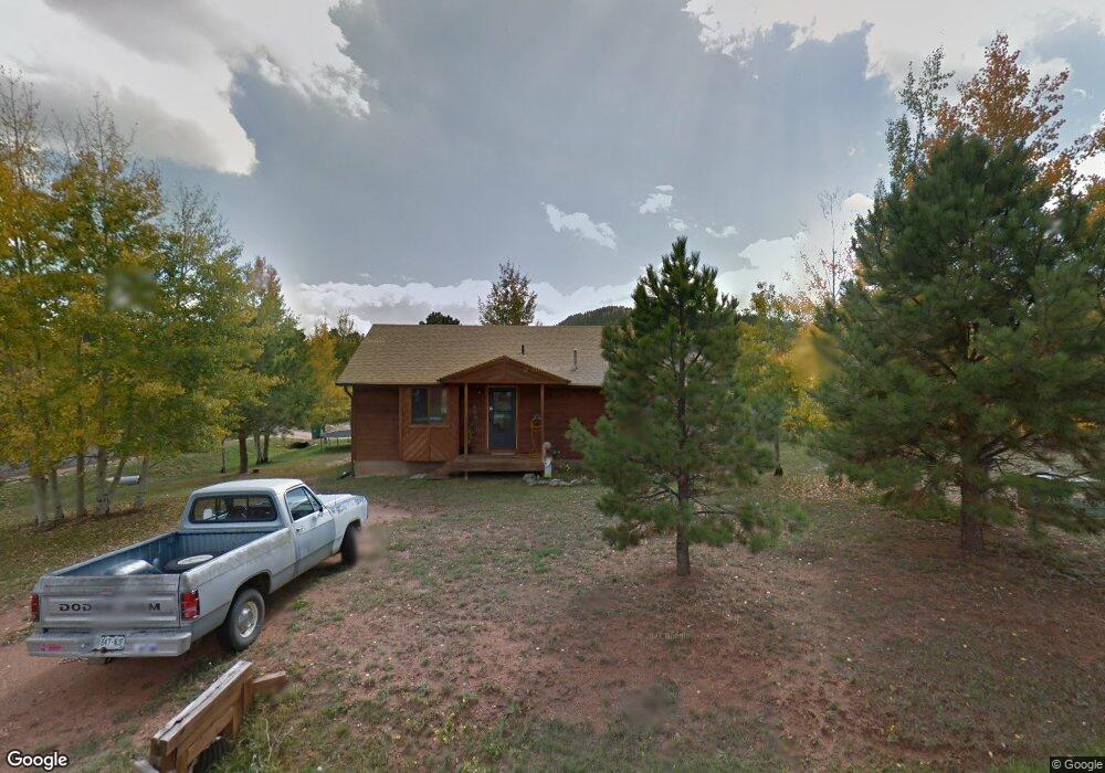
1305 Thomas Cir Woodland Park, CO 80863
Estimated Value: $540,964 - $582,000
4
Beds
3
Baths
2,584
Sq Ft
$220/Sq Ft
Est. Value
About This Home
This home is located at 1305 Thomas Cir, Woodland Park, CO 80863 and is currently estimated at $567,741, approximately $219 per square foot. 1305 Thomas Cir is a home located in Teller County with nearby schools including Merit Academy, Woodland Park Junior/Senior High School, and Colorado Springs Christian School.
Ownership History
Date
Name
Owned For
Owner Type
Purchase Details
Closed on
Mar 28, 2023
Sold by
Urban Thomas M and Urban Patrica L
Bought by
Thomas And Patricia Urban Living Trust
Current Estimated Value
Purchase Details
Closed on
Sep 4, 2020
Sold by
Mardis Daniel W and Mardis Deborah
Bought by
Urban Thomas M and Urban Patricia L
Purchase Details
Closed on
Sep 25, 2015
Sold by
Walstad Robert E and Walstad Belle J
Bought by
Mardis Daniel W and Mardis Deborah
Home Financials for this Owner
Home Financials are based on the most recent Mortgage that was taken out on this home.
Original Mortgage
$206,600
Interest Rate
3.99%
Mortgage Type
VA
Purchase Details
Closed on
Jan 19, 2001
Sold by
Greene William David
Bought by
Walstad Robert E and Walstad Belle J
Purchase Details
Closed on
Oct 24, 1990
Bought by
Mardis Daniel W and Mardis Deborah
Create a Home Valuation Report for This Property
The Home Valuation Report is an in-depth analysis detailing your home's value as well as a comparison with similar homes in the area
Home Values in the Area
Average Home Value in this Area
Purchase History
| Date | Buyer | Sale Price | Title Company |
|---|---|---|---|
| Thomas And Patricia Urban Living Trust | -- | -- | |
| Urban Thomas M | $425,000 | Fidelity National Title | |
| Mardis Daniel W | $200,000 | Unified Title Company | |
| Walstad Robert E | $70,000 | -- | |
| Mardis Daniel W | $70,600 | -- |
Source: Public Records
Mortgage History
| Date | Status | Borrower | Loan Amount |
|---|---|---|---|
| Previous Owner | Mardis Daniel W | $206,600 |
Source: Public Records
Tax History Compared to Growth
Tax History
| Year | Tax Paid | Tax Assessment Tax Assessment Total Assessment is a certain percentage of the fair market value that is determined by local assessors to be the total taxable value of land and additions on the property. | Land | Improvement |
|---|---|---|---|---|
| 2024 | $2,683 | $33,880 | $3,740 | $30,140 |
| 2023 | $2,683 | $33,880 | $3,740 | $30,140 |
| 2022 | $2,336 | $28,740 | $3,660 | $25,080 |
| 2021 | $2,391 | $29,570 | $3,770 | $25,800 |
| 2020 | $2,154 | $27,260 | $3,520 | $23,740 |
| 2019 | $2,140 | $27,260 | $0 | $0 |
| 2018 | $1,645 | $20,510 | $0 | $0 |
| 2017 | $1,648 | $20,510 | $0 | $0 |
| 2016 | $1,531 | $19,000 | $0 | $0 |
| 2015 | $1,662 | $19,000 | $0 | $0 |
| 2014 | $1,602 | $18,140 | $0 | $0 |
Source: Public Records
Map
Nearby Homes
- 1300 Thomas Cir
- 1279 Firestone Dr
- 1313 Stone Ridge Dr
- 1290 Firestone Dr
- 0 Firestone Dr
- 1127 Michael Ln
- 1322 Firestone Dr
- 1136 Ptarmigan Dr
- 1163 Ptarmigan Dr
- 1145 Ptarmigan Dr
- 828 Northwoods Dr E
- 1149 Ptarmigan Dr
- 220 Wildrose Ct
- 718 Misty Pines Cir
- 1378 Millstone Ln
- 0 Colorado 67
- Tract 36 Colorado 67
- 780 W Kelley's Rd
- 1260 Sundance St
- 1394 Millstone Ln
- 1315 Thomas Cir
- 1305 Michael Ln
- 1325 Thomas Cir
- 1310 Michael Ln
- 1300 Michael Ln
- 1320 Michael Ln
- 1310 Thomas Cir
- 1485 Northwoods Dr
- 1335 Thomas Cir
- 1280 Michael Ln
- 1330 Michael Ln
- 1335 Michael Ln
- 1345 Thomas Cir
- 1410 Juli Ct
- 1340 Thomas Cir
- 1445 Northwoods Dr
- 1255 Michael Ln
- 1350 Thomas Cir
- 1355 Thomas Cir
- 1420 Juli Ct