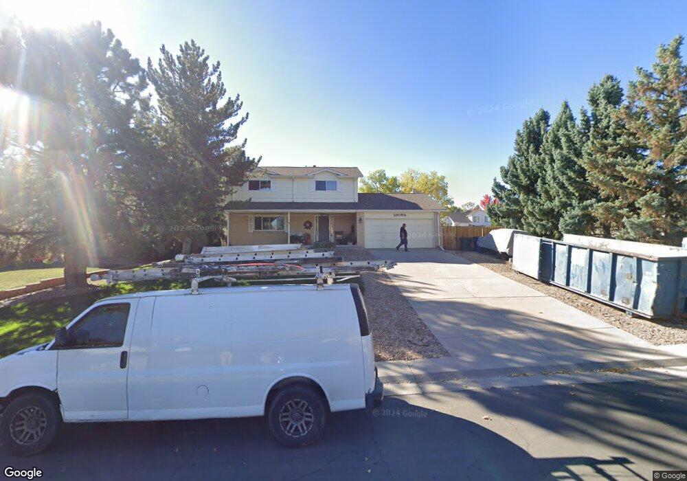
13052 Mercury Dr Lone Tree, CO 80124
Estimated Value: $621,000 - $659,000
4
Beds
3
Baths
1,982
Sq Ft
$320/Sq Ft
Est. Value
About This Home
This home is located at 13052 Mercury Dr, Lone Tree, CO 80124 and is currently estimated at $633,350, approximately $319 per square foot. 13052 Mercury Dr is a home located in Douglas County with nearby schools including Acres Green Elementary School, Cresthill Middle School, and Highlands Ranch High School.
Ownership History
Date
Name
Owned For
Owner Type
Purchase Details
Closed on
Sep 7, 2023
Sold by
Meyers Lawrence S and Meyers Patricia K
Bought by
Meyers Family Trust
Current Estimated Value
Purchase Details
Closed on
Aug 26, 1992
Sold by
Omohundro Richard E and Omohundro Neva M
Bought by
Meyers Lawrence S and Meyers Patricia K
Purchase Details
Closed on
May 1, 1981
Sold by
Unavailable
Bought by
Unavailable
Create a Home Valuation Report for This Property
The Home Valuation Report is an in-depth analysis detailing your home's value as well as a comparison with similar homes in the area
Home Values in the Area
Average Home Value in this Area
Purchase History
| Date | Buyer | Sale Price | Title Company |
|---|---|---|---|
| Meyers Family Trust | -- | None Listed On Document | |
| Meyers Lawrence S | $126,000 | -- | |
| Unavailable | $88,000 | -- |
Source: Public Records
Tax History Compared to Growth
Tax History
| Year | Tax Paid | Tax Assessment Tax Assessment Total Assessment is a certain percentage of the fair market value that is determined by local assessors to be the total taxable value of land and additions on the property. | Land | Improvement |
|---|---|---|---|---|
| 2024 | $3,164 | $44,860 | $11,270 | $33,590 |
| 2023 | $3,197 | $44,860 | $11,270 | $33,590 |
| 2022 | $2,273 | $32,480 | $9,570 | $22,910 |
| 2021 | $2,365 | $32,480 | $9,570 | $22,910 |
| 2020 | $2,260 | $32,150 | $9,390 | $22,760 |
| 2019 | $2,267 | $32,150 | $9,390 | $22,760 |
| 2018 | $2,297 | $27,130 | $7,960 | $19,170 |
| 2017 | $1,714 | $27,130 | $7,960 | $19,170 |
| 2016 | $1,376 | $23,630 | $7,910 | $15,720 |
| 2015 | $1,062 | $23,630 | $7,910 | $15,720 |
| 2014 | $958 | $19,960 | $4,780 | $15,180 |
Source: Public Records
Map
Nearby Homes
- 7971 Arrowhead Ct
- 8049 Sweet Water Rd
- 979 Mercury Cir
- 789 Hamal Dr
- 13134 Deneb Dr
- 8159 Lodgepole Trail
- 7804 Silverweed Way
- 8260 Lodgepole Trail
- 9416 Kemper Dr
- 202 Helena Cir
- 9308 Miles Dr Unit 5
- 8176 Lone Oak Ct
- 9275 Erminedale Dr
- 9412 La Quinta Way
- 426 Jupiter Dr
- 250 Jupiter Dr
- 7404 La Quinta Ln
- 9556 Kemper Dr
- 8754 Mesquite Row
- 7151 Palisade Dr
- 13056 Mercury Dr
- 13042 Mercury Dr
- 13060 Mercury Dr
- 13036 Mercury Dr
- 7845 Chaparral Rd
- 13049 Mercury Dr
- 13055 Mercury Dr
- 13043 Mercury Dr
- 7797 Chaparral Rd
- 7863 Chaparral Rd
- 13064 Mercury Dr
- 7887 Chaparral Rd
- 13037 Mercury Dr
- 7773 Chaparral Rd
- 13030 Mercury Dr
- 13072 Spica Dr
- 13091 Spica Dr
- 7911 Chaparral Rd
- 13031 Mercury Dr
- 13068 Mercury Dr