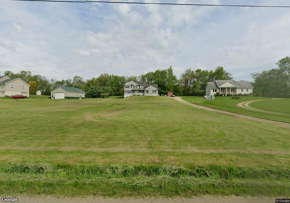
13057 Upper Gilchrist Rd Mount Vernon, OH 43050
Estimated Value: $456,000 - $506,000
4
Beds
3
Baths
2,690
Sq Ft
$181/Sq Ft
Est. Value
About This Home
This home is located at 13057 Upper Gilchrist Rd, Mount Vernon, OH 43050 and is currently estimated at $486,600, approximately $180 per square foot. 13057 Upper Gilchrist Rd is a home located in Knox County with nearby schools including Mount Vernon High School.
Ownership History
Date
Name
Owned For
Owner Type
Purchase Details
Closed on
Jan 12, 2005
Sold by
Centofanti Dominie J
Bought by
Walchle John and Walchle Lisa A
Current Estimated Value
Purchase Details
Closed on
Mar 14, 2002
Sold by
Centofanti Dominic J Sr T
Bought by
Centofanti Dominic J Sr T
Purchase Details
Closed on
Oct 27, 2000
Sold by
Centofanti Dominic J Sr T
Bought by
Centofanti Dominic J Sr T
Purchase Details
Closed on
Jun 14, 2000
Sold by
Stevens Tom and Stevens Linda
Bought by
Centofanti Dominic J Sr T
Purchase Details
Closed on
Nov 2, 1999
Sold by
Cornelius Bernard R
Bought by
Stevens Tom and Stevens Linda
Purchase Details
Closed on
Apr 16, 1999
Sold by
Cornelius Bernard R and Cornelius Jac
Bought by
Cornelius Bernard R
Purchase Details
Closed on
Jul 6, 1989
Sold by
Gabbert Gale L and Eula May
Bought by
Cornelius Bernard R and Cornelius Jac
Create a Home Valuation Report for This Property
The Home Valuation Report is an in-depth analysis detailing your home's value as well as a comparison with similar homes in the area
Home Values in the Area
Average Home Value in this Area
Purchase History
| Date | Buyer | Sale Price | Title Company |
|---|---|---|---|
| Walchle John | $17,925 | None Available | |
| Centofanti Dominic J Sr T | -- | -- | |
| Centofanti Dominic J Sr T | -- | -- | |
| Centofanti Dominic J Sr T | $37,000 | -- | |
| Stevens Tom | $38,000 | -- | |
| Cornelius Bernard R | -- | -- | |
| Cornelius Bernard R | $31,300 | -- |
Source: Public Records
Tax History Compared to Growth
Tax History
| Year | Tax Paid | Tax Assessment Tax Assessment Total Assessment is a certain percentage of the fair market value that is determined by local assessors to be the total taxable value of land and additions on the property. | Land | Improvement |
|---|---|---|---|---|
| 2024 | $5,633 | $132,690 | $17,260 | $115,430 |
| 2023 | $5,633 | $132,690 | $17,260 | $115,430 |
| 2022 | $4,210 | $91,510 | $11,900 | $79,610 |
| 2021 | $4,210 | $91,510 | $11,900 | $79,610 |
| 2020 | $4,108 | $91,510 | $11,900 | $79,610 |
| 2019 | $4,199 | $86,750 | $11,580 | $75,170 |
| 2018 | $4,200 | $86,750 | $11,580 | $75,170 |
| 2017 | $4,131 | $86,750 | $11,580 | $75,170 |
| 2016 | $3,849 | $80,320 | $10,720 | $69,600 |
| 2015 | $3,864 | $80,320 | $10,720 | $69,600 |
| 2014 | $3,882 | $80,320 | $10,720 | $69,600 |
| 2013 | $3,757 | $75,530 | $10,080 | $65,450 |
Source: Public Records
Map
Nearby Homes
- 12627 Upper Gilchrist Rd
- 13618 Gilchrist Rd
- 14021 Gilchrist Rd
- 188 Plymouth Rd
- 104 Colonial Woods Dr Unit 4
- 117 Colonial Woods Dr
- 11791 McManis Rd
- 13999 Wooster Rd
- 17421 Coshocton Rd
- 14499 Wooster Rd
- 14702 Wooster Rd
- 17970 Scott Rd
- 1737 Vernonview Dr
- 0 Venture Dr Unit 20240369
- 17 Upland Terrace
- 6 Fairway Dr
- 42 Wildwood Ln
- 0 Wildwood Ln
- 84 Woodlake Trail
- 55 Wildwood Ln
- 13081 Upper Gilchrist Rd
- 13013 Upper Gilchrist Rd
- 13105 Upper Gilchrist Rd
- 12985 Upper Gilchrist Rd
- 13123 Upper Gilchrist Rd
- 12943 Upper Gilchrist Rd
- 12981 Gilchrist Rd
- 13153 Upper Gilchrist Rd
- 18222 Paige Rd
- 13083 Gilchrist Rd
- 12913 Upper Gilchrist Rd
- 13041 Gilchrist Rd
- 18320 Paige Rd
- 18420 Paige Rd
- 12931 Gilchrist Rd
- 13221 Upper Gilchrist Rd
- 18454 Paige Rd
- 12859 Gilchrist Rd
- 18490 Paige Rd
- 13281 Upper Gilchrist Rd