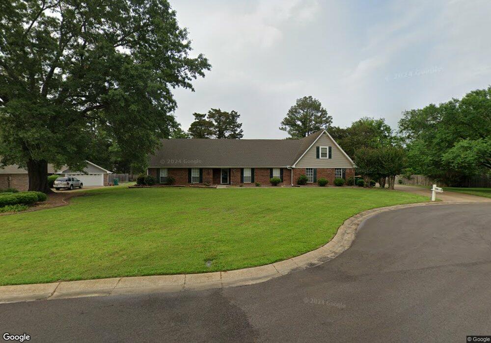
1306 Michael Cr Tupelo, MI 38801
Estimated Value: $261,000 - $350,818
4
Beds
3
Baths
2,721
Sq Ft
$109/Sq Ft
Est. Value
About This Home
This home is located at 1306 Michael Cr, Tupelo, MI 38801 and is currently estimated at $297,705, approximately $109 per square foot. 1306 Michael Cr is a home located in Lee County with nearby schools including Lawndale Elementary School, Parkway Elementary School, and Tupelo Middle School.
Ownership History
Date
Name
Owned For
Owner Type
Purchase Details
Closed on
Dec 23, 2020
Bought by
Alwaisi Noman
Current Estimated Value
Home Financials for this Owner
Home Financials are based on the most recent Mortgage that was taken out on this home.
Original Mortgage
$144,000
Outstanding Balance
$127,907
Interest Rate
2.7%
Mortgage Type
New Conventional
Estimated Equity
$169,798
Purchase Details
Closed on
Sep 17, 2018
Sold by
Pike David Norman and Pike Cynthia Cole
Bought by
Thurman Brandy L
Create a Home Valuation Report for This Property
The Home Valuation Report is an in-depth analysis detailing your home's value as well as a comparison with similar homes in the area
Purchase History
| Date | Buyer | Sale Price | Title Company |
|---|---|---|---|
| Alwaisi Noman | $180,000 | -- | |
| Alwaisi Noman | -- | None Available | |
| Thurman Brandy L | -- | None Available |
Source: Public Records
Mortgage History
| Date | Status | Borrower | Loan Amount |
|---|---|---|---|
| Open | Alwaisi Noman | $144,000 |
Source: Public Records
Tax History
| Year | Tax Paid | Tax Assessment Tax Assessment Total Assessment is a certain percentage of the fair market value that is determined by local assessors to be the total taxable value of land and additions on the property. | Land | Improvement |
|---|---|---|---|---|
| 2025 | $3,052 | $22,450 | $0 | $0 |
| 2024 | $3,052 | $22,450 | $0 | $0 |
| 2023 | $2,598 | $19,410 | $0 | $0 |
| 2022 | $2,298 | $19,410 | $0 | $0 |
| 2021 | $2,298 | $19,410 | $0 | $0 |
| 2020 | $2,598 | $19,410 | $0 | $0 |
| 2019 | $2,191 | $18,609 | $0 | $0 |
| 2018 | $2,182 | $18,547 | $0 | $0 |
| 2017 | $2,173 | $18,547 | $0 | $0 |
| 2016 | $2,173 | $18,547 | $0 | $0 |
| 2015 | $2,081 | $17,919 | $0 | $0 |
| 2014 | $2,081 | $17,919 | $0 | $0 |
Source: Public Records
Map
Nearby Homes
- 103 Hinton Cir
- 2411 William Dr
- 1213 Winwood Cove
- 1913 Pheasant Run
- 1914 Cardinal Dr
- 2102 Fillmore Dr
- 2010 Lawndale Dr
- 1904 Bob White Dr
- 1015 Taft St
- 1009 Taft St
- 1585 Cedar Grove Rd
- 911 Rockefeller Ave
- 1712 Valley View Dr
- 1702 Fillmore Dr
- 0 S Thomas St
- 1909 President Ave
- 0 (3 Acres) S Thomas St
- 1011 Coolidge St
- 2736 Lawndale Dr
- Lot 3 Cliff Gookin Blvd
- 1306 Michael Cir
- 1304 Michael Cir
- 1304 Michael Cir
- 1317 Ruffwood Rd
- 1317 Ruffwood Rd
- 1308 Michael Cr
- 1319 Ruffwood Rd
- 2403 Philp Dr
- 2403 Philp Dr
- 1305 Michael Cir
- 2405 Philp Dr
- 2405 Philp
- 1307 Michael Cir
- 1303 Michael Cir
- 1321 Ruffwood Rd
- 106 Balfour Cir
- 106 Balfour
- 106 Balfour Cir
- 1301 Michael Cir
- 1301 Michael Cir
Your Personal Tour Guide
Ask me questions while you tour the home.