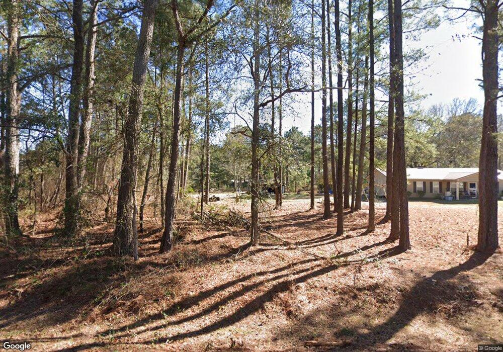
1306 Ralph Keen Rd East Dublin, GA 31027
Estimated Value: $222,000 - $302,000
2
Beds
2
Baths
1,328
Sq Ft
$200/Sq Ft
Est. Value
About This Home
This home is located at 1306 Ralph Keen Rd, East Dublin, GA 31027 and is currently estimated at $264,963, approximately $199 per square foot. 1306 Ralph Keen Rd is a home located in Laurens County with nearby schools including Northwest Laurens Elementary School, Southwest Laurens Elementary School, and East Laurens Primary School.
Ownership History
Date
Name
Owned For
Owner Type
Purchase Details
Closed on
Feb 25, 2015
Sold by
Curry Billy Frank
Bought by
Fordham Caleb R
Current Estimated Value
Home Financials for this Owner
Home Financials are based on the most recent Mortgage that was taken out on this home.
Original Mortgage
$120,000
Outstanding Balance
$92,212
Interest Rate
3.77%
Mortgage Type
VA
Estimated Equity
$172,751
Purchase Details
Closed on
Dec 27, 2002
Sold by
Kight Chester
Bought by
Curry Billy Frank and Curry Mattie F
Create a Home Valuation Report for This Property
The Home Valuation Report is an in-depth analysis detailing your home's value as well as a comparison with similar homes in the area
Home Values in the Area
Average Home Value in this Area
Purchase History
| Date | Buyer | Sale Price | Title Company |
|---|---|---|---|
| Fordham Caleb R | $120,000 | -- | |
| Curry Billy Frank | $145,000 | -- |
Source: Public Records
Mortgage History
| Date | Status | Borrower | Loan Amount |
|---|---|---|---|
| Open | Fordham Caleb R | $120,000 |
Source: Public Records
Tax History Compared to Growth
Tax History
| Year | Tax Paid | Tax Assessment Tax Assessment Total Assessment is a certain percentage of the fair market value that is determined by local assessors to be the total taxable value of land and additions on the property. | Land | Improvement |
|---|---|---|---|---|
| 2024 | $1,473 | $69,981 | $17,432 | $52,549 |
| 2023 | $1,140 | $66,203 | $17,432 | $48,771 |
| 2022 | $1,187 | $65,695 | $16,924 | $48,771 |
| 2021 | $1,133 | $53,020 | $7,353 | $45,667 |
| 2020 | $1,132 | $53,020 | $7,353 | $45,667 |
| 2019 | $1,131 | $53,020 | $7,353 | $45,667 |
| 2018 | $1,130 | $53,020 | $7,353 | $45,667 |
| 2017 | $1,127 | $53,020 | $7,353 | $45,667 |
| 2016 | $1,031 | $53,020 | $7,353 | $45,667 |
| 2015 | $948 | $46,159 | $492 | $45,667 |
| 2014 | $531 | $45,818 | $18,860 | $26,957 |
Source: Public Records
Map
Nearby Homes
- 0 Ralph Keen Rd Unit 21905127
- 520 Kenneth Hilburn Cir
- 509 Maddox Rd
- 859 Silver Rd
- 0 Mamie Graham Rd Unit 257372
- 0 Mamie Graham Rd Unit 10647192
- 0 Mamie Graham Rd Unit 30544
- 437 Mccord Rd
- 461 Mccord Rd
- 907 Orianna Rd
- 1613 Georgia 29
- 132 Shaddock Creek Cir
- 1739 Snellbridge Rd
- 529 Irish Lake Cir
- 527 Irish Lake Cir
- 6.98 ACRES Brewton Lovett Rd
- 3.5 ACRES Brewton Lovett Rd
- 9.56 ACRES Brewton Lovett Rd
- 177 Lovett Scott Rd
- NA Rd
- 1067 Leon Brantley Dr
- 1209 Leon Brantley Dr
- 1316 Ralph Keen Rd
- 1209 Brantley Way
- 1050 Leon Brantley Dr
- 1051 Leon Brantley Dr
- 1046 Leon Brantley Dr
- 00 Tomahawk
- 1366 Ralph Keen Rd
- 515 Tomohawk Trail
- 515 Tomohawk Trail
- 1208 Brantley Way
- 1008 Leon Brantley Dr
- 0 Leon Brantley Dr
- 00 Leon Brantley Dr
- 1309 Ralph Keen Rd
- 1033 Leon Brantley Dr
- 1370 Ralph Keen Rd
- 516 Tomohawk Trail
- 534 Tomahawk Tr
