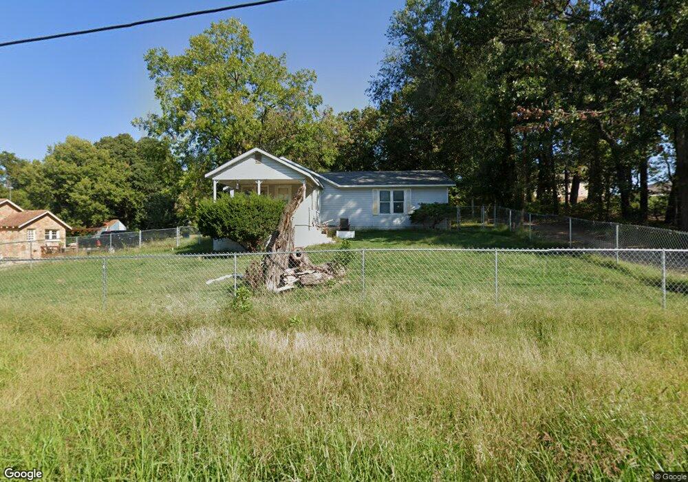
1306 Reid Rd Neosho, MO 64850
Estimated Value: $196,550 - $255,000
3
Beds
--
Bath
1,488
Sq Ft
$147/Sq Ft
Est. Value
About This Home
This home is located at 1306 Reid Rd, Neosho, MO 64850 and is currently estimated at $218,388, approximately $146 per square foot. 1306 Reid Rd is a home with nearby schools including Neosho High School, Ozark Christian Academy, and Neosho Christian Schools.
Ownership History
Date
Name
Owned For
Owner Type
Purchase Details
Closed on
May 6, 2024
Sold by
Caulk Joey Allen
Bought by
Philliber Ashtyn F and Philliber Christopher D
Current Estimated Value
Home Financials for this Owner
Home Financials are based on the most recent Mortgage that was taken out on this home.
Original Mortgage
$182,400
Outstanding Balance
$179,669
Interest Rate
6.87%
Mortgage Type
New Conventional
Estimated Equity
$38,719
Purchase Details
Closed on
May 11, 2023
Sold by
Caulk Joey Allen
Bought by
Caulk Joey Allen and Caulk Ashtyn
Create a Home Valuation Report for This Property
The Home Valuation Report is an in-depth analysis detailing your home's value as well as a comparison with similar homes in the area
Home Values in the Area
Average Home Value in this Area
Purchase History
| Date | Buyer | Sale Price | Title Company |
|---|---|---|---|
| Philliber Ashtyn F | -- | Fidelity Title | |
| Caulk Joey Allen | -- | None Listed On Document |
Source: Public Records
Mortgage History
| Date | Status | Borrower | Loan Amount |
|---|---|---|---|
| Open | Philliber Ashtyn F | $182,400 |
Source: Public Records
Tax History
| Year | Tax Paid | Tax Assessment Tax Assessment Total Assessment is a certain percentage of the fair market value that is determined by local assessors to be the total taxable value of land and additions on the property. | Land | Improvement |
|---|---|---|---|---|
| 2024 | $762 | $16,490 | -- | -- |
| 2023 | $762 | $13,890 | $1,672 | $12,218 |
| 2022 | $762 | $13,890 | -- | -- |
| 2021 | $762 | $13,890 | $0 | $0 |
| 2020 | $664 | $12,150 | $0 | $0 |
| 2019 | $605 | $12,150 | $0 | $0 |
| 2018 | $609 | $12,150 | $0 | $0 |
| 2017 | $594 | $12,150 | $0 | $0 |
| 2016 | $594 | $11,840 | $0 | $0 |
| 2015 | -- | $11,550 | $0 | $0 |
| 2014 | -- | $11,550 | $0 | $0 |
Source: Public Records
Map
Nearby Homes
- TBD N Bus 49 & Reid Rd
- Tbd-B State Highway 86
- TBD N Business 49
- 1094 N Business 49
- 1310 Reid Rd
- 1211 Northwest Blvd
- 1306 Marion Dr
- 1431 Greenwood Blvd
- 508 Major Ln
- 1121 Skyline Dr
- 1604 Greenwood Blvd
- 246 Hillcrest Dr
- 13194 Kirkwood Ln
- 13673 Oakwood Trail - Tract 4 Rd
- 13673 Oakwood Trail - Tract 2 Rd
- 13673 Oakwood Trail - Tract 6 Rd
- 619 W Brook St
- 527 Morrow St
- 515 Morrow St
- 1026 Sherry Dr
- 1232 Reid Rd
- 1616 Mayberry Dr
- 1655 Mayberry Dr
- 1609 Mayberry Dr
- 1229 Reid Rd
- 1227 Reid Rd Unit 2
- 1602 Mayberry Dr
- 1606 Mayberry Dr
- 1601 Mayberry Dr Unit D
- 1601 Mayberry Dr
- 1601 Mayberry Dr Unit C
- 1601 Mayberry Dr Unit A
- 1601 Mayberry Dr Unit B
- 1605 Mayberry Dr Unit C
- 1605 Mayberry Dr Unit D
- 1612 Mayberry Dr
- 1608 1610 1612 Mayberry
- 1221 Reid Rd
- 1205 Reid Rd
- 1611 Mayberry Dr
Your Personal Tour Guide
Ask me questions while you tour the home.