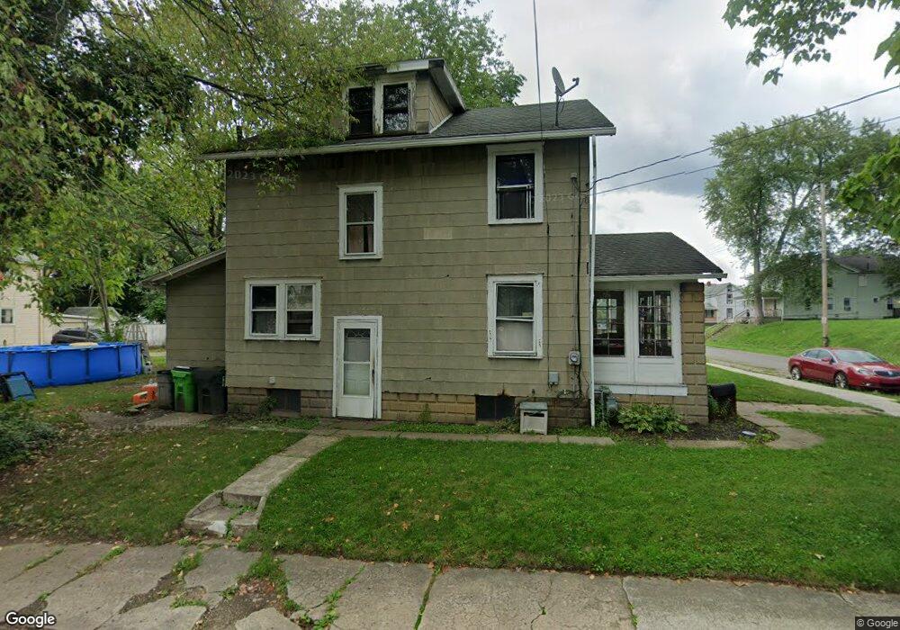
1306 South St Alliance, OH 44601
Estimated Value: $59,000 - $100,000
3
Beds
1
Bath
1,332
Sq Ft
$59/Sq Ft
Est. Value
About This Home
This home is located at 1306 South St, Alliance, OH 44601 and is currently estimated at $78,155, approximately $58 per square foot. 1306 South St is a home located in Stark County with nearby schools including Alliance Elementary School at Rockhill, Alliance Intermediate School at Northside, and Alliance Middle School.
Ownership History
Date
Name
Owned For
Owner Type
Purchase Details
Closed on
Jan 19, 2021
Sold by
Thomas Patricia A
Bought by
Thomas Kristian N and Petti Ryan K
Current Estimated Value
Purchase Details
Closed on
Aug 8, 2008
Sold by
Carli Douglas D
Bought by
Thomas Patricia A
Create a Home Valuation Report for This Property
The Home Valuation Report is an in-depth analysis detailing your home's value as well as a comparison with similar homes in the area
Home Values in the Area
Average Home Value in this Area
Purchase History
| Date | Buyer | Sale Price | Title Company |
|---|---|---|---|
| Thomas Kristian N | -- | None Available | |
| Thomas Patricia A | $27,000 | Attorney |
Source: Public Records
Tax History Compared to Growth
Tax History
| Year | Tax Paid | Tax Assessment Tax Assessment Total Assessment is a certain percentage of the fair market value that is determined by local assessors to be the total taxable value of land and additions on the property. | Land | Improvement |
|---|---|---|---|---|
| 2025 | $660 | $18,980 | $3,330 | $15,650 |
| 2024 | $678 | $16,980 | $3,330 | $13,650 |
| 2023 | $1,018 | $14,360 | $3,400 | $10,960 |
| 2022 | $581 | $14,360 | $3,400 | $10,960 |
| 2021 | $581 | $14,360 | $3,400 | $10,960 |
| 2020 | $533 | $12,290 | $2,940 | $9,350 |
| 2019 | $525 | $12,290 | $2,940 | $9,350 |
| 2018 | $528 | $12,290 | $2,940 | $9,350 |
| 2017 | $458 | $10,500 | $2,450 | $8,050 |
| 2016 | $462 | $10,500 | $2,450 | $8,050 |
| 2015 | $466 | $10,500 | $2,450 | $8,050 |
| 2014 | $410 | $8,790 | $2,240 | $6,550 |
| 2013 | $194 | $8,790 | $2,240 | $6,550 |
Source: Public Records
Map
Nearby Homes
- 1233 Woodland Ave
- 831 Wade Ave
- 814 Milner St
- 1395 S Webb Ave
- 1044 S Liberty Ave
- 729 Waugh St
- 815 Grace St
- 551 South St
- 1005 S Freedom Ave
- 442 S Liberty Ave
- 452 E Summit St
- 1437 S Linden Ave
- 548 E High St
- 1846 S Freedom Ave
- 390 E College St
- V/L S Fredeom Ave
- 167 11th St
- 432 S Linden Ave
- 404 S Linden Ave
- 1214 Jersey St
- 1312 South St
- 1157 Meadow Ave
- 1148 Meadow Ave
- 1140 Meadow Ave
- 1276 South St
- 1145 Meadow Ave
- 1139 Meadow Ave
- 1307 South St Unit 1315
- 1307 South St
- 1340 South St
- 1315 South St
- 1132 Meadow Ave
- 1345 South St
- 1345 1347 South St
- 1133 Meadow Ave
- 1266 South St
- 1124 Meadow Ave
- 1289 South St
- 1131 Willow Ave
- 1347 South St