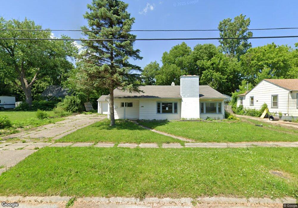
1306 Waldman Ave Flint, MI 48507
South Side NeighborhoodEstimated Value: $70,000 - $129,000
2
Beds
2
Baths
1,516
Sq Ft
$60/Sq Ft
Est. Value
About This Home
This home is located at 1306 Waldman Ave, Flint, MI 48507 and is currently estimated at $90,320, approximately $59 per square foot. 1306 Waldman Ave is a home located in Genesee County with nearby schools including Neithercut Elementary School, Flint Southwestern Classical Academy, and International Academy of Flint (K-12).
Ownership History
Date
Name
Owned For
Owner Type
Purchase Details
Closed on
Dec 18, 2024
Sold by
Us Bank National Association
Bought by
Roscoe Curtis J
Current Estimated Value
Purchase Details
Closed on
Oct 18, 2023
Sold by
Genesee County
Bought by
Us Bank National Association and Deyoung
Purchase Details
Closed on
Mar 14, 2007
Sold by
Smith William L and Doerr Kim M
Bought by
Fifth Third Bank
Create a Home Valuation Report for This Property
The Home Valuation Report is an in-depth analysis detailing your home's value as well as a comparison with similar homes in the area
Home Values in the Area
Average Home Value in this Area
Purchase History
| Date | Buyer | Sale Price | Title Company |
|---|---|---|---|
| Roscoe Curtis J | $23,040 | None Listed On Document | |
| Roscoe Curtis J | $23,040 | None Listed On Document | |
| Roscoe Curtis J | $23,040 | None Listed On Document | |
| Us Bank National Association | $30,020 | None Listed On Document | |
| Fifth Third Bank | $50,000 | None Available |
Source: Public Records
Tax History
| Year | Tax Paid | Tax Assessment Tax Assessment Total Assessment is a certain percentage of the fair market value that is determined by local assessors to be the total taxable value of land and additions on the property. | Land | Improvement |
|---|---|---|---|---|
| 2025 | $1,412 | $26,000 | $0 | $0 |
| 2024 | $1,302 | $26,000 | $0 | $0 |
| 2023 | $990 | $22,100 | $0 | $0 |
| 2022 | $0 | $18,600 | $0 | $0 |
| 2021 | $1,032 | $16,600 | $0 | $0 |
| 2020 | $926 | $13,900 | $0 | $0 |
| 2019 | $954 | $14,900 | $0 | $0 |
| 2018 | $969 | $18,500 | $0 | $0 |
| 2017 | $940 | $0 | $0 | $0 |
| 2016 | $934 | $0 | $0 | $0 |
| 2015 | -- | $0 | $0 | $0 |
| 2014 | -- | $0 | $0 | $0 |
| 2012 | -- | $19,100 | $0 | $0 |
Source: Public Records
Map
Nearby Homes
- 1410 Berrywood Ln
- 1130 W Atherton Rd
- 1413 Lincoln Ave
- 1514 W Atherton Rd
- 1506 Pettibone Ave
- 1028 Campbell St
- 1310 Alvord Ave
- 1310 Huron St
- 1234 Huron St
- 1318 Ingleside Ave
- 3902 Brunswick Ave
- 1125 Ingleside Ave
- 1210 Pinehurst Ave
- 1826 Greenbrook Ln
- 1741 Carmanbrook Pkwy
- 842 Leland St
- 1814 Carmanbrook Pkwy
- 845 Vermilya Ave
- 4302 Huckleberry Ln
- 912 Huron St
- 1310 Waldman Ave
- 1226 Waldman Ave
- 1222 Waldman Ave
- 1305 Pettibone Ave
- 1225 Pettibone Ave
- 1309 Pettibone Ave
- 1218 Waldman Ave
- 1221 Pettibone Ave
- 1318 Waldman Ave
- 1305 Waldman Ave
- 1225 Waldman Ave
- 1309 Waldman Ave
- 1217 Pettibone Ave
- 1214 Waldman Ave
- 1221 Waldman Ave
- 1313 Waldman Ave
- 1322 Waldman Ave
- 1325 Pettibone Ave
- 1321 Pettibone Ave
- 1213 Pettibone Ave
Your Personal Tour Guide
Ask me questions while you tour the home.