Estimated Value: $328,000 - $404,000
3
Beds
3
Baths
1,750
Sq Ft
$209/Sq Ft
Est. Value
About This Home
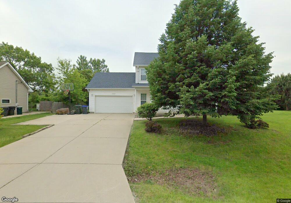
This home is located at 13063 W 29th St, Zion, IL 60099 and is currently estimated at $365,419, approximately $208 per square foot. 13063 W 29th St is a home located in Lake County with nearby schools including Kenneth Murphy School, Beach Park Middle School, and Zion-Benton Township High School.
Ownership History
Date
Name
Owned For
Owner Type
Purchase Details
Closed on
Nov 27, 2017
Sold by
U S Bank Na
Bought by
Zagal Jose A Arizmendi
Current Estimated Value
Home Financials for this Owner
Home Financials are based on the most recent Mortgage that was taken out on this home.
Original Mortgage
$119,700
Outstanding Balance
$101,573
Interest Rate
4.25%
Mortgage Type
New Conventional
Estimated Equity
$263,846
Purchase Details
Closed on
Mar 13, 1995
Sold by
Grand National Bank
Bought by
Girardi Diane
Create a Home Valuation Report for This Property
The Home Valuation Report is an in-depth analysis detailing your home's value as well as a comparison with similar homes in the area
Home Values in the Area
Average Home Value in this Area
Purchase History
| Date | Buyer | Sale Price | Title Company |
|---|---|---|---|
| Zagal Jose A Arizmendi | $126,000 | Chicago Title Insurance Comp | |
| Girardi Diane | $1,500 | Chicago Title Insurance Co |
Source: Public Records
Mortgage History
| Date | Status | Borrower | Loan Amount |
|---|---|---|---|
| Open | Zagal Jose A Arizmendi | $119,700 |
Source: Public Records
Tax History Compared to Growth
Tax History
| Year | Tax Paid | Tax Assessment Tax Assessment Total Assessment is a certain percentage of the fair market value that is determined by local assessors to be the total taxable value of land and additions on the property. | Land | Improvement |
|---|---|---|---|---|
| 2024 | $7,853 | $100,612 | $12,484 | $88,128 |
| 2023 | $7,117 | $83,734 | $10,414 | $73,320 |
| 2022 | $7,117 | $73,657 | $9,288 | $64,369 |
| 2021 | $6,842 | $67,604 | $8,494 | $59,110 |
| 2020 | $6,829 | $66,033 | $8,297 | $57,736 |
| 2019 | $6,689 | $61,745 | $7,968 | $53,777 |
| 2018 | $5,783 | $41,996 | $7,147 | $34,849 |
| 2017 | $7,102 | $60,811 | $7,014 | $53,797 |
| 2016 | $7,062 | $58,777 | $6,779 | $51,998 |
| 2015 | $7,029 | $55,508 | $6,402 | $49,106 |
| 2014 | $6,168 | $53,985 | $6,226 | $47,759 |
| 2012 | $6,220 | $54,885 | $6,330 | $48,555 |
Source: Public Records
Map
Nearby Homes
- 13051 Bucksburn Ct
- 39787 Torry Ln
- 13129 W Shannon Dr
- 39631 N Warren Ln Unit 4625
- 13154 W Sheffield Ln
- 13661 W Adams Rd
- 13551 W Adams Rd
- 39616 N Warren Ln Unit 4824
- 13428 Victoria Ln
- 39520 N Green Bay Rd
- 39401 N Green Bay Rd
- 2414 Phillip Dr
- 39092 Welsh Ln Unit 5501
- 39111 N Aberdeen Ln Unit 39111
- 42334 N Heritage Lot 7 Trail
- 14067 W Pratum Terra Dr
- 12920 W Wadsworth Rd
- 2407 Phillip Dr
- 39113 N Green Bay Rd
- 2407 Miriam Ave
- 13049 W 29th St
- 13068 Bucksburn Ln
- 13107 W 29th St
- 13054 Bucksburn Ln
- 13082 Bucksburn Ln
- 13058 W 29th St
- 13072 W 29th St
- 13107 29th St
- 13041 W 29th St
- 13096 Bucksburn Ln
- 13039 W 29th St
- 13130 W 29th St
- 13039 W 29th St
- 13035 W 29th St
- 13058 W 29th St
- 13033 W 29th St
- 13110 Bucksburn Ln
- 13034 W 29th St
- 13124 Bucksburn Ln
- 13124 Bucksburn Ln Unit 13124