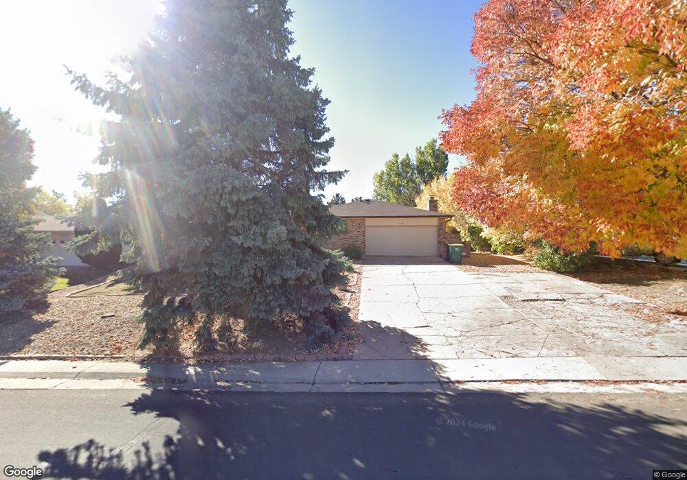
13064 Mercury Dr Lone Tree, CO 80124
Estimated Value: $526,000 - $610,000
3
Beds
2
Baths
1,505
Sq Ft
$380/Sq Ft
Est. Value
About This Home
This home is located at 13064 Mercury Dr, Lone Tree, CO 80124 and is currently estimated at $572,496, approximately $380 per square foot. 13064 Mercury Dr is a home located in Douglas County with nearby schools including Acres Green Elementary School, Cresthill Middle School, and Highlands Ranch High School.
Ownership History
Date
Name
Owned For
Owner Type
Purchase Details
Closed on
Jul 28, 2005
Sold by
Sharp Patricia K
Bought by
Hartliep Rhonda J
Current Estimated Value
Home Financials for this Owner
Home Financials are based on the most recent Mortgage that was taken out on this home.
Original Mortgage
$183,920
Outstanding Balance
$94,108
Interest Rate
5.65%
Mortgage Type
Fannie Mae Freddie Mac
Estimated Equity
$478,388
Purchase Details
Closed on
May 25, 2005
Sold by
Dodge Robert Theodore
Bought by
Sharp Patricia K
Purchase Details
Closed on
Sep 22, 1993
Sold by
Dodge June Edna
Bought by
Dodge Robert T
Purchase Details
Closed on
Aug 3, 1990
Sold by
Dodge Robert T
Bought by
Dodge Robert T and Dodge June E
Purchase Details
Closed on
Feb 20, 1980
Sold by
Unavailable
Bought by
Unavailable
Create a Home Valuation Report for This Property
The Home Valuation Report is an in-depth analysis detailing your home's value as well as a comparison with similar homes in the area
Home Values in the Area
Average Home Value in this Area
Purchase History
| Date | Buyer | Sale Price | Title Company |
|---|---|---|---|
| Hartliep Rhonda J | $229,900 | Guardian Title | |
| Sharp Patricia K | -- | -- | |
| Dodge Robert T | -- | -- | |
| Dodge Robert T | -- | -- | |
| Unavailable | $73,300 | -- |
Source: Public Records
Mortgage History
| Date | Status | Borrower | Loan Amount |
|---|---|---|---|
| Open | Hartliep Rhonda J | $183,920 |
Source: Public Records
Tax History
| Year | Tax Paid | Tax Assessment Tax Assessment Total Assessment is a certain percentage of the fair market value that is determined by local assessors to be the total taxable value of land and additions on the property. | Land | Improvement |
|---|---|---|---|---|
| 2025 | $3,982 | $40,490 | $9,130 | $31,360 |
| 2024 | $3,982 | $47,070 | $10,040 | $37,030 |
| 2023 | $4,023 | $47,070 | $10,040 | $37,030 |
| 2022 | $2,940 | $33,020 | $8,520 | $24,500 |
| 2021 | $3,058 | $33,020 | $8,520 | $24,500 |
| 2020 | $2,918 | $32,280 | $8,260 | $24,020 |
| 2019 | $2,928 | $32,280 | $8,260 | $24,020 |
| 2018 | $2,359 | $27,860 | $7,060 | $20,800 |
| 2017 | $2,398 | $27,860 | $7,060 | $20,800 |
| 2016 | $2,152 | $24,490 | $6,260 | $18,230 |
| 2015 | $2,201 | $24,490 | $6,260 | $18,230 |
| 2014 | $2,118 | $22,070 | $4,780 | $17,290 |
Source: Public Records
Map
Nearby Homes
- 8159 Lodgepole Trail
- 789 Mercury Cir
- 13226 Canopus Dr
- 9320 Miles Dr
- 9314 Wiltshire Dr
- 8666 Ainsdale Ct Unit 12B
- 6945 Mountain Brush Cir
- 8852 Chestnut Hill Ln
- 7191 Palisade Dr
- 8822 Fiesta Terrace
- 8860 Kachina Way
- 9466 Wiltshire Dr
- 8870 Fiesta Terrace
- 181 Dianna Dr
- 9631 Kemper Dr
- 7057 Chestnut Hill St
- 130 Dianna Dr
- 7459 La Quinta Place
- 8356 Green Island Cir
- 6823 Edgewood Place
- 13060 Mercury Dr
- 13068 Mercury Dr
- 13056 Mercury Dr
- 13072 Mercury Dr
- 7911 Chaparral Rd
- 13072 Spica Dr
- 7943 Chaparral Rd
- 13071 Acres Green Dr
- 7887 Chaparral Rd
- 13076 Mercury Dr
- 7961 Chaparral Rd
- 7863 Chaparral Rd
- 13052 Mercury Dr
- 13055 Mercury Dr
- 7977 Chaparral Rd
- 13081 Acres Green Dr
- 13077 Mercury Dr
- 13082 Spica Dr
- 7845 Chaparral Rd
- 13084 Mercury Dr
Your Personal Tour Guide
Ask me questions while you tour the home.