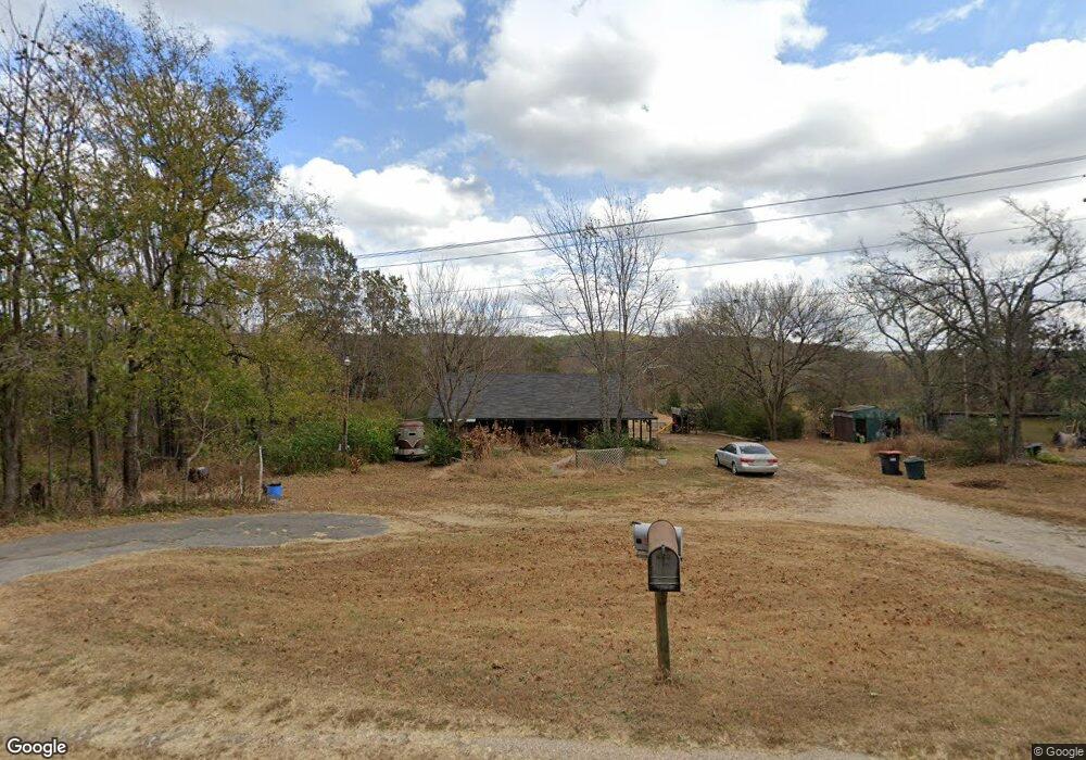
13067 Highway 10 Tahlequah, OK 74464
Estimated Value: $162,000 - $403,000
3
Beds
2
Baths
2,286
Sq Ft
$107/Sq Ft
Est. Value
About This Home
This home is located at 13067 Highway 10, Tahlequah, OK 74464 and is currently estimated at $243,705, approximately $106 per square foot. 13067 Highway 10 is a home located in Cherokee County with nearby schools including Lowrey School.
Ownership History
Date
Name
Owned For
Owner Type
Purchase Details
Closed on
Mar 29, 2023
Sold by
Gourd Donna Ann
Bought by
Housing Authority Of The Cherokee Nation Of O
Current Estimated Value
Purchase Details
Closed on
May 26, 2022
Sold by
Hodges Janice T and Hodges Alene T
Bought by
Gourd Donna Ann
Purchase Details
Closed on
Nov 12, 2012
Sold by
Hodges Janice and Fields Alene T
Bought by
Hodges Janice and Fields Alene T
Purchase Details
Closed on
Apr 1, 2008
Sold by
Jerzyk Walter T and Jerzyk Crystal L
Bought by
Lobaugh Regina and Field Alene
Purchase Details
Closed on
Nov 24, 2003
Sold by
Irene Tincher Trust
Bought by
Walter and Crystal Jerzyk
Create a Home Valuation Report for This Property
The Home Valuation Report is an in-depth analysis detailing your home's value as well as a comparison with similar homes in the area
Home Values in the Area
Average Home Value in this Area
Purchase History
| Date | Buyer | Sale Price | Title Company |
|---|---|---|---|
| Housing Authority Of The Cherokee Nation Of O | -- | -- | |
| Gourd Donna Ann | -- | None Listed On Document | |
| Hodges Janice | -- | None Available | |
| Lobaugh Regina | -- | None Available | |
| Walter | $70,000 | -- |
Source: Public Records
Tax History Compared to Growth
Tax History
| Year | Tax Paid | Tax Assessment Tax Assessment Total Assessment is a certain percentage of the fair market value that is determined by local assessors to be the total taxable value of land and additions on the property. | Land | Improvement |
|---|---|---|---|---|
| 2025 | $588 | $8,000 | $1,294 | $6,706 |
| 2024 | $588 | $7,619 | $1,232 | $6,387 |
| 2023 | $588 | $7,256 | $1,156 | $6,100 |
| 2022 | $542 | $6,910 | $931 | $5,979 |
| 2021 | $514 | $6,582 | $887 | $5,695 |
| 2020 | $448 | $6,268 | $845 | $5,423 |
| 2019 | $476 | $5,970 | $805 | $5,165 |
| 2018 | $456 | $5,686 | $766 | $4,920 |
| 2017 | $439 | $5,415 | $835 | $4,580 |
| 2016 | $419 | $5,157 | $793 | $4,364 |
| 2015 | $341 | $4,912 | $837 | $4,075 |
| 2014 | $325 | $4,678 | $795 | $3,883 |
Source: Public Records
Map
Nearby Homes
- 21088 E Steely Hollow Rd
- 13468 Hwy 10
- 13468 Oklahoma 10
- 105 Summit Ridge Dr
- 13725 N 527 Rd
- 12562 N Webster Rd
- 912 Summit Ridge Ct
- 20819 E Steely Hollow Rd
- TBD Blk 1 Lot 11 E Steely Hollow Rd
- TBD Blk 1 Lot 4 E Steely Hollow Rd
- TBD BLK 1 Lot 10 E Steely Hollow Rd
- TBD BLK 1 Lot 9 E Steely Hollow Rd
- TBD Blk 1 Lot 1 E Steely Hollow Rd
- TBD BLK 1 Lot 2 E Steely Hollow Rd
- TBD Blk 1 Lot 6 E Steely Hollow Rd
- TBD Blk 1 Lot 8 E Steely Hollow Rd
- TBD Blk 1 Lot 5 E Steely Hollow Rd
- 206 Alder Way
- 202 Alder Way
- 0 Alder Way
- 13047 N Highway 10
- 13068 N Highway 10
- 13086 N Highway 10
- 13086 N Highway 10
- 13086 N Highway 10
- 13111 N Hwy 10
- 13020 N Highway 10
- 13034 N Highway 10
- 12689 N Highway 10
- 13151 N Highway 10
- 11709 N 569 Rd
- 11858 N 569 Rd
- 13144 N Highway 10
- 11744 N 569 Rd
- 12231 N 569 Rd
- 12231 N 569 Rd
- 11944 N 569 Rd
- 11670 N 569 Rd
- 13171 Highway 10
- 11528 N 569 Rd