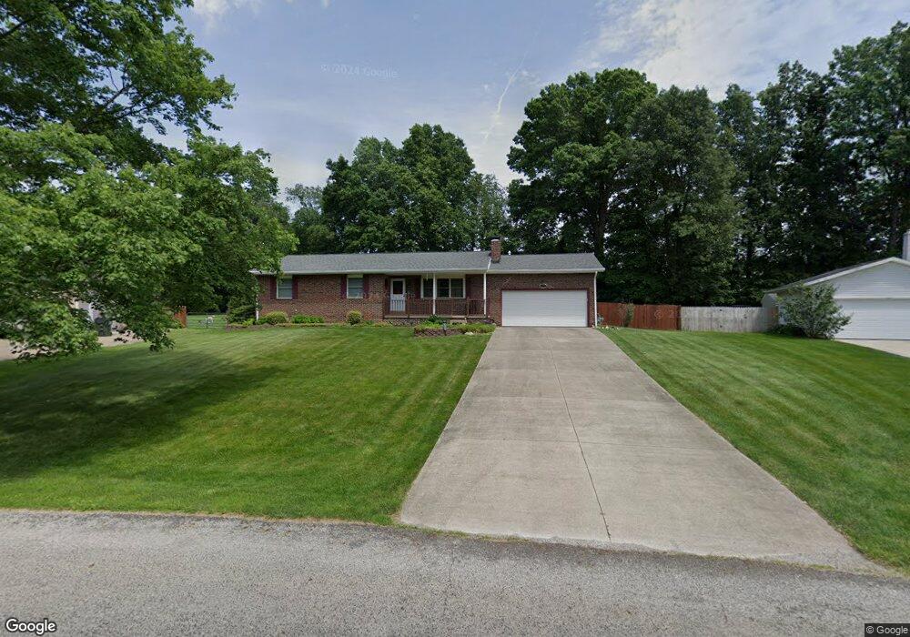
13067 Mark Path Doylestown, OH 44230
Estimated Value: $262,000 - $335,000
3
Beds
2
Baths
1,660
Sq Ft
$172/Sq Ft
Est. Value
About This Home
This home is located at 13067 Mark Path, Doylestown, OH 44230 and is currently estimated at $285,891, approximately $172 per square foot. 13067 Mark Path is a home located in Wayne County with nearby schools including Hazel Harvey Elementary School, Chippewa Intermediate School, and Chippewa Jr./Sr. High School.
Ownership History
Date
Name
Owned For
Owner Type
Purchase Details
Closed on
Dec 24, 2003
Sold by
Fout Michael W and Fout Carol S
Bought by
Fout Michael W and Fout Carol S
Current Estimated Value
Home Financials for this Owner
Home Financials are based on the most recent Mortgage that was taken out on this home.
Original Mortgage
$60,000
Outstanding Balance
$27,725
Interest Rate
5.84%
Mortgage Type
New Conventional
Estimated Equity
$258,166
Purchase Details
Closed on
Jul 31, 1987
Bought by
Fout Michael W and Fout Carol S
Create a Home Valuation Report for This Property
The Home Valuation Report is an in-depth analysis detailing your home's value as well as a comparison with similar homes in the area
Home Values in the Area
Average Home Value in this Area
Purchase History
| Date | Buyer | Sale Price | Title Company |
|---|---|---|---|
| Fout Michael W | -- | -- | |
| Fout Michael W | $57,500 | -- |
Source: Public Records
Mortgage History
| Date | Status | Borrower | Loan Amount |
|---|---|---|---|
| Open | Fout Michael W | $60,000 |
Source: Public Records
Tax History
| Year | Tax Paid | Tax Assessment Tax Assessment Total Assessment is a certain percentage of the fair market value that is determined by local assessors to be the total taxable value of land and additions on the property. | Land | Improvement |
|---|---|---|---|---|
| 2024 | $2,360 | $78,400 | $20,250 | $58,150 |
| 2023 | $2,383 | $78,400 | $20,250 | $58,150 |
| 2022 | $1,831 | $57,220 | $14,780 | $42,440 |
| 2021 | $1,845 | $57,220 | $14,780 | $42,440 |
| 2020 | $1,858 | $57,220 | $14,780 | $42,440 |
| 2019 | $1,437 | $44,880 | $11,940 | $32,940 |
| 2018 | $1,451 | $44,880 | $11,940 | $32,940 |
| 2017 | $1,439 | $44,880 | $11,940 | $32,940 |
| 2016 | $1,389 | $43,150 | $11,480 | $31,670 |
| 2015 | $1,383 | $43,150 | $11,480 | $31,670 |
| 2014 | $1,214 | $43,150 | $11,480 | $31,670 |
| 2013 | $1,227 | $42,460 | $11,580 | $30,880 |
Source: Public Records
Map
Nearby Homes
- 12214 Vince Dr
- 18592 Edwards Rd Unit 137
- 18592 Edwards Rd Unit 243
- 18592 Edwards Rd Unit 3
- 18592 Edwards Rd
- 100 Merlot Ct
- 6151 Taylor Rd
- 18331 William Dr
- 14740 Oak Grove Dr Unit 41
- 580 Thorn Way
- 46 Hidden Pond Dr
- 680 Thorn Way
- 620 Thorn Way
- 288 E Clinton St
- 5776 Sonata Ave
- VL 1067 Homan Dr
- 12045 Coal Bank Rd
- 15240 Hametown Rd
- V/L 1050 Melanie Ln
- 15899 Mccallum Dr
- 13057 Mark Path
- 13075 Mark Path
- 13043 Mark Path
- 13085 Mark Path
- 13074 Mark Path
- 13050 Mark Path
- 18111 James Way
- 13029 Mark Path
- 17989 Edwards Rd
- 17965 Edwards Rd
- 18139 James Way
- 13036 Mark Path
- 17941 Edwards Rd
- 13119 Hametown Rd
- 13101 Hametown Rd
- 13099 Mark Path
- 13017 Mark Path
- 13022 Mark Path
- 17915 Edwards Rd
- 13085 Hametown Rd
Your Personal Tour Guide
Ask me questions while you tour the home.