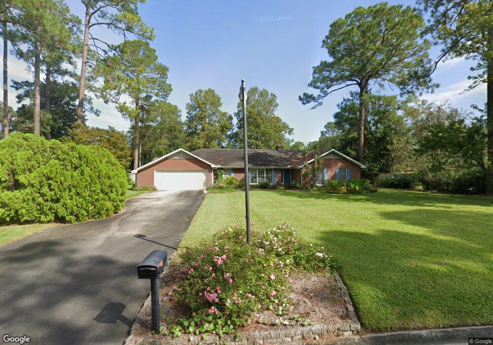
1307 Atlantic Ave Waycross, GA 31501
Estimated Value: $301,000 - $325,000
3
Beds
2
Baths
2,802
Sq Ft
$112/Sq Ft
Est. Value
About This Home
This home is located at 1307 Atlantic Ave, Waycross, GA 31501 and is currently estimated at $313,096, approximately $111 per square foot. 1307 Atlantic Ave is a home located in Ware County with nearby schools including Williams Heights Elementary School, Waycross Middle School, and Ware County High School.
Ownership History
Date
Name
Owned For
Owner Type
Purchase Details
Closed on
Mar 4, 2025
Sold by
Morris Denise
Bought by
Ddc Ventures Llc
Current Estimated Value
Purchase Details
Closed on
Apr 13, 2012
Sold by
Daleo Denise
Bought by
Morris Denise A
Purchase Details
Closed on
May 10, 2004
Sold by
Daleo John and Daleo Denise
Bought by
Daleo Denise
Purchase Details
Closed on
Nov 26, 1997
Sold by
Moye Mary S
Bought by
Daleo John and Daleo Denise
Purchase Details
Closed on
Feb 5, 1986
Create a Home Valuation Report for This Property
The Home Valuation Report is an in-depth analysis detailing your home's value as well as a comparison with similar homes in the area
Home Values in the Area
Average Home Value in this Area
Purchase History
| Date | Buyer | Sale Price | Title Company |
|---|---|---|---|
| Ddc Ventures Llc | $52,600 | -- | |
| Morris Denise A | $10,000 | -- | |
| Daleo Denise | -- | -- | |
| Daleo John | $143,500 | -- | |
| -- | $10,500 | -- |
Source: Public Records
Tax History Compared to Growth
Tax History
| Year | Tax Paid | Tax Assessment Tax Assessment Total Assessment is a certain percentage of the fair market value that is determined by local assessors to be the total taxable value of land and additions on the property. | Land | Improvement |
|---|---|---|---|---|
| 2024 | $4,181 | $125,242 | $7,840 | $117,402 |
| 2023 | $4,267 | $102,024 | $14,000 | $88,024 |
| 2022 | $4,008 | $102,024 | $14,000 | $88,024 |
| 2021 | $3,651 | $85,876 | $14,000 | $71,876 |
| 2020 | $3,625 | $84,628 | $14,000 | $70,628 |
| 2019 | $3,456 | $79,640 | $14,000 | $65,640 |
| 2018 | $3,396 | $77,562 | $14,000 | $63,562 |
| 2017 | $3,317 | $77,562 | $14,000 | $63,562 |
| 2016 | $3,317 | $77,562 | $14,000 | $63,562 |
| 2015 | $3,340 | $77,562 | $14,000 | $63,562 |
| 2014 | $3,336 | $77,562 | $14,000 | $63,562 |
| 2013 | -- | $91,012 | $14,000 | $77,012 |
Source: Public Records
Map
Nearby Homes
- 1312 Atlantic Ave
- 1204 Richmond Ave
- 807 City Blvd
- 914 Barkley St
- 1002 Baltimore Ave
- 7438 Central Ave
- 1100 Atlantic Ave
- 1502 Seminole Trail
- 1100 Euclid Ave
- 1205 Dean Dr
- 1504 Danora Dr
- 00 Seminole Trail
- 1009 Euclid Ave
- 1400 E Cherokee Dr
- 903 Atlantic Ave
- 907 Euclid Ave
- 955 Lynn Dr
- 1621 Camellia Dr
- 1001 Coral Rd
- 1617 Moss Creek Rd
- 105 Plantation Dr
- 1305 Atlantic Ave
- 1310 Atlantic Ave
- 125 Plantation Dr
- 1302 Atlantic Ave
- 106 Plantation Dr
- 1303 Atlantic Ave
- 1306 Richmond Ave
- 1309 Shawnee Dr
- 108 Plantation Dr
- 1307 Shawnee Dr
- 102 Plantation Dr
- 101 Plantation Dr
- 1300 Richmond Ave
- 902 City Blvd
- 1303 Shawnee Dr
- 200 Plantation Dr
- 1308 Andrea Dr
- 914 Carrie Dr
- Lot #2 Plantation Pines Dr