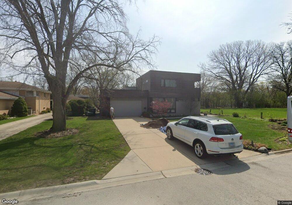
1307 Brook Ln Glenview, IL 60025
Estimated Value: $846,000 - $1,130,000
4
Beds
4
Baths
2,307
Sq Ft
$409/Sq Ft
Est. Value
About This Home
This home is located at 1307 Brook Ln, Glenview, IL 60025 and is currently estimated at $943,680, approximately $409 per square foot. 1307 Brook Ln is a home located in Cook County with nearby schools including Marie Murphy School, Avoca West Elementary School, and New Trier Township High School - Northfield.
Ownership History
Date
Name
Owned For
Owner Type
Purchase Details
Closed on
Jul 16, 2004
Sold by
Bauman James G
Bought by
Angyalosy Adrian and Angyalosy Alina S
Current Estimated Value
Home Financials for this Owner
Home Financials are based on the most recent Mortgage that was taken out on this home.
Original Mortgage
$372,800
Outstanding Balance
$161,841
Interest Rate
4.25%
Mortgage Type
Unknown
Estimated Equity
$781,839
Purchase Details
Closed on
Aug 28, 2000
Sold by
St Johns Evangelical Lutheran Church Of
Bought by
Bauman James G
Create a Home Valuation Report for This Property
The Home Valuation Report is an in-depth analysis detailing your home's value as well as a comparison with similar homes in the area
Home Values in the Area
Average Home Value in this Area
Purchase History
| Date | Buyer | Sale Price | Title Company |
|---|---|---|---|
| Angyalosy Adrian | $466,000 | Chicago Title Insurance Comp | |
| Bauman James G | -- | -- |
Source: Public Records
Mortgage History
| Date | Status | Borrower | Loan Amount |
|---|---|---|---|
| Open | Angyalosy Adrian | $372,800 |
Source: Public Records
Tax History Compared to Growth
Tax History
| Year | Tax Paid | Tax Assessment Tax Assessment Total Assessment is a certain percentage of the fair market value that is determined by local assessors to be the total taxable value of land and additions on the property. | Land | Improvement |
|---|---|---|---|---|
| 2024 | $12,202 | $59,000 | $14,144 | $44,856 |
| 2023 | $11,666 | $59,000 | $14,144 | $44,856 |
| 2022 | $11,666 | $59,000 | $14,144 | $44,856 |
| 2021 | $10,901 | $48,217 | $10,166 | $38,051 |
| 2020 | $10,681 | $48,217 | $10,166 | $38,051 |
| 2019 | $10,435 | $52,986 | $10,166 | $42,820 |
| 2018 | $10,625 | $50,865 | $8,398 | $42,467 |
| 2017 | $11,709 | $57,206 | $8,398 | $48,808 |
| 2016 | $11,247 | $57,206 | $8,398 | $48,808 |
| 2015 | $6,570 | $31,290 | $6,851 | $24,439 |
| 2014 | $6,444 | $31,290 | $6,851 | $24,439 |
| 2013 | $6,150 | $31,290 | $6,851 | $24,439 |
Source: Public Records
Map
Nearby Homes
- 228 Mark Dr
- 1201 Harms Rd
- 1115 Hunter Rd
- 1101 Juniper Terrace
- 941 Harms Rd
- 4072 Bunker Ln
- 3507 Greenwood Ave
- 1133 Manor Dr
- 542 Laramie Ave
- 341 Taft Ct
- 821 Harms Rd
- 25 Wilmette Ave
- 828 Lavergne Ave
- 711 Becker Rd
- 1702 Del Ogier Dr
- 3227 Greenleaf Ave
- 737 Becker Rd
- 639 Harms Rd
- 846 Wagner Rd
- 805 Hibbard Rd
- 1313 Brook Ln
- 1304 Heatherfield Ln
- 1319 Brook Ln
- 1312 Heatherfield Ln
- 1300 Heatherfield Ln
- 1316 Heatherfield Ln
- 1306 Brook Ln
- 1246 Heatherfield Ln
- 1325 Brook Ln Unit 2
- 1314 Brook Ln
- 1322 Heatherfield Ln
- 1322 Brook Ln
- 1240 Heatherfield Ln
- 1329 Brook Ln
- 425 Brook Ln
- 1236 Heatherfield Ln
- 1305 Heatherfield Ln
- 1311 Heatherfield Ln
- 1301 Heatherfield Ln
- 1324 Heatherfield Ln