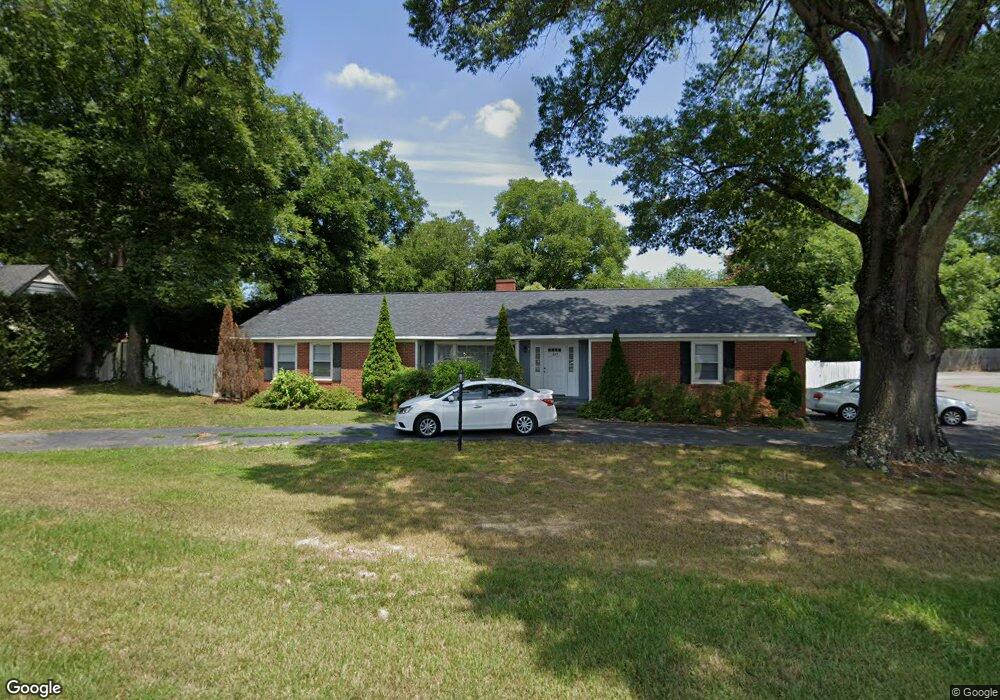
1307 Lane St Kannapolis, NC 28083
Estimated Value: $269,000 - $334,000
3
Beds
2
Baths
1,794
Sq Ft
$166/Sq Ft
Est. Value
About This Home
This home is located at 1307 Lane St, Kannapolis, NC 28083 and is currently estimated at $297,015, approximately $165 per square foot. 1307 Lane St is a home located in Cabarrus County with nearby schools including Jackson Park Elementary School, Kannapolis Middle, and A.L. Brown High School.
Ownership History
Date
Name
Owned For
Owner Type
Purchase Details
Closed on
Jun 30, 2016
Sold by
Forrets Stephen J and Forrets Judy W
Bought by
Gray Mary Hunter and Hunter Pamela Elaine
Current Estimated Value
Purchase Details
Closed on
Jul 1, 2005
Sold by
Forrest Lee and Forrest Ashley M
Bought by
Forrest Stephen J and Forrest Judy W
Purchase Details
Closed on
Jun 1, 2005
Sold by
Va
Bought by
Forrest Lee
Purchase Details
Closed on
Apr 6, 2004
Sold by
Haas David L and Haas Theresa M
Bought by
Va
Purchase Details
Closed on
Oct 1, 1994
Bought by
Haas David L and Wf Theresa M
Create a Home Valuation Report for This Property
The Home Valuation Report is an in-depth analysis detailing your home's value as well as a comparison with similar homes in the area
Home Values in the Area
Average Home Value in this Area
Purchase History
| Date | Buyer | Sale Price | Title Company |
|---|---|---|---|
| Gray Mary Hunter | $35,142 | None Available | |
| Forrest Stephen J | -- | -- | |
| Forrest Lee | -- | -- | |
| Va | $72,402 | -- | |
| Haas David L | $69,000 | -- |
Source: Public Records
Tax History Compared to Growth
Tax History
| Year | Tax Paid | Tax Assessment Tax Assessment Total Assessment is a certain percentage of the fair market value that is determined by local assessors to be the total taxable value of land and additions on the property. | Land | Improvement |
|---|---|---|---|---|
| 2025 | $1,326 | $233,530 | $65,000 | $168,530 |
| 2024 | $1,326 | $233,530 | $65,000 | $168,530 |
| 2023 | $1,068 | $155,880 | $55,690 | $100,190 |
| 2022 | $1,010 | $147,460 | $55,690 | $91,770 |
| 2021 | $1,010 | $147,460 | $55,690 | $91,770 |
| 2020 | $1,010 | $147,460 | $55,690 | $91,770 |
| 2019 | $785 | $114,590 | $54,450 | $60,140 |
| 2018 | $1,547 | $114,590 | $54,450 | $60,140 |
| 2017 | $1,524 | $114,590 | $54,450 | $60,140 |
| 2016 | $1,524 | $110,970 | $21,600 | $89,370 |
| 2015 | $1,398 | $110,970 | $21,600 | $89,370 |
| 2014 | $1,398 | $110,970 | $21,600 | $89,370 |
Source: Public Records
Map
Nearby Homes
- 1102 Lane St
- 712 Grace Ave
- 604 Pearl Ave
- 311 Jean Ave
- 1202 Woodlawn St
- 406 Ruth Ave
- 904 Venus St
- 904 Marie Ave
- 807 Carolyn Ave
- 1406 Shepard St
- 1526 Shepard St
- 1905 Clay St
- 302 Melinda Ave
- 1001 N Cannon Blvd
- 916 Taylor St
- 776 Washington Ln
- 502 Helen St
- 2010 Samantha Dr
- 137 Beaumont Ave
- 1517 Jamaica Rd