1307 Misty Ln Gilbert, SC 29054
Estimated Value: $590,701 - $747,000
About This Home
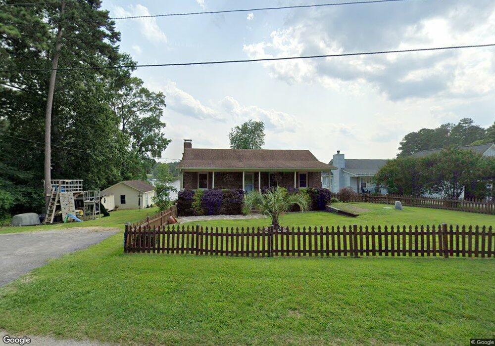
This home is located at 1307 Misty Ln, Gilbert, SC 29054 and is currently estimated at $652,675, approximately $627 per square foot. 1307 Misty Ln is a home located in Lexington County with nearby schools including Centerville Elementary School, Gilbert Middle School, and Gilbert High School.
Ownership History
We collect this data history from publicly available records. To have your information removed, we recommend requesting removal directly through your county’s website.
Purchase Details
Purchase Details
Home Financials for this Owner
Home Financials are based on the most recent Mortgage that was taken out on this home.Purchase Details
Home Financials for this Owner
Home Financials are based on the most recent Mortgage that was taken out on this home.Home Values in the Area
Average Home Value in this Area
Purchase History
We collect this data history from publicly available records. To have your information removed, we recommend requesting removal directly through your county’s website.
| Date | Buyer | Sale Price | Title Company |
|---|---|---|---|
| $334,500 | None Available | ||
| $315,000 | -- | ||
| $239,000 | -- |
Mortgage History
We collect this data history from publicly available records. To have your information removed, we recommend requesting removal directly through your county’s website.
| Date | Status | Borrower | Loan Amount |
|---|---|---|---|
| Previous Owner | $252,000 | ||
| Previous Owner | $23,900 | ||
| Previous Owner | $191,200 |
Tax History
We collect this data history from publicly available records. To have your information removed, we recommend requesting removal directly through your county’s website.
| Year | Tax Paid | Tax Assessment Tax Assessment Total Assessment is a certain percentage of the fair market value that is determined by local assessors to be the total taxable value of land and additions on the property. | Land | Improvement |
|---|---|---|---|---|
| 2024 | $2,182 | $13,380 | $8,000 | $5,380 |
| 2023 | $1,998 | $13,380 | $8,000 | $5,380 |
| 2022 | $1,992 | $13,380 | $8,000 | $5,380 |
| 2020 | $2,043 | $13,380 | $8,000 | $5,380 |
| 2019 | $2,080 | $13,380 | $6,400 | $6,980 |
| 2018 | $2,042 | $13,380 | $6,400 | $6,980 |
| 2017 | $1,980 | $13,380 | $6,400 | $6,980 |
| 2016 | $1,474 | $15,076 | $9,600 | $5,476 |
| 2014 | $8,220 | $18,899 | $11,400 | $7,499 |
| 2013 | -- | $18,900 | $11,400 | $7,500 |
Map
- 1324 Sundown Ct
- 0 Misty Cir Unit 566318
- 1628 Deep Cove Ln
- 417 Dot Ct
- 335 Calypso Rd
- 1329 Martins Camp Ln
- 1338 Camping Rd
- 870 Shore Rd
- 116 Aloha Ct
- 421 & 0 Shore Rd
- 1384 Camping Rd
- 1305 Rock Island Rd
- 841 Foxden Rd
- 157 Blue Wing Dr
- 2337 Shulls Fork Rd
- 148 Pintail Lake Dr
- 1148 Shull Island Rd
- 1223 Shull Island Rd
- 501 Canasta Dr
- 274 Pintail Lake Dr
Ask me questions while you tour the home.