Estimated Value: $828,000 - $1,211,000
4
Beds
3
Baths
3,084
Sq Ft
$351/Sq Ft
Est. Value
About This Home
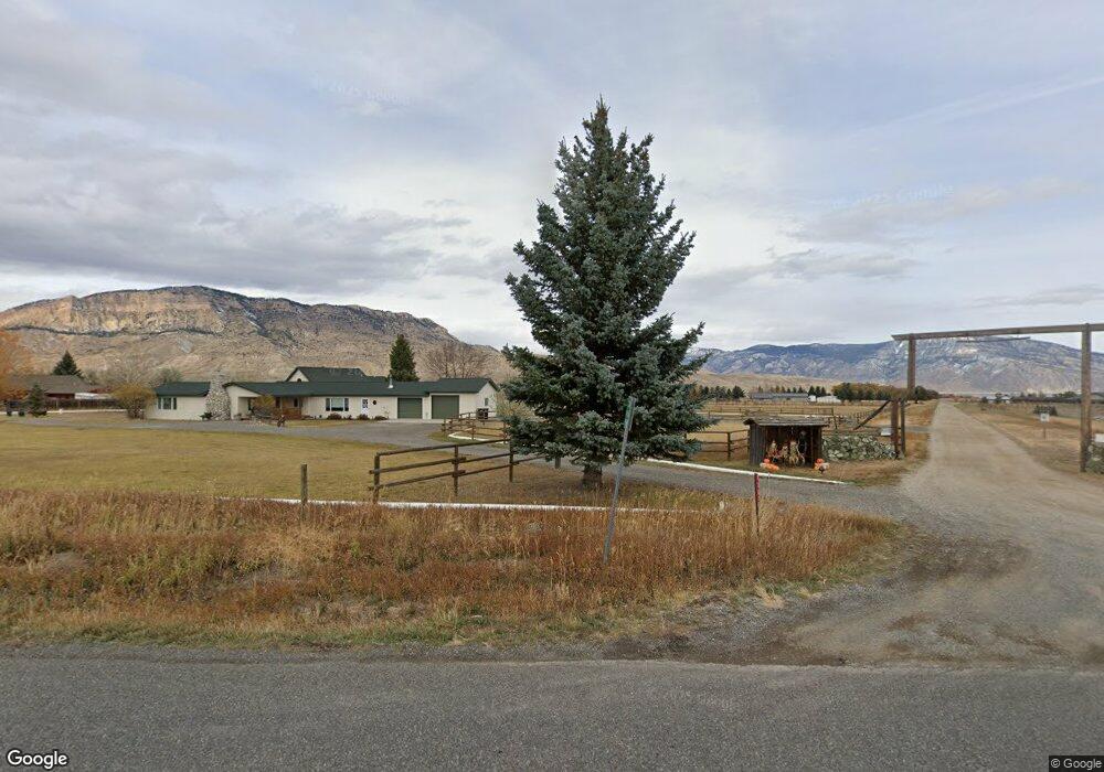
This home is located at 1307 S Fork Rd, Cody, WY 82414 and is currently estimated at $1,081,035, approximately $350 per square foot. 1307 S Fork Rd is a home located in Park County with nearby schools including Cody Middle School and Cody High School.
Ownership History
Date
Name
Owned For
Owner Type
Purchase Details
Closed on
Oct 5, 2021
Sold by
Torbit John A
Bought by
Torbit Carol A and Prins Family Trust
Current Estimated Value
Purchase Details
Closed on
Apr 29, 2020
Sold by
Prins Carol A and Torbit Carol A
Bought by
Torbit Carol A and Prins Family Trsut
Purchase Details
Closed on
Feb 4, 2011
Sold by
Torbit John A
Bought by
Torbit Carol A and Prins Carol A
Purchase Details
Closed on
Apr 25, 2006
Sold by
Prins Carol A and Vorst Diane Van
Bought by
Prins Carol A and Vorst Diane Van
Create a Home Valuation Report for This Property
The Home Valuation Report is an in-depth analysis detailing your home's value as well as a comparison with similar homes in the area
Purchase History
| Date | Buyer | Sale Price | Title Company |
|---|---|---|---|
| Torbit Carol A | -- | None Available | |
| Torbit Carol A | -- | None Available | |
| Torbit Carol A | -- | None Available | |
| Prins Carol A | -- | None Available |
Source: Public Records
Tax History
| Year | Tax Paid | Tax Assessment Tax Assessment Total Assessment is a certain percentage of the fair market value that is determined by local assessors to be the total taxable value of land and additions on the property. | Land | Improvement |
|---|---|---|---|---|
| 2025 | $4,917 | $70,752 | $10,853 | $59,899 |
| 2024 | $6,092 | $87,660 | $13,151 | $74,509 |
| 2023 | $5,939 | $85,453 | $13,209 | $72,244 |
| 2022 | $4,941 | $70,475 | $10,864 | $59,611 |
| 2021 | $4,399 | $62,837 | $10,199 | $52,638 |
| 2020 | $4,119 | $58,844 | $8,003 | $50,841 |
| 2019 | $3,882 | $55,464 | $7,528 | $47,936 |
| 2018 | $3,737 | $53,388 | $6,764 | $46,624 |
| 2017 | $3,685 | $52,648 | $6,764 | $45,884 |
| 2016 | $3,528 | $50,406 | $6,741 | $43,665 |
| 2015 | $3,443 | $48,490 | $7,433 | $41,057 |
| 2014 | $3,348 | $48,519 | $8,246 | $40,273 |
Source: Public Records
Map
Nearby Homes
- 30 Carter Mountain Rd
- 366 6qs Rd
- 272 Road 6rt
- TBD Callen Dr
- TBD Bartlett Ln
- 407 Diamond Basin Rd
- 131 Copperleaf Dr
- TBD Diamond Basin Rd Unit 3
- 74 Big Creek Dr
- 12 Big Creek Dr
- 19 Diamond View Rd
- TBD Logan Mountain Dr
- TBD Campbell Ln
- 82 Stagecoach Trail
- TBD Wapiti Estates Dr Unit 5
- TBD Wapiti Estates Dr Unit 13
- 30 Nielsen Trail
- 80 Southfork Rd Unit Lot 16
- tbd Wapiti Estates Dr S Unit 2
- 2329 Cover St
- 1307 S Fork Rd
- 1313 Southfork Rd Unit 15
- 1313 S Fork Rd
- 10 Carter Mountain Rd
- TBD Carter Mountain Dr
- 1302 S Fork Rd
- 1298 S Fork Rd
- 19 Carter Mountain Rd
- 14 Road 6or Unit 10
- 14 Road 6or
- 1329 S Fork Rd
- 1329 S Fork Rd
- 1324 S Fork Rd
- 1324 S Fork Rd
- 1330 S Fork Rd
- 2 Trout Ranch Rd
- 38 Trout Ranch Rd
- 1330 Southfork Rd
- 24 Road 6or
- 23 Road 6or