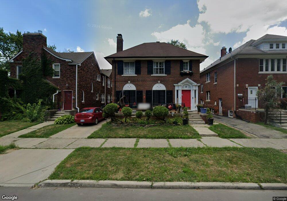
1307 Somerset Ave Grosse Pointe Park, MI 48230
Estimated Value: $393,000 - $609,000
--
Bed
--
Bath
3,720
Sq Ft
$128/Sq Ft
Est. Value
About This Home
This home is located at 1307 Somerset Ave, Grosse Pointe Park, MI 48230 and is currently estimated at $475,961, approximately $127 per square foot. 1307 Somerset Ave is a home located in Wayne County with nearby schools including George Defer Elementary School, Pierce Middle School, and Grosse Pointe South High School.
Ownership History
Date
Name
Owned For
Owner Type
Purchase Details
Closed on
Jun 14, 2018
Sold by
Maiale Carl D
Bought by
Maiale Laura J
Current Estimated Value
Purchase Details
Closed on
Aug 4, 2006
Sold by
Maiale Laura J
Bought by
Maiale Carl
Home Financials for this Owner
Home Financials are based on the most recent Mortgage that was taken out on this home.
Original Mortgage
$50,000
Outstanding Balance
$33,848
Interest Rate
9.25%
Mortgage Type
New Conventional
Estimated Equity
$442,113
Purchase Details
Closed on
Nov 10, 2000
Sold by
Potthoff Robert L
Bought by
Laura J Maiale
Create a Home Valuation Report for This Property
The Home Valuation Report is an in-depth analysis detailing your home's value as well as a comparison with similar homes in the area
Home Values in the Area
Average Home Value in this Area
Purchase History
| Date | Buyer | Sale Price | Title Company |
|---|---|---|---|
| Maiale Laura J | -- | None Available | |
| Maiale Carl | -- | Title Source Inc | |
| Laura J Maiale | -- | -- |
Source: Public Records
Mortgage History
| Date | Status | Borrower | Loan Amount |
|---|---|---|---|
| Open | Maiale Carl | $50,000 |
Source: Public Records
Tax History Compared to Growth
Tax History
| Year | Tax Paid | Tax Assessment Tax Assessment Total Assessment is a certain percentage of the fair market value that is determined by local assessors to be the total taxable value of land and additions on the property. | Land | Improvement |
|---|---|---|---|---|
| 2025 | $5,371 | $213,100 | $0 | $0 |
| 2024 | $5,034 | $201,500 | $0 | $0 |
| 2023 | $2,568 | $189,300 | $0 | $0 |
| 2022 | $2,439 | $165,500 | $0 | $0 |
| 2021 | $6,258 | $143,900 | $0 | $0 |
| 2019 | $6,113 | $119,900 | $0 | $0 |
| 2018 | $2,326 | $97,900 | $0 | $0 |
| 2017 | $5,310 | $66,100 | $0 | $0 |
| 2016 | $7,058 | $89,400 | $0 | $0 |
| 2015 | $9,144 | $92,300 | $0 | $0 |
| 2013 | $9,690 | $98,900 | $0 | $0 |
| 2012 | $4,215 | $103,900 | $23,300 | $80,600 |
Source: Public Records
Map
Nearby Homes
- 1306 Beaconsfield Ave Unit 1308
- 1254 Beaconsfield Ave
- 1328 Lakepointe St
- 1417 Beaconsfield Ave
- 1451 Beaconsfield Ave
- 1332 Wayburn St
- 1336 Wayburn St
- 1324 Wayburn St
- 1337 Wayburn St
- 2580 Alter Rd
- 2140 Alter Rd
- 15239 Mack Ave
- 1148 Devonshire Rd
- 2568 Alter Rd
- 1465 Maryland St
- 1083 Lakepointe St
- 1456 Wayburn St
- 3650 Somerset Ave
- 1449 Wayburn St
- 1048 Lakepointe St Unit A
- 1311 Somerset Ave Unit 1313
- 1311 Somerset Ave Unit 1311-1313
- 1301 Somerset Ave
- 1315 Somerset Ave Unit 17
- 1306 Nottingham Rd
- 1319 Somerset Ave Unit 21
- 1310 Nottingham Rd
- 1300 Nottingham Rd
- 1314 Nottingham Rd
- 1323 Somerset Ave Unit 25
- 1318 Nottingham Rd
- 1306 Somerset Ave Unit 8
- 1310 Somerset Ave Unit 12
- 1302 Somerset Ave
- 1322 Nottingham Rd
- 1327 Somerset Ave Unit 29
- 1314 Somerset Ave Unit 16
- 1318 Somerset Ave Unit 20
- 1326 Nottingham Rd
- 1331 Somerset Ave Unit 33