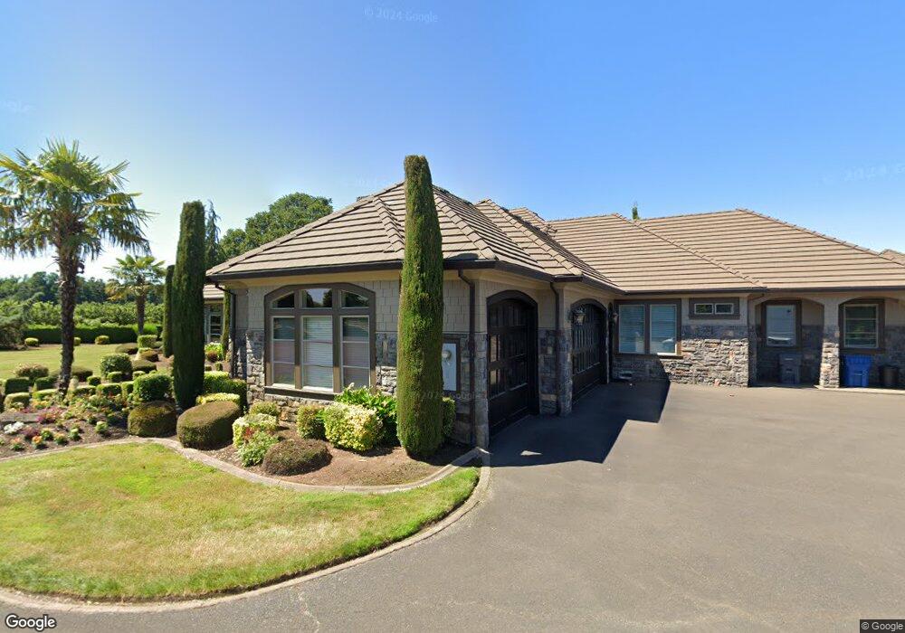
13077 Donald Rd NE Aurora, OR 97002
Estimated Value: $2,248,756
4
Beds
6
Baths
5,253
Sq Ft
$428/Sq Ft
Est. Value
About This Home
This home is located at 13077 Donald Rd NE, Aurora, OR 97002 and is currently estimated at $2,248,756, approximately $428 per square foot. 13077 Donald Rd NE is a home located in Marion County with nearby schools including North Marion Primary School, North Marion Middle School, and North Marion High School.
Ownership History
Date
Name
Owned For
Owner Type
Purchase Details
Closed on
May 5, 2017
Sold by
Lapoint Garry L and Lapoint Katherine M
Bought by
Lapoint Garry L and Lapoint Katherine M
Current Estimated Value
Purchase Details
Closed on
Jul 30, 2014
Sold by
Kartal Fiofil
Bought by
Lapoint Garry L and Lapoint Katherine M
Home Financials for this Owner
Home Financials are based on the most recent Mortgage that was taken out on this home.
Original Mortgage
$788,000
Outstanding Balance
$597,560
Interest Rate
4.12%
Mortgage Type
New Conventional
Estimated Equity
$1,651,196
Purchase Details
Closed on
May 16, 2005
Sold by
Palmer John Joseph and Palmer Pamela A
Bought by
Kartal Fiofil
Home Financials for this Owner
Home Financials are based on the most recent Mortgage that was taken out on this home.
Original Mortgage
$400,000
Interest Rate
5.87%
Mortgage Type
Construction
Create a Home Valuation Report for This Property
The Home Valuation Report is an in-depth analysis detailing your home's value as well as a comparison with similar homes in the area
Home Values in the Area
Average Home Value in this Area
Purchase History
| Date | Buyer | Sale Price | Title Company |
|---|---|---|---|
| Lapoint Garry L | -- | None Available | |
| Lapoint Garry L | $985,000 | Amerititle | |
| Kartal Fiofil | $315,000 | Ticor Title |
Source: Public Records
Mortgage History
| Date | Status | Borrower | Loan Amount |
|---|---|---|---|
| Open | Lapoint Garry L | $788,000 | |
| Previous Owner | Kartal Fiofil | $400,000 |
Source: Public Records
Tax History Compared to Growth
Tax History
| Year | Tax Paid | Tax Assessment Tax Assessment Total Assessment is a certain percentage of the fair market value that is determined by local assessors to be the total taxable value of land and additions on the property. | Land | Improvement |
|---|---|---|---|---|
| 2025 | $11,204 | $987,943 | -- | -- |
| 2024 | $11,204 | $959,410 | -- | -- |
| 2023 | $10,409 | $931,715 | $0 | $0 |
| 2022 | $9,836 | $904,816 | $0 | $0 |
| 2021 | $9,489 | $878,700 | $0 | $0 |
| 2020 | $9,262 | $853,350 | $0 | $0 |
| 2019 | $9,079 | $828,730 | $0 | $0 |
| 2018 | $8,676 | $0 | $0 | $0 |
| 2017 | $8,130 | $0 | $0 | $0 |
| 2016 | $7,927 | $0 | $0 | $0 |
| 2015 | $7,743 | $0 | $0 | $0 |
| 2014 | $7,335 | $0 | $0 | $0 |
Source: Public Records
Map
Nearby Homes
- 13042 Brookside Dr NE
- 12602 Fry Rd NE
- 21150 Boones Ferry Rd NE
- 13424 Ehlen Rd NE
- 19601 Boones Ferry Rd NE
- 21358 Oak Ln NE
- 21984 Camellia Ct NE
- 14665 Orchard Ave NE
- 14750 Orchard St NE
- 20923 Filbert St NE
- 11105 Main St NE Unit 11
- 11105 Main St NE
- 11105 Main St NE Unit 14
- 11105 Main St NE Unit 6
- 18767 Highway 99e
- 20800 Yosemite St NE
- 14713 Ottaway Rd NE
- 20870 Yosemite St NE
- 21497 Highway 99e NE
- 2469 Dorsey Dr
- 13078 Donald Rd NE
- 13058 Donald Rd NE
- 13098 Donald Rd NE
- 13118 Donald Rd NE
- 13138 Donald Rd NE
- 13158 Donald Rd NE
- 13093 Brookside Dr NE
- 13063 Brookside Dr NE
- 13133 Brookside Dr NE
- 13033 Brookside Dr NE
- 13188 Donald Rd NE
- 13208 Donald Rd NE
- 13183 Brookside Dr NE
- 13072 Brookside Dr NE
- 13052 Brookside Dr NE
- 13122 Brookside Dr NE
- 13132 Brookside Dr NE
- 13142 Brookside Dr NE
- 13213 Brookside Dr NE
- 13202 Brookside Dr NE