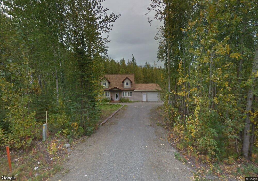
13079 W King Arthur Dr Wasilla, AK 99623
Estimated Value: $190,000 - $376,000
--
Bed
--
Bath
896
Sq Ft
$315/Sq Ft
Est. Value
About This Home
This home is located at 13079 W King Arthur Dr, Wasilla, AK 99623 and is currently estimated at $281,906, approximately $314 per square foot. 13079 W King Arthur Dr is a home located in Matanuska-Susitna Borough with nearby schools including Big Lake Elementary School, Houston Middle School, and Houston High School.
Ownership History
Date
Name
Owned For
Owner Type
Purchase Details
Closed on
Mar 28, 2013
Sold by
Philo Anna B
Bought by
Schultz Smith Kimberly Ann and Smith Joseph K
Current Estimated Value
Home Financials for this Owner
Home Financials are based on the most recent Mortgage that was taken out on this home.
Original Mortgage
$116,412
Outstanding Balance
$82,245
Interest Rate
3.49%
Mortgage Type
FHA
Estimated Equity
$199,661
Purchase Details
Closed on
Mar 23, 2006
Sold by
Philo Anna B
Bought by
Ross Vernon S and Ross Sylvia C
Create a Home Valuation Report for This Property
The Home Valuation Report is an in-depth analysis detailing your home's value as well as a comparison with similar homes in the area
Home Values in the Area
Average Home Value in this Area
Purchase History
| Date | Buyer | Sale Price | Title Company |
|---|---|---|---|
| Schultz Smith Kimberly Ann | -- | None Available | |
| Ross Vernon S | -- | None Available |
Source: Public Records
Mortgage History
| Date | Status | Borrower | Loan Amount |
|---|---|---|---|
| Open | Schultz Smith Kimberly Ann | $116,412 |
Source: Public Records
Tax History Compared to Growth
Tax History
| Year | Tax Paid | Tax Assessment Tax Assessment Total Assessment is a certain percentage of the fair market value that is determined by local assessors to be the total taxable value of land and additions on the property. | Land | Improvement |
|---|---|---|---|---|
| 2025 | $8 | $288,200 | $11,000 | $277,200 |
| 2024 | $8 | $271,400 | $11,000 | $260,400 |
| 2023 | $323 | $257,600 | $11,000 | $246,600 |
| 2022 | $179 | $233,000 | $11,000 | $222,000 |
| 2021 | $2,364 | $202,900 | $11,000 | $191,900 |
| 2020 | $2,364 | $194,000 | $11,000 | $183,000 |
| 2019 | $111 | $187,000 | $11,000 | $176,000 |
| 2018 | $103 | $184,400 | $11,000 | $173,400 |
| 2017 | $2,404 | $180,300 | $11,000 | $169,300 |
| 2016 | $2,364 | $182,100 | $11,000 | $171,100 |
| 2015 | -- | $175,200 | $11,000 | $164,200 |
| 2014 | -- | $144,000 | $11,000 | $133,000 |
Source: Public Records
Map
Nearby Homes
- 0000 No Name Hill Rd
- 12086 W Leprechaun Dr
- 11923 W Ballyshannon Dr
- 12262 W Wonderland Dr
- 47300 W Merlin Dr
- 3975 N Maid Marian Dr
- 13854 W King Arthur Dr
- 12453 W Wilderness Ct
- 2949 N Ross St
- 3854 N Sluice Box Dr
- 11064 Dutchess Cir
- 12770 W Armstrong Rd
- 12340 W Cheri Lake Dr
- 18444 W Parks Hwy
- 10900 W Hobbit Rd
- 2668 N Gaunt Ln
- 3846 N White Knight Dr
- 11265 W King Arthur Dr
- 2196 Anthony Rd
- 2126 N Skye Cir
- 13079 W King Arthur Dr
- 13031 W King Arthur Dr
- 5389 N No Name Hill Dr
- 13031 W King Arthur Dr
- 13074 W King Arthur Dr
- 3419 N Rainbow Cir
- 13048 W King Arthur Dr
- 12225 W Lepprechaun Dr
- 13148 W King Arthur Dr
- 12281 Leprechaun Dr
- 12281 W Leprechaun Dr
- 3481 Rainbow Cir
- 3528 N Rainbow Cir
- L25 Us Survey Unit 3579
- 000 No Name Hill Rd
- 12985 W King Arthur Dr
- 3453 N Rainbow St
- 3453 N Rainbow Cir
- 3453 Rainbow Cir
- 3481 N Rainbow St