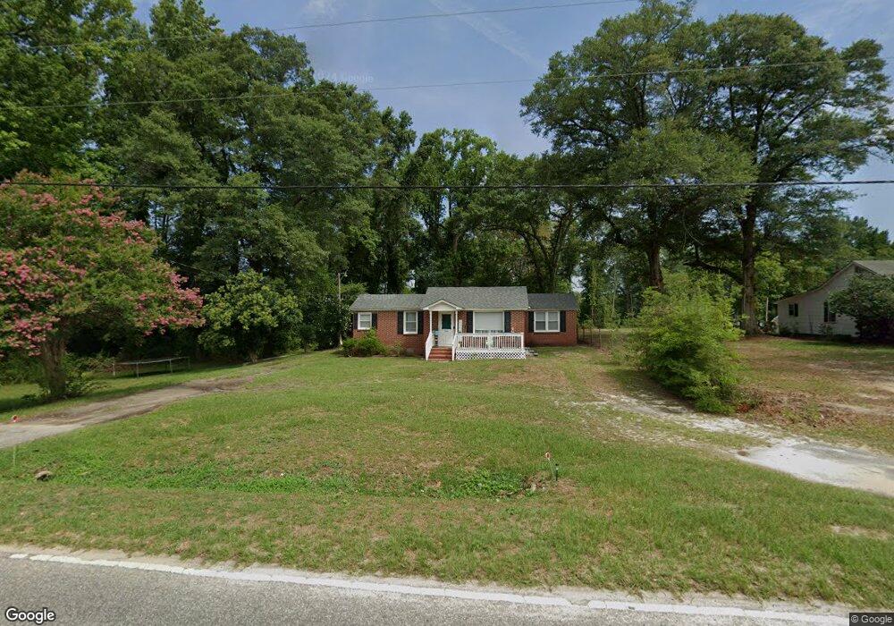
1308 Indian Branch Rd Darlington, SC 29532
Estimated Value: $81,000 - $152,000
2
Beds
2
Baths
1,147
Sq Ft
$95/Sq Ft
Est. Value
About This Home
This home is located at 1308 Indian Branch Rd, Darlington, SC 29532 and is currently estimated at $108,492, approximately $94 per square foot. 1308 Indian Branch Rd is a home located in Darlington County with nearby schools including Pate Elementary School, Brockington Elementary Magnet School, and Darlington Middle School.
Ownership History
Date
Name
Owned For
Owner Type
Purchase Details
Closed on
May 17, 2023
Sold by
Real Estate 38 Llc
Bought by
Lt 23 Assets Llc
Current Estimated Value
Purchase Details
Closed on
Jun 10, 2022
Sold by
Dennis Powell Robert
Bought by
Real Estate 38 Llc
Purchase Details
Closed on
Sep 28, 2015
Sold by
Gandy James D
Bought by
Powell Robert Dennis and Powell Rebekah H
Home Financials for this Owner
Home Financials are based on the most recent Mortgage that was taken out on this home.
Original Mortgage
$68,367
Interest Rate
3.88%
Mortgage Type
New Conventional
Create a Home Valuation Report for This Property
The Home Valuation Report is an in-depth analysis detailing your home's value as well as a comparison with similar homes in the area
Home Values in the Area
Average Home Value in this Area
Purchase History
| Date | Buyer | Sale Price | Title Company |
|---|---|---|---|
| Lt 23 Assets Llc | -- | None Listed On Document | |
| Real Estate 38 Llc | $72,005 | G Lee Miller Esquire Pc | |
| Powell Robert Dennis | $65,900 | -- |
Source: Public Records
Mortgage History
| Date | Status | Borrower | Loan Amount |
|---|---|---|---|
| Previous Owner | Powell Robert Dennis | $68,367 |
Source: Public Records
Tax History Compared to Growth
Tax History
| Year | Tax Paid | Tax Assessment Tax Assessment Total Assessment is a certain percentage of the fair market value that is determined by local assessors to be the total taxable value of land and additions on the property. | Land | Improvement |
|---|---|---|---|---|
| 2024 | $1,518 | $4,320 | $0 | $0 |
| 2023 | $720 | $4,320 | $0 | $0 |
| 2022 | $693 | $4,320 | $0 | $0 |
| 2021 | $693 | $2,770 | $400 | $2,370 |
| 2020 | $389 | $2,770 | $400 | $2,370 |
| 2019 | $390 | $2,770 | $400 | $2,370 |
| 2018 | $377 | $2,640 | $400 | $2,240 |
| 2017 | $350 | $2,640 | $400 | $2,240 |
| 2016 | $1,146 | $3,950 | $600 | $3,350 |
| 2014 | $706 | $2,310 | $600 | $1,710 |
| 2013 | $659 | $2,310 | $600 | $1,710 |
Source: Public Records
Map
Nearby Homes
- 1111 Syracuse St
- 1316 Sunset Dr
- TBD Lamar Hwy
- 2064 Eastpark
- 2213 Highway 52
- 2225 Highway 52
- 265 Syracuse St
- 0 Harry Byrd Hwy
- 1011 Pearl St
- 0 Stanley Cir
- Lot 14 Wildshall Rd
- 527 Stanley Cir
- 640 Stanley Cir
- 2303 N Governor Williams Hwy
- 113 Cleveland St
- 116 Cleveland St
- 500 Alexander St
- 608 Wood Duck Dr
- S Governor Williams Hwy
- 0 High Hill Rd
- 1304 Indian Branch Rd
- 1301 Indian Branch Rd
- 1317 Indian Branch Rd
- 000 Harmony Dr
- 1232 Indian Branch Rd
- 1225 Indian Branch Rd
- 516 Harmony Dr
- 1333 Indian Branch Rd
- 1217 Indian Branch Rd
- 1224 Whites Cir
- 1220 Whites Cir
- 1213 Indian Branch Rd
- 528 Harmony Dr
- 1916 Rogers Rd
- 1216 Whites Cir
- 1912 Rogers Rd
- 529 Harmony Dr
- 1320 Syracuse St
- 1324 Syracuse St
- 1910 Rogers Rd